Discover and read the best of Twitter Threads about #lidar
Most recents (21)
1/ 🎉 Day 8 of #AllinAI: As someone who's always been fascinated by #AR #VR and 3D scanning, I'm excited to explore Neural Radiance Fields (#NeRF)! NeRF is a game-changing AI technique that has transformed the 3D scene reconstruction & rendering. Let's dive in!
2/ 📊 Traditional 3D scanning methods like #photogrammetry & #lidar faced challenges like noise, inconsistencies & limited detail. NeRF uses AI to help overcome these by creating high-quality 3D renderings from 2D images.
3/ 🌐 How it works: Take a few pictures of an object. NeRF's deep neural network optimizes the radiance field to match the 2D image, combining color & volume density to create a stunning, detailed 3D rendering.
Created using @LumaLabsAI @SirWrender 👇
Created using @LumaLabsAI @SirWrender 👇
The wait is over: A new release of #HELIOS++ is out. Get v1.2.0 here: github.com/3dgeo-heidelbe… #opensource #opensourcesoftware #3dgeo #LiDARSimulation #VLS #laserscanning
🧵 to summarize the new features and improvements (1/7)
🧵 to summarize the new features and improvements (1/7)
➡️Interpolated trajectories
You can now input existing trajectory files (time, roll, pitch, yaw, x, y, z) and your simulated platform will follow this trajectory. Find a simple example here: nbviewer.org/github/3dgeo-h… (2/7)
You can now input existing trajectory files (time, roll, pitch, yaw, x, y, z) and your simulated platform will follow this trajectory. Find a simple example here: nbviewer.org/github/3dgeo-h… (2/7)

➡️Multi-channel scanners
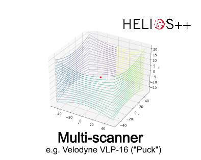
Multi-channel scanners are now supported. We created #jupyternotebook demos for two popular scanners, the @LivoxTech Mid-100 and the @VelodyneLidar Puck. Check out one of our demos: a) nbviewer.org/github/3dgeo-h… b) nbviewer.org/github/3dgeo-h… (3/7)
Multi-channel scanners are now supported. We created #jupyternotebook demos for two popular scanners, the @LivoxTech Mid-100 and the @VelodyneLidar Puck. Check out one of our demos: a) nbviewer.org/github/3dgeo-h… b) nbviewer.org/github/3dgeo-h… (3/7)
🌎 ¡Acabo de encontrar una serie de mapas increíbles realizados con #RStats! Desde mapas interactivos hasta diseños 3D, hay algo para todos los amantes de los datos espaciales
👇 ¡8 cuentas a las que definitivamente vale la pena darle un vistazo!🧵
#dataviz #maps #geospatial #gis
👇 ¡8 cuentas a las que definitivamente vale la pena darle un vistazo!🧵
#dataviz #maps #geospatial #gis
✅ Tyler Morgan-Wall @tylermorganwall
🔗 buff.ly/3ZBWNKe
Mapa 3D giratorio con puntos de luz (mapa anterior)
🔗 buff.ly/3QDfXLx
La red de cable submarino de fibra óptica de la Tierra.
Utiliza #rayshader #rayrender #rayverse
#dataviz #maps #geospatial #gis
🔗 buff.ly/3ZBWNKe
Mapa 3D giratorio con puntos de luz (mapa anterior)
🔗 buff.ly/3QDfXLx
La red de cable submarino de fibra óptica de la Tierra.
Utiliza #rayshader #rayrender #rayverse
#dataviz #maps #geospatial #gis
@tylermorganwall ✅ Milos Popovic @milos_agathon
🔗 buff.ly/3CJM6LN
Mapa % de empleados en la fabricación, datos Eurostat.
#dataviz #maps #geospatial #gis #rstats #DataVisualization #stats #DataScience
🔗 buff.ly/3CJM6LN
Mapa % de empleados en la fabricación, datos Eurostat.
#dataviz #maps #geospatial #gis #rstats #DataVisualization #stats #DataScience

#quantum is here! Why not collect #fluorescence #photon-by-photon in your laser-scanning #microscope? We developed the #BrightEyes_TTM, an #opensource data acquisition system able to do it!
nature.com/articles/s4146…
@IITalk @ERC_Research @RNA_iit @MSCActions #BrightEyes_ERC
(1/5)
nature.com/articles/s4146…
@IITalk @ERC_Research @RNA_iit @MSCActions #BrightEyes_ERC
(1/5)
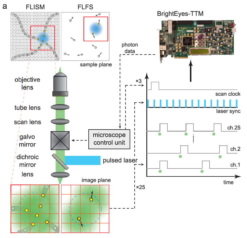
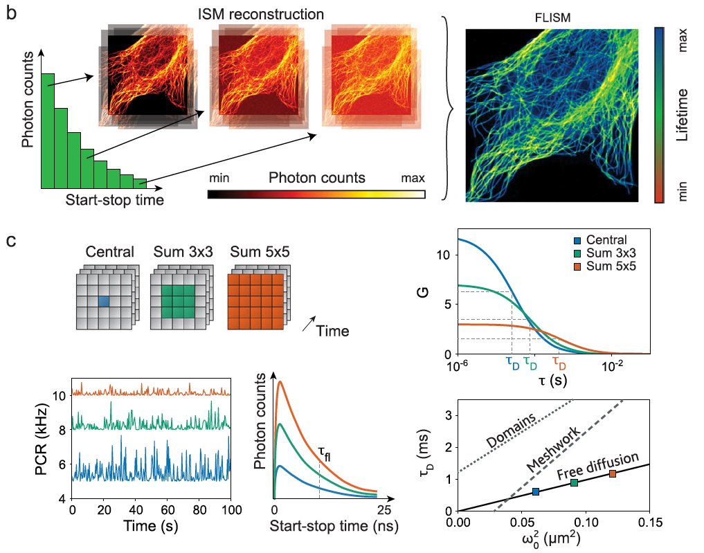
Our time-tagging #DAQ module can collect single-photon signals from 25 independent channels and reference signals from 3 channels. We showed how this module combined with a #SPAD array allows us to perform #FLISM and #FLFS. (2/5)
#imagescanningmicroscopy #fluorescence #lifetime
#imagescanningmicroscopy #fluorescence #lifetime
We characterized the #BrightEyes_TTM. We can reach a single-shot precision of 30 ps, 4 ns dead-time, and an "infinite" range in all channels, with a total flux of up to 125 MHz. (3/5)
#TCSPC #antibunching #quantum #microscopy #FPGA
#coding #LIDAR
#TCSPC #antibunching #quantum #microscopy #FPGA
#coding #LIDAR

$CPTN Shaping mobility together. Cepton has entered into a binding agreement with our long-term automotive Tier 1 partner and current shareholder, Koito, for a $100 million investment: cepton.com/announcements/…
#lidar #smartmobility #Investment #ADAS #autonomousvehicles
#lidar #smartmobility #Investment #ADAS #autonomousvehicles

Under the terms of the agreement, Koito will purchase $100 million of convertible preferred stock at an initial conversion price representing a 13.4% premium to Cepton’s closing price yesterday and a 7.0% premium to Cepton’s average closing price over the last five trading days.
This marks Koito’s third investment in $CPTN since 2020, and we are excited to strengthen our partnership and continue our focus on commercialization and mass-market deployment of our lidar solutions!
benzinga.com/news/22/10/294…
benzinga.com/news/22/10/294…
Vous voulez un petit exemple des dialogues de sourds en matière d'environnement/numérique ? Je viens d'assister à un exemple très ponctuel mais qui me semble très révélateur, au sujet de l'#opendata.
Depuis quelques temps il y a une poussée pour *fermer* l'opendata sous couvert d'environnement. Je reviens plus bas sur le "sous couvert", voici juste un document qui va être publié en version définitive sous peu (donc quasi finalisé). opendatafrance.net/2022/09/22/sob…
Do you love 3D maps, worlds & visualisations? Here are 24 world creators, mapmakers, or visuals I've come across recently. Brilliant and creative minds using many different tools! PART 1 #dataviz #GISchat #3dmaps #map #gis #3d 1/🧵
Steven Kay | @stevefaeembra creates many original and cool #3dmaps such as this great visualisation of Windturbines in the British Isles. Follow him! #Blender3D and #QGis are his tools. #SDGs #Wind #b3d 2/🧵
This new @Polycam3D room scan tool is bonkers … another step closer to the commoditization of the digitization of assets. 😳🚀 #lidar #3D #metaverse @Apple #Apple
Here is the full floor 3D model + measurements + walk through … all on the iPhone in minutes. So clean. 🤯🤯🤯 Next up, drop it in the @simulacra_io metaverse platform for a full social walk through. The use cases of this are bananas. 📈📈📈
Only took minutes to drop the raw model into the @simulacra_io metaverse platform. Few clicks in the web browser and anyone on the planet with internet can meet up in the digital twin. (Needs scale and texture work - but dang that flow is efficient). 👀 @Polycam3D
1/6 #Archéologie des #paysages, où comment retrouver les étendues forestières disparues.
Vous voyez cette constellation de points noirs dans les cultures ?

Vous voyez cette constellation de points noirs dans les cultures ?
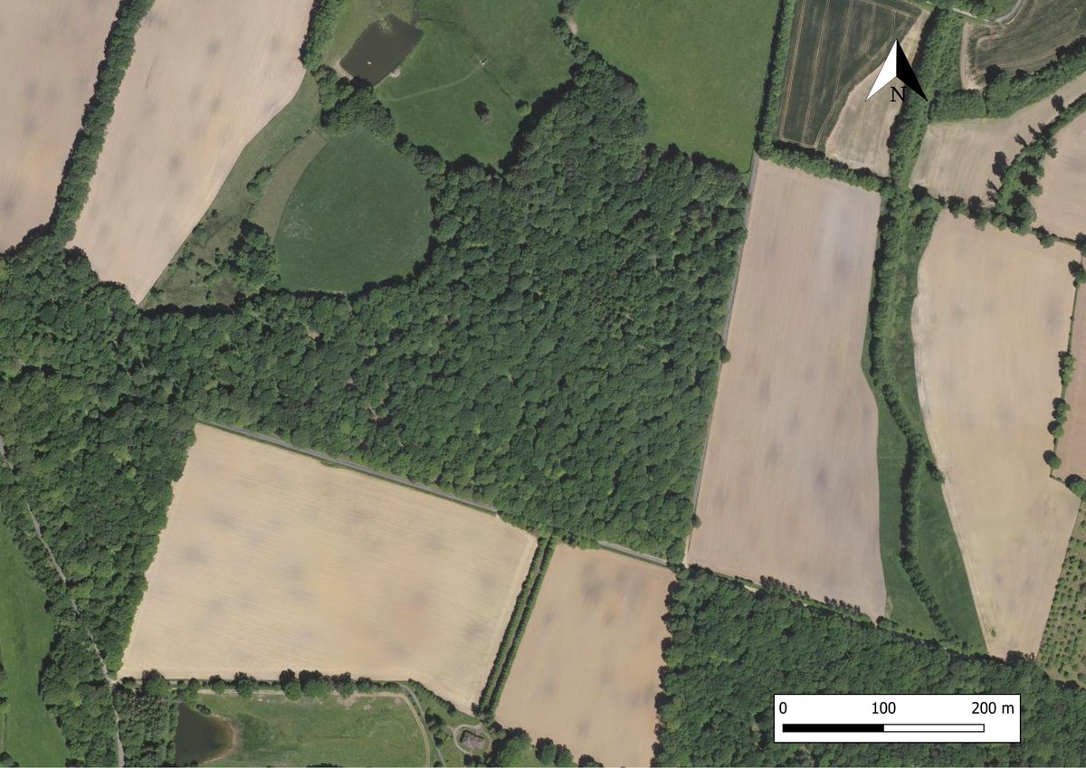

2/ Il s'agit probablement de résidus de charbons issus de la fabrication de charbon sur meule : une plateforme de #charbonnage, communément appelée place à feu. 

3/ Pourtant dans l'état actuel, il n'y a pas un #arbre pour en fabriquer !...Vous l'aurez compris, leur observation est rendue possible suite à un défrichement postérieur aux combustions.
Autrement dit : leur observation signale la présence révolue d'une forêt.

Autrement dit : leur observation signale la présence révolue d'une forêt.


Voxelizing a photogrammetry mesh to render it in Unreal Engine
Using voxels makes it lightweight to render and allows for extremely easy & speedy edits
1/3
#ue5 #voxel #lidar #photogrammetry
Using voxels makes it lightweight to render and allows for extremely easy & speedy edits
1/3
#ue5 #voxel #lidar #photogrammetry
Voxelization is fully GPU-based and only takes a few minutes for huge meshes (several GB)
Collisions are fully supported, only loading the area around the player to reduce perf impact
2/3
Collisions are fully supported, only loading the area around the player to reduce perf impact
2/3
The photogrammetry mesh was created in DJI Terra by @TotalviewVR
Combined with the voxelized LiDAR interiors, this is going to make a pretty fun package :)
If you're in the visualization industry & want to learn more you can contact us at contact@voxelplugin.com
3/3
Combined with the voxelized LiDAR interiors, this is going to make a pretty fun package :)
If you're in the visualization industry & want to learn more you can contact us at contact@voxelplugin.com
3/3
Here is a selection of the *coolest* 3D maps and map-like worlds I've seen on Twitter in the past months. Wonderful dynamic, interactive, static, creative or artistic visuals. #Dataviz #3dMap #GIS #3D #Cartography #GISchat 1/23🧵⬇️
Thomas Kole | @ThomasKoleTA 's stunning realistic 3D model of Tenochtitlan capital of the Aztec Empire (now Mexico City) made in #blender using #geometrynodes. Stunning water, clouds & details. #b3d #CDMX 2/23 🧵
Craig Taylor | @CraigTaylorViz 's mesmerizing ship data animation of the Gulf of Mexico. Made in #Cinema4D, with pleasant colours and satisfyingly well-made animation and light reflections. As always impressive work. 3/23 #3dmaps
Dende a Escola de #Enxeñaria #Forestal de #Pontevedra ( ∈ @Uvigo) queremos pechar o 2021 facendo un pequeno fío-resumo do traballo feito polos noso investigadores ao longo do ano a través de 21 noticias publicadas no #Duvi (1/24) #EEF2021 

Desenvolvendo disolventes verdes aplicables aos produtos derivados da #madeira (2/24) #EEF2021
uvigo.gal/universidade/c…
uvigo.gal/universidade/c…

Desenvolvendo metodoloxías de caracterización de masas #forestais con tecnoloxía #Lidar que permite identificar e coñecer as dimensións de cada árbore (3/24) #EEF2021
uvigo.gal/universidade/c…
uvigo.gal/universidade/c…

3D maps can look complex & difficult to make…
Here are 12 humans who proved to me that 3D is not out of reach:
Different tools, many styles... all fantastic: 1/14🧵 #dataviz #3dmaps #gis
Here are 12 humans who proved to me that 3D is not out of reach:
Different tools, many styles... all fantastic: 1/14🧵 #dataviz #3dmaps #gis
Graig Taylor | @CraigTaylorViz: Legendary 3D maps made in #Cinema4D. Not only gorgeous maps but also perfectly animated worlds. His maps cannot be unseen. Clearly a #3dmap guru. #GIS #dataviz 2/14
Tyler Morgan-Wall |@tylermorganwall devlpr of the incredible R libraries #rayshader and #rayrender adding features & tutorials for free at an incredible pace: a *true treasure* for the #rstats #3dmaps & #3dviz world. A must-follow for 3d #dataviz. 3/14 🧵
1/5 #TropiCon21 Large rivers are integral to Amazonia, and their associated wetlands are a key maintainer of biodiversity and carbon cycling & they are essential to support the majority of people living in the Amazon. Yet wetlands are rarely included in climate-ecosystem models. 

2/5 #TropiCon21 Amz wetlands are under immediate threat by climate change, deforestation and hydropower damming. Dams cause profound changes to the ecosystems (doi.org/10.1002/aqc.35…), and so do deforestation and climate-related changes that are known to be already happening. 

3/5 #TropiCon21 We know little about forest assembly/function in Amz wetlands. Correlative studies show inundation dynamics and trophic levels strongly influence species composition. But what are the eco-evo mechanisms behind it? At what spatial / temporal scales do they operate? 

#Lidar is an operational technology for #forestinventory. Single-photon lidar (#SPL) may provide an acquisition advantage for large areas. How does #SPL perform in an area-based #forest inventory? Some things we have learned (i.e. a thread)!
#OpenAccess: bit.ly/37GTeZG
#OpenAccess: bit.ly/37GTeZG

2/ We used #SPL and 269 field plots to generate an area-based operational #forestinventory over a 15000 ha study area of temperate mixedwood forest representing a complex assemblage of tree species, forest structures, and management histories. bit.ly/37GTeZG 


3/ We validated our #forestinventory estimates at the stand-level using independent field measured data. Why? Because the stand is the fundamental spatial unit for forest management and planning, and the unit at which decisions are made. #CFSEFI bit.ly/37GTeZG 


Daily Bookmarks to GAVNet 04/11/2021 greeneracresvaluenetwork.wordpress.com/2021/04/11/dai…
Device sketches objects 200 kilometres away, one photon at a time
nature.com/articles/d4158…
#RemoteSensingDevices #HighFidelityImagery #lidar
nature.com/articles/d4158…
#RemoteSensingDevices #HighFidelityImagery #lidar
An open-access database of infectious disease transmission trees to explore superspreader epidemiology
medrxiv.org/content/10.110…
#database #infectiousDisease #TransmissionTrees #superspreader #epidemiology
medrxiv.org/content/10.110…
#database #infectiousDisease #TransmissionTrees #superspreader #epidemiology
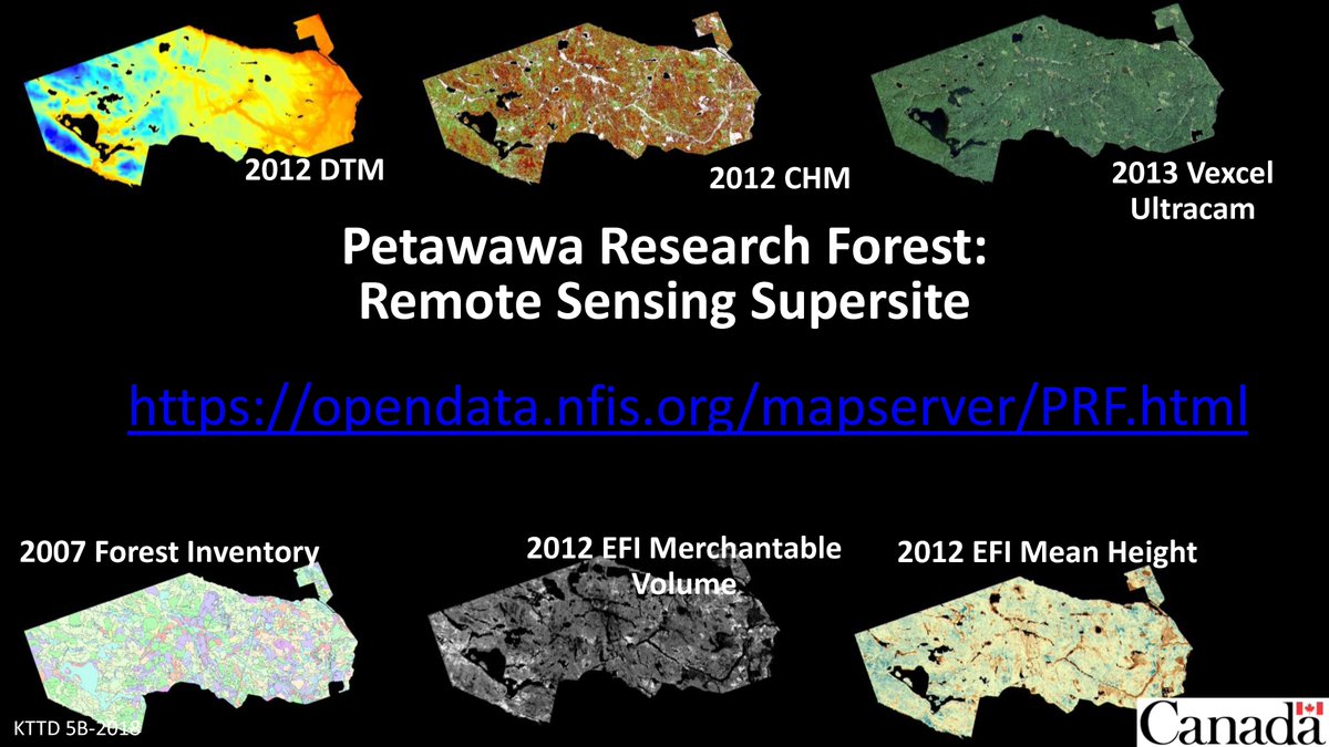
1/3 Interested in #lidar and enhanced #forestinventory? Here's everything you need to develop practical hands-on training materials & lab excercises, benchmark your algorithms, develop innovative solutions for the #forest sector, and support your research #CFSEFI #PRFSS #EOchat 

2/3 Included are #lidar data, contemporaneous field reference data, derived lidar predictors (point cloud metrics), EFI outputs (prediction rasters for volume, biomass, basal area, etc.), helpful guides, & software tools. All part of our #remotesensing #supersite #PRFSS #OpenData 


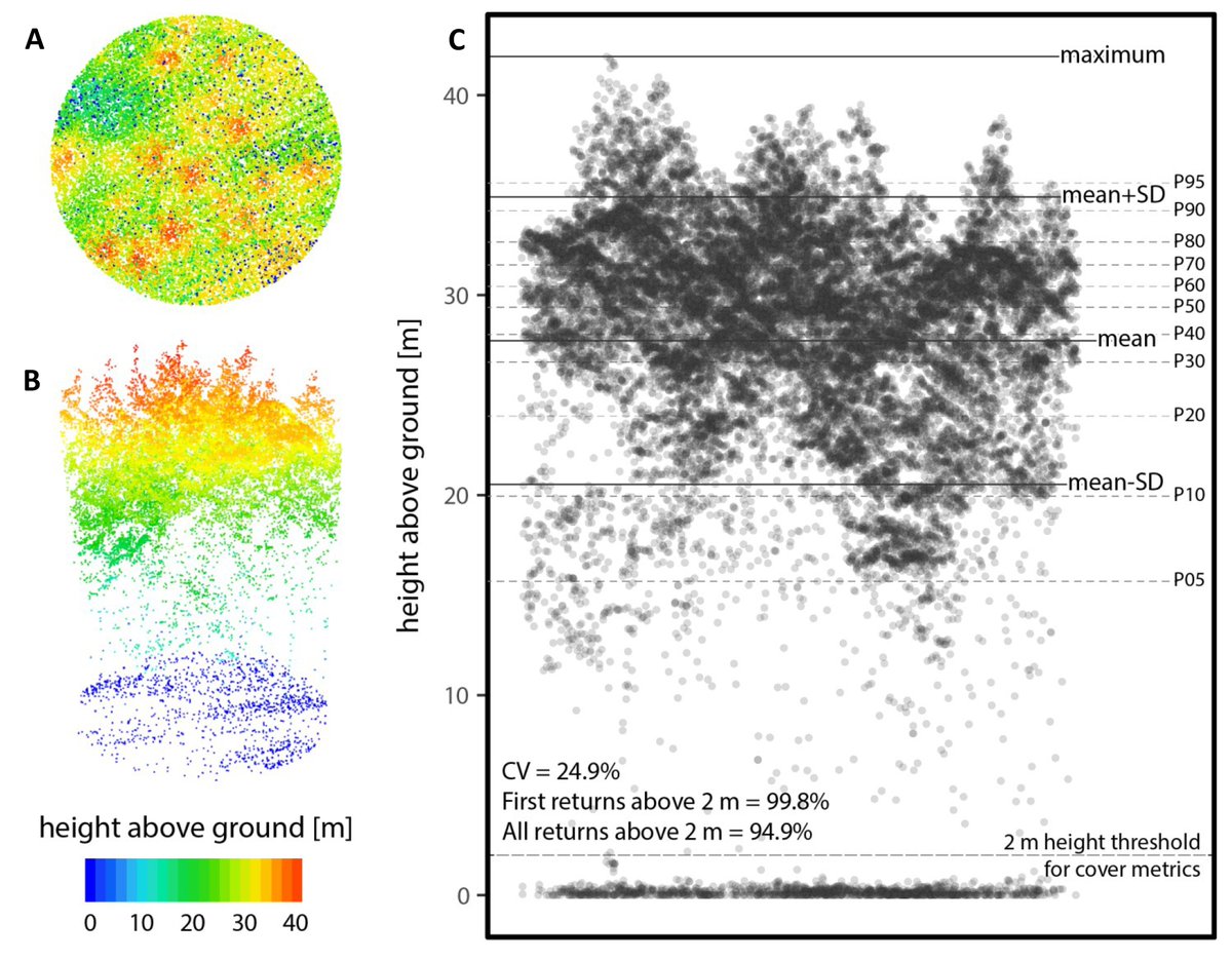
3/3
#Lidar: bit.ly/3b8pAgL
Field plots: bit.ly/3poQKFa
Predictors (metrics): bit.ly/2Zh4veE
EFI rasters: bit.ly/3jTTgm4
How-to guides: bit.ly/2S3IBFW; bit.ly/2Sc5ffD
Software tools: bit.ly/2LHA7ae
#OpenData #PRFSS
#Lidar: bit.ly/3b8pAgL
Field plots: bit.ly/3poQKFa
Predictors (metrics): bit.ly/2Zh4veE
EFI rasters: bit.ly/3jTTgm4
How-to guides: bit.ly/2S3IBFW; bit.ly/2Sc5ffD
Software tools: bit.ly/2LHA7ae
#OpenData #PRFSS
📲 You just received a new iPhone 12 Pro with the LiDAR Scanner?
As a reminder of the amazing capabilities, here is the #LiDAR segment of the iPhone Keynote
+ Thread of some amazing LiDAR apps you should definitely try out
👇
As a reminder of the amazing capabilities, here is the #LiDAR segment of the iPhone Keynote
+ Thread of some amazing LiDAR apps you should definitely try out
👇
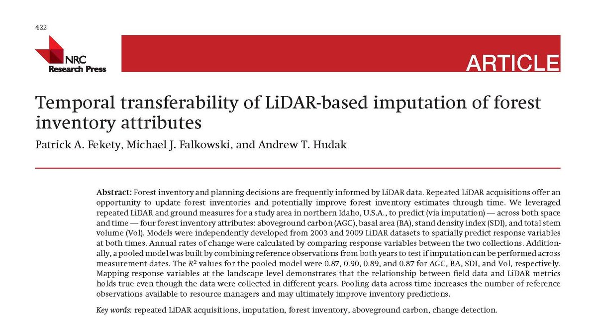
An increasingly common question: “We generated an enhanced forest inventory with #lidar data and ground plots for one of our management units. Can we use the same models for our other management areas?” #CFSEFI #forestinventory 
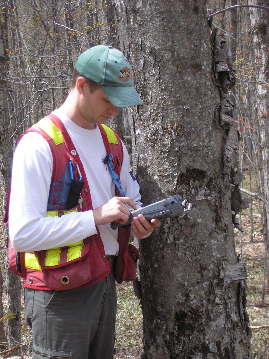
A great question and one that is top of mind for many of us who generate and use #forestinventory data. So what does the #science tell us about the transferability of area-based models? #CFSEFI 
Fekety et al. 2015: "Mapping response variables at the landscape level demonstrates that the relationship between field data and LiDAR metrics holds true even though the data were collected in different years."
Read: dx.doi.org/10.1139/cjfr-2…
Read: dx.doi.org/10.1139/cjfr-2…
UN FUTURO MAGICO. PECCATO PER GLI UMANI (SCORDATE L’EUROZONA 2).
(2017-03-27)
» paolobarnard.info/intervento_mos…
"Qui l’arrivo di VR e di AR compiono come mai immaginato prima, né sognato prima, il sogno di Edward Bernays"
VR AND AR PUSHING CONNECTIVITY LIMITS
» qualcomm.com/media/document…
(2017-03-27)
» paolobarnard.info/intervento_mos…
"Qui l’arrivo di VR e di AR compiono come mai immaginato prima, né sognato prima, il sogno di Edward Bernays"
VR AND AR PUSHING CONNECTIVITY LIMITS
» qualcomm.com/media/document…

Researchers at the Samsung #AI Center have produced a system that can recreate realistic motion from just a single image of a person
» arxiv.org/pdf/1905.08233…
"We believe that telepresence technologies in AR, VR and other media are to transform the world"
» arxiv.org/pdf/1905.08233…
"We believe that telepresence technologies in AR, VR and other media are to transform the world"
Graphene could soon make your computer 1000 times faster
» weforum.org/agenda/2017/08…
“If you want to continue to push technology forward, we need faster computers to be able to run bigger and better simulations for climate science, for space exploration, for Wall Street”
» weforum.org/agenda/2017/08…
“If you want to continue to push technology forward, we need faster computers to be able to run bigger and better simulations for climate science, for space exploration, for Wall Street”

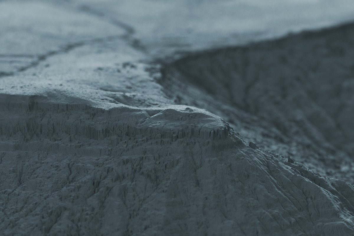
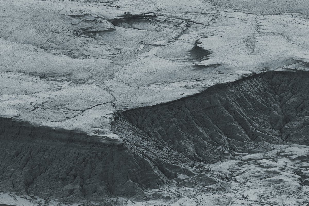
Playing around with #aerialod by @ephtracy, new software that makes it fairly straightforward to create renderings of #lidar terrain data, cleared of forest. It's amazing.... 

@ephtracy The paper that we released last week describes a city up on a forested plateau near Angkor. Here you can see the sandstone valley up top that they tried to carve into a reservoir. There's features all around & a canal leading over the cliff sending water down to quarries below... 
@ephtracy ... with a temple (that we knew of) perched on the promontory overlooking the plains below where Angkor is. 
