Discover and read the best of Twitter Threads about #cartography
Most recents (22)
Here is a selection of the *coolest* 3D maps, visuals, and map-like worlds from the past months you don't want to miss. Wonderful dynamic, interactive, static, creative or artistic visuals PART 3. #Dataviz #3dMap #GIS #3D #Cartography #GISchat 1/20🧵
spatial_occasions | @spatial_occasions mesmerizing and stunning visualization of the flight networks on the Globe. Just perfect. Made in #Blender3D. #B3d #3DMap #GeometryNodes #Dataviz 2/🧵
Terence Fostodon's | @researchremora perfect mix of 3D and 2D with a brilliant style. Ultra productive 3D map maker, worth every follow! Made in #rstats with #rayshader. 3/🧵
Tutorial Thread🧵 on how to create Climate maps using R Language specifically ClimateR🌧️🌤️ package created by Mike Johnson...In this tutorial I'm going to use The Kingdom of Saudi Arabia 🇸🇦#gischat #cartography #GIS #geospatial #Remotesensing #dataviz #R #rspatial #mapping
So At first Climate R is package created specifically to deal with climate illustration ......So in order to get it working you have to Have Remote package already and you have to Install Using the codes below. 

So after that were going prepare the Tempreture illustration in which they are three ways of illustrating Mean Tempreture(One map),Annual Tempreture(Mutiple Maps) and Monthly Tempreture.
Do you love 3D maps, worlds & visualisations? Here are 24 world creators, mapmakers, or visuals I've come across recently. Brilliant and creative minds using many different tools! PART 1 #dataviz #GISchat #3dmaps #map #gis #3d 1/🧵
Steven Kay | @stevefaeembra creates many original and cool #3dmaps such as this great visualisation of Windturbines in the British Isles. Follow him! #Blender3D and #QGis are his tools. #SDGs #Wind #b3d 2/🧵
Here is a selection of the *coolest* 3D maps and map-like worlds I've seen on Twitter in the past months. Wonderful dynamic, interactive, static, creative or artistic visuals. #Dataviz #3dMap #GIS #3D #Cartography #GISchat 1/23🧵⬇️
Thomas Kole | @ThomasKoleTA 's stunning realistic 3D model of Tenochtitlan capital of the Aztec Empire (now Mexico City) made in #blender using #geometrynodes. Stunning water, clouds & details. #b3d #CDMX 2/23 🧵
Craig Taylor | @CraigTaylorViz 's mesmerizing ship data animation of the Gulf of Mexico. Made in #Cinema4D, with pleasant colours and satisfyingly well-made animation and light reflections. As always impressive work. 3/23 #3dmaps
I enjoyed speaking at @OutlierConf this weekend on how I introduce #cartography to design students: by making schematic maps of hometowns (from all around India & beyond!).
If you missed it, here is a thread of some of the student maps to inspire you!
🗺🧵👇
#Outlier2022 (1/9)
If you missed it, here is a thread of some of the student maps to inspire you!
🗺🧵👇
#Outlier2022 (1/9)

First, some context.
After spending all my childhood calling Delhi my *home*, I have sought *home* in many Indian cities: DEL → GOA → Mysuru → BLR → HYD → BOM → Pune → BLR ✨
I perceived each city differently from others & made memory maps to show this.
2/9

After spending all my childhood calling Delhi my *home*, I have sought *home* in many Indian cities: DEL → GOA → Mysuru → BLR → HYD → BOM → Pune → BLR ✨
I perceived each city differently from others & made memory maps to show this.
2/9


When @venkatrajam invited me to introduce cartography to his students, we blended this idea of mapping personal lived experiences with schematic map (like Harry Beck’s London tube map, or any other metro map you’ve seen)
Voila: Schematic hometown mapping exercise was born!
3/9
Voila: Schematic hometown mapping exercise was born!
3/9

Daily Bookmarks to GAVNet 04/04/2021 greeneracresvaluenetwork.wordpress.com/2021/04/04/dai…
Humans Will Probably Evolve to Be Venomous
popularmechanics.com/science/a35982…
#HumanGenome #EvolutionaryBiology #adaptation
popularmechanics.com/science/a35982…
#HumanGenome #EvolutionaryBiology #adaptation
Alison Blunt in Twitter and ThreadReader
threadreaderapp.com/thread/1377233…
#quotation #UrsulaKLeGuin #earthsea
threadreaderapp.com/thread/1377233…
#quotation #UrsulaKLeGuin #earthsea
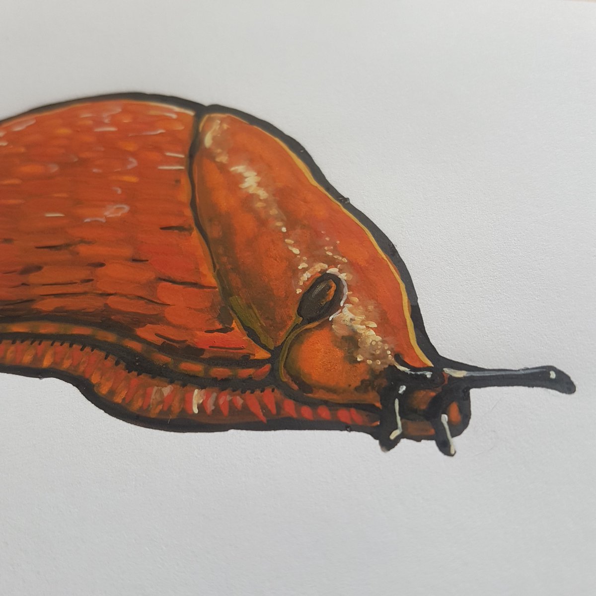
Point gouache et numérique avec le process d'illustrations naturaliste d'escargots pour des panneaux dans un parc animalier.
D'abord des nudes (le pied lol) et les coquilles à côté, pour pouvoir les assembler au mieux selon le panneau et les textes.


D'abord des nudes (le pied lol) et les coquilles à côté, pour pouvoir les assembler au mieux selon le panneau et les textes.


Détails : démarrage sur croquis au crayon, trait de cerne à la Linel Sépia (ma préf) puis je monte mes textures à la gouache toujours, en jouant sur la fluidité grâce à l'eau.
En général on part du plus aqueux vers le plus sec.
#illustration


En général on part du plus aqueux vers le plus sec.
#illustration


With his #JAMS @MC_UPress article on #SinoJapanese #War, it's time to update The #AndrewRhodes #Bookshelf!
bit.ly/AndyRhodes
@NavalWarCollege distinguished grad guides leaders through #IndoPacific w/ Geo-#History, #Strategy & Visual Communications
andrewerickson.com/2020/12/the-an…


bit.ly/AndyRhodes
@NavalWarCollege distinguished grad guides leaders through #IndoPacific w/ Geo-#History, #Strategy & Visual Communications
andrewerickson.com/2020/12/the-an…


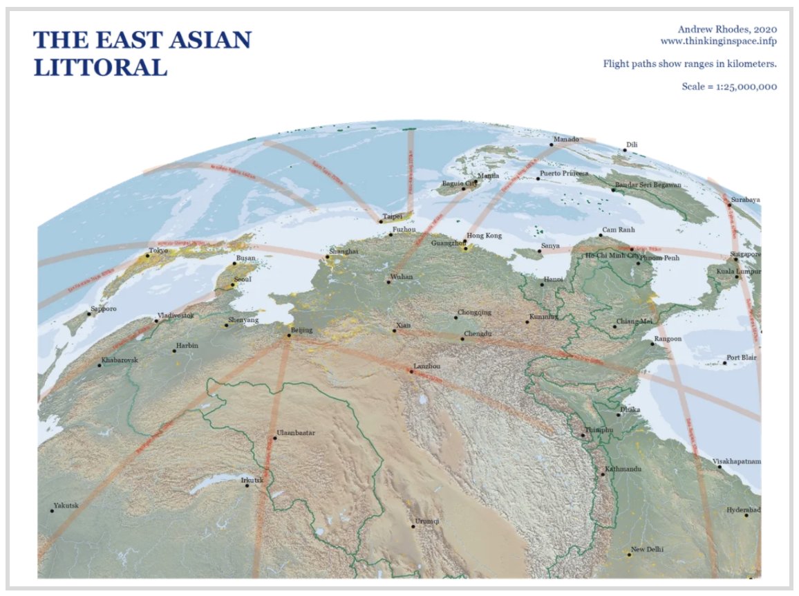

And by "#Visual #Communications," I mean #MAPS—beautiful, self-crafted maps. That should have existed already, but didn't.
For fresh perspective from the innovative #cartography @RhodesCartogra1 creates, check out: thinkinginspace.info
Prepare to have your horizons expanded!
For fresh perspective from the innovative #cartography @RhodesCartogra1 creates, check out: thinkinginspace.info
Prepare to have your horizons expanded!
My favorite example:
@RhodesCartogra1's pathbreaking piece @NavalWarCollege won 2019 @thejointstaff #Strategic #Essay Competition's Strategic #Research Paper category.
Cogent geo-history-grounded insights for US strategy toward PRC.
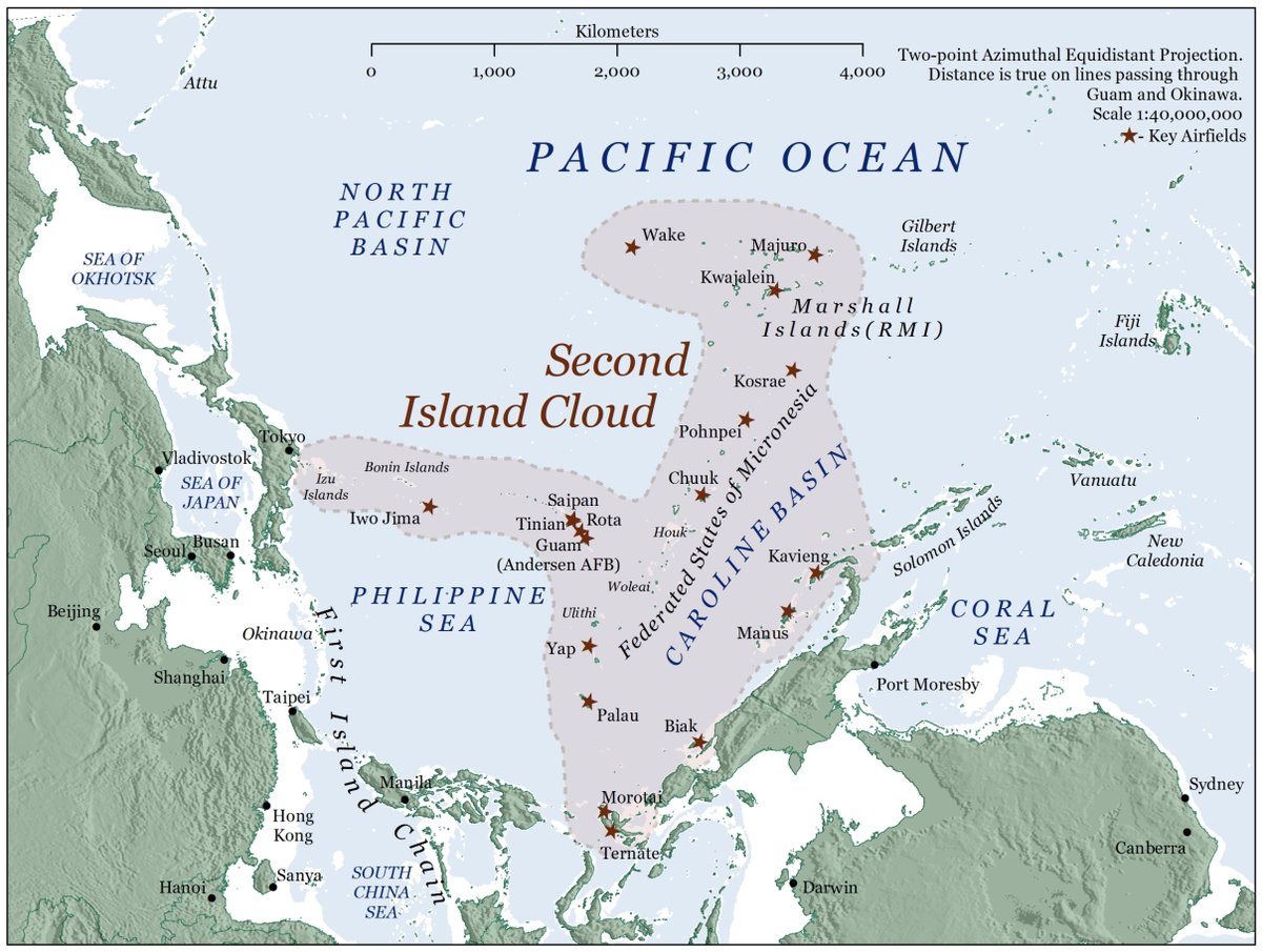
Neatly summarized by his map (attached here)
@RhodesCartogra1's pathbreaking piece @NavalWarCollege won 2019 @thejointstaff #Strategic #Essay Competition's Strategic #Research Paper category.
Cogent geo-history-grounded insights for US strategy toward PRC.
Neatly summarized by his map (attached here)
I might be the last one on the population flag map bandwagon, but I’m pleased with the result! Thanks to @StatCan_eng @StatCan_fra for providing nearly *half a million* polygons to select from.
#cartography #gischat #QGIS #canada @CanadianGIS @GANSorg
(Details in the thread.)
#cartography #gischat #QGIS #canada @CanadianGIS @GANSorg
(Details in the thread.)

Over the last couple of weeks people have been posting their population flag maps, so I thought I’d try my hand at creating one for Canada. I figured that with detailed census data, I might even be able to include a reasonable facsimile of the maple leaf.
So I went to download the boundary file of Canada’s 56,589 dissemination areas, the smallest geographic area for which full census data is provided. That’s when I discovered that Statistics Canada also provides a 'dissemination block' boundary file.
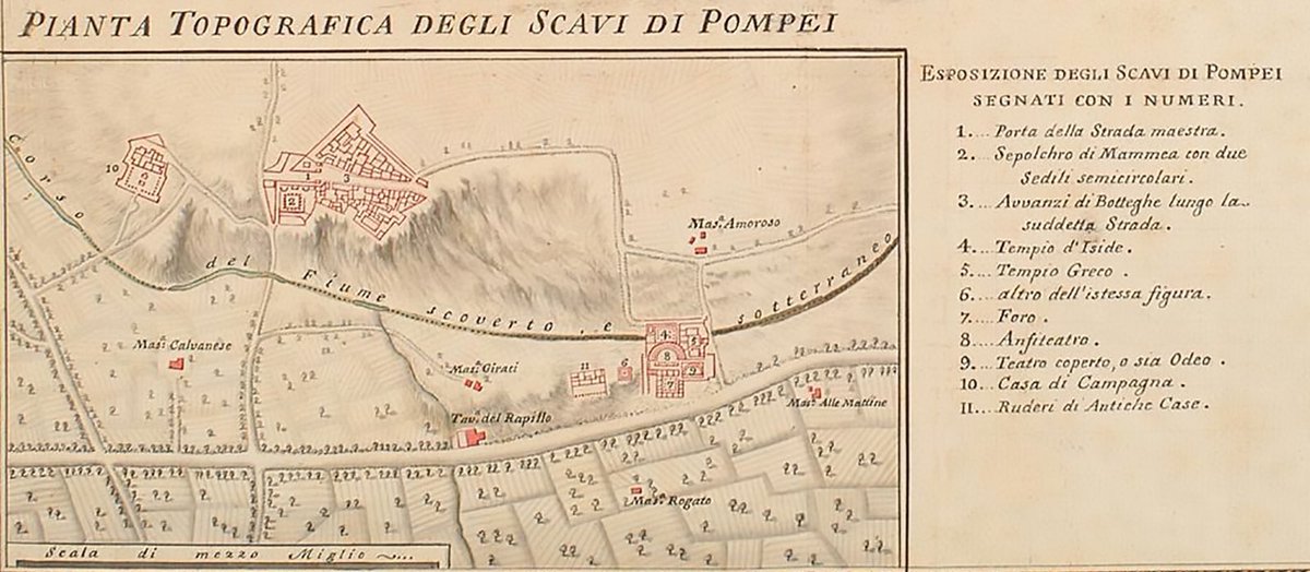
A very brief history of Pompeii in plans:
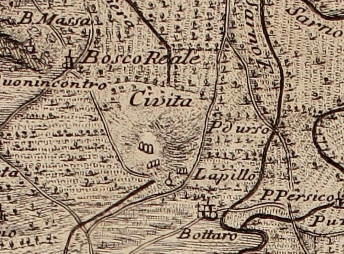
Historically, the hill that covered the ancient city of #Pompeii was known as ‘La Civita’ – the settlement.
Gaultier 1754
raremaps.com/gallery/detail…
#cartography @_MiBACT #viaggioinitalia #ArTyouReady #paesaggioitaliano
Historically, the hill that covered the ancient city of #Pompeii was known as ‘La Civita’ – the settlement.
Gaultier 1754
raremaps.com/gallery/detail…
#cartography @_MiBACT #viaggioinitalia #ArTyouReady #paesaggioitaliano
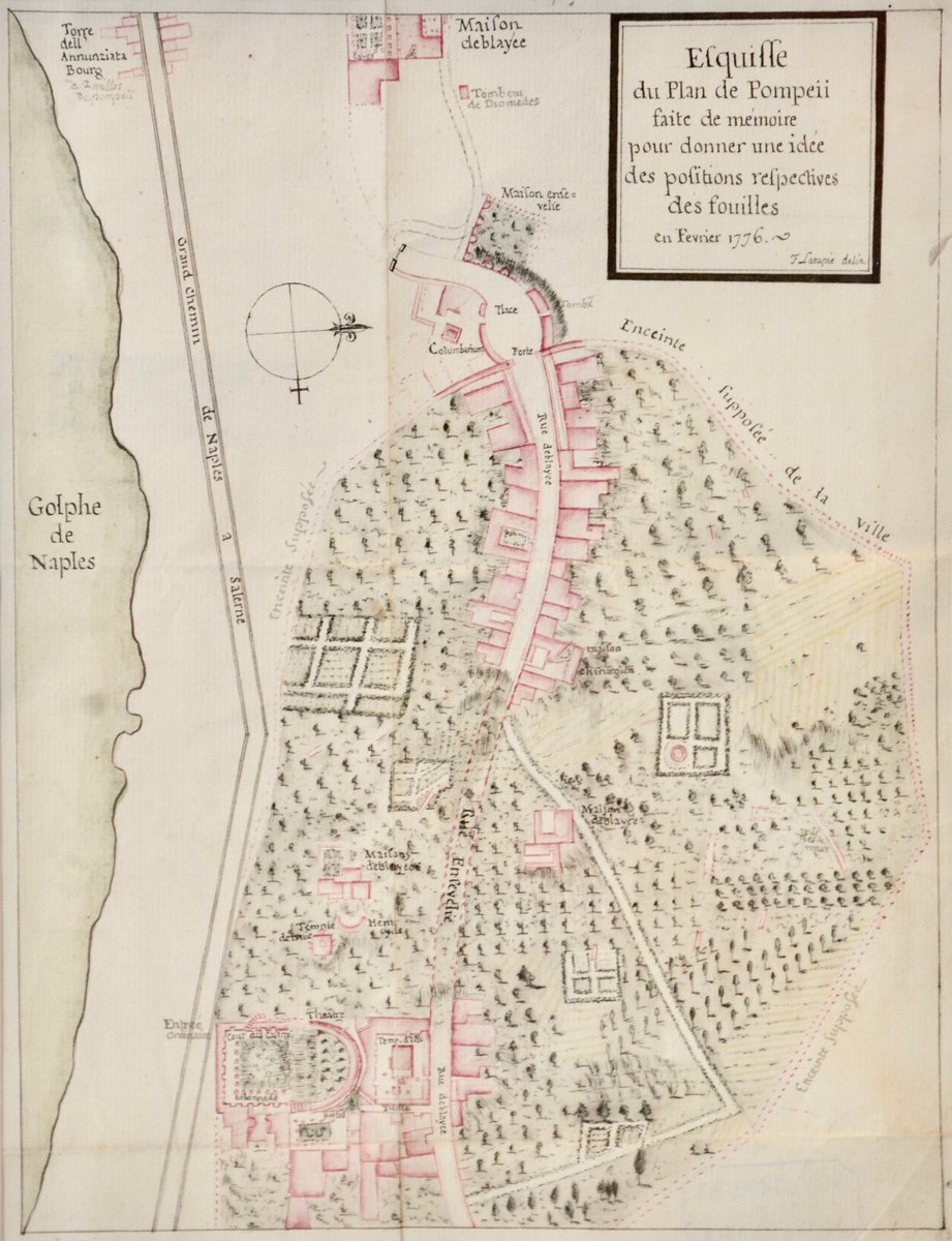
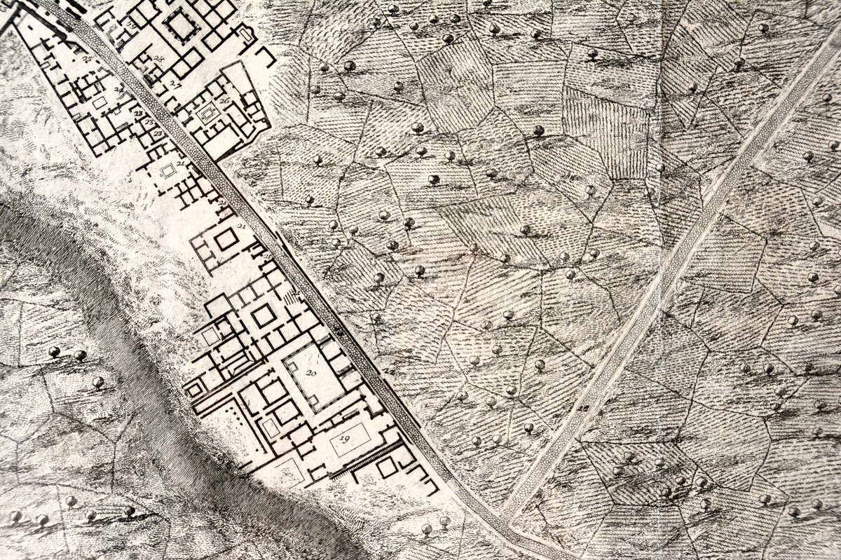
While excavation of #Pompeii was in its infancy plans of the city were being made and I love that they are barely identifiable as being the ancient city we see today.
Lapatie 1776
Piranesi 1792 (detail)
La Vega 1800
#cartography for @_MiBACT #viaggioinitalia


Lapatie 1776
Piranesi 1792 (detail)
La Vega 1800
#cartography for @_MiBACT #viaggioinitalia
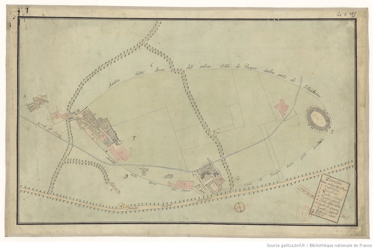
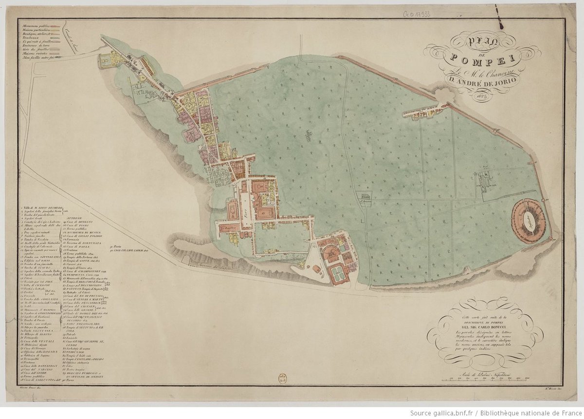
Under the auspices of French rule at the start of the 19th cent, excavations in #Pompeii opened up huge swathes of the ancient site & the city walls were uncovered revealing the extent of the urban area.
Unknown 1800
De Jorio 1825
#cartography for @_MiBACT #viaggioinitalia

Unknown 1800
De Jorio 1825
#cartography for @_MiBACT #viaggioinitalia
OK, so the first #cartobooks I am reviewing is "Österreich – Raum und Gesellschaft" (2019) by M. Seger and Thomas Hafner (cartographer, not credited as author). The book's claim is to give a comprehensive overview of Austria from a geographic perspective on 648 pages. #mapsathome 


Christopher Myers kalyban of #Cartography leads a creativity workshop at @NYUADArtsCenter with young poets from the moe_uaestudents #Masterpieces program before the final performance at @NYUAbuDhabi. Translations by… instagram.com/p/B8izE_SJttO/…
The conversation focuses on cultural memory and the role of poetry in shaping monuments to memories and what we’re trying to hold.
What will most poets say are the most important things in the world? asks Christopher Myers. He suggests that often, poets will argue for poetry as being that thing. (Even if behind the scenes, they are talking about money).
Q: why is a piece like this important?
A: there’s so much talk about migration and the framing and statistics impact policy. We can forget that those stories represent individual people with dreams that we can relate to #heroesjourney
A: there’s so much talk about migration and the framing and statistics impact policy. We can forget that those stories represent individual people with dreams that we can relate to #heroesjourney
On a show of hands, almost the entire audience from @acsabudhabi have lived in at least 2 or more countries. Migration is a common story in the UAE
Attention web cartographers: Today I'm releasing d3-geo-scale-bar version 1! It's a JavaScript library that makes it easy to add scale bars to your #D3js maps. Here's an introduction and tutorial on @observablehq: observablehq.com/@harrystevens/… #cartography 
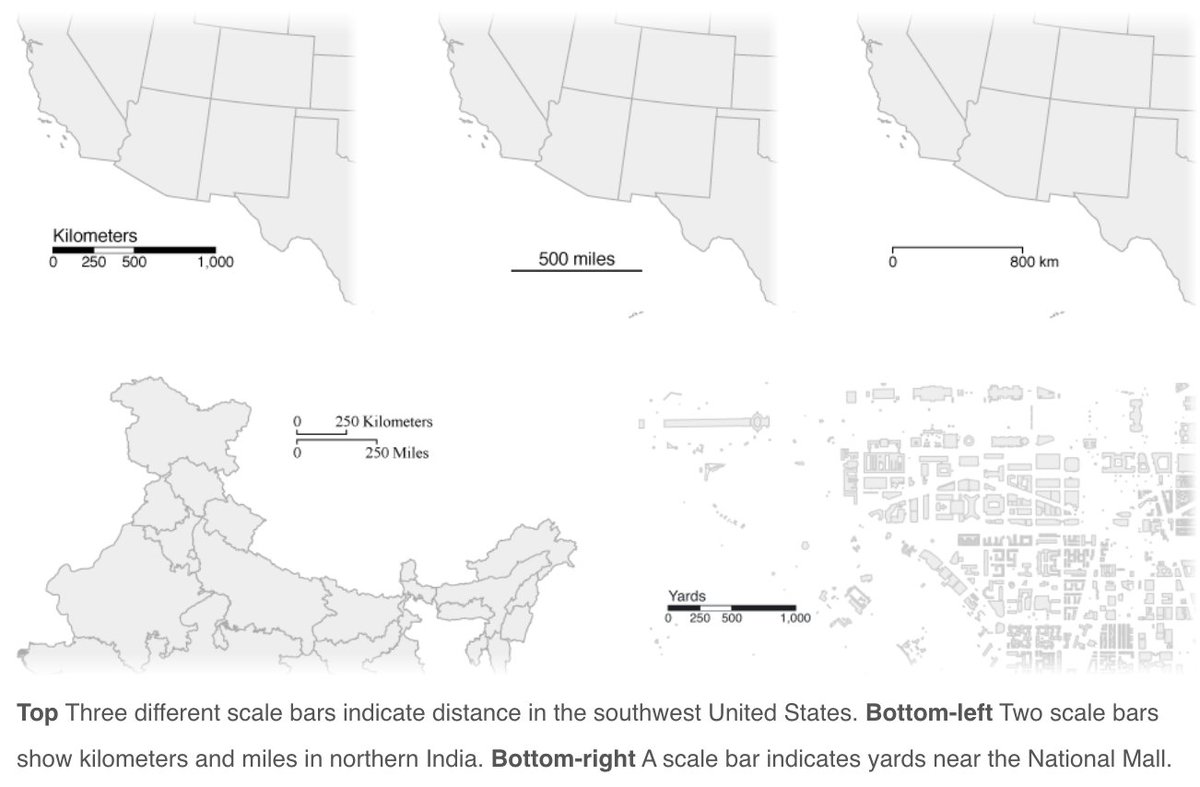
@observablehq Just give it a projection, and it'll give you a scale bar. It even plays nicely with transitions! observablehq.com/@harrystevens/…
@observablehq It also plays nicely with d3-zoom. observablehq.com/@harrystevens/…
The moment you’ve been waiting for! Welcome to North Road’s 2019 #24daysofQGIS. It’s our gift to you! Follow this thread to learn new tricks and tips to try in #QGIS. Every day a new bite-size, cinnamon-scented mapping treat to get you through to Christmas Day... 🎄🎁🌎
(This year we'll provide some tips that are accessible to all spatial people, regardless of your software of choice. We don’t want our #arcgis #mapinfo friends excluded! We'll be showing all examples in our software of choice - #QGIS, but we hope you can apply them to yours 👫🌏)
In 2019 we’ve been inspired by many beautiful looking maps (we’re looking at you #30daymapchallenge!), so this year we are dedicating #24daysofqgis to #dataviz, and sharing with you our insider tips to beautify your maps and data! 🗺️ Let’s begin...
Thread: Another overview amazing #Muslim *female* achievement.
Did you know the first university in the world was built by a Muslim woman approx 1200 years ago?
This is the story of Fatima Al-Fihiri (800–880 CE). #BadassWoman #twitterstorians
1/15
Did you know the first university in the world was built by a Muslim woman approx 1200 years ago?
This is the story of Fatima Al-Fihiri (800–880 CE). #BadassWoman #twitterstorians
1/15
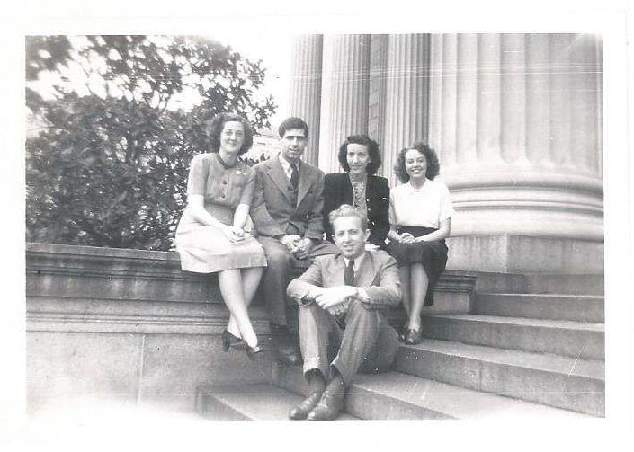
The First Female Intelligence Cartographer: Marion Frieswyk
As a 21yr old grad student @ClarkUniversity, Marion was 1st woman recruited into #OSS Map Division’s #Cartography Section, helping create a unique system of #map production.
bit.ly/2F55NyT
#WomensHistoryMonth
As a 21yr old grad student @ClarkUniversity, Marion was 1st woman recruited into #OSS Map Division’s #Cartography Section, helping create a unique system of #map production.
bit.ly/2F55NyT
#WomensHistoryMonth

During #WWII, Marion produced custom #maps & #3D topographic models supporting strategic studies & #military ops for US & allies.
After #OSS dissolved, Marion was one of a few cartographers who stayed w/the unit. She worked in CIA’s #Cartography Division until 1958.
After #OSS dissolved, Marion was one of a few cartographers who stayed w/the unit. She worked in CIA’s #Cartography Division until 1958.

Marion recognized early on how #geography enhances an intel officer’s ability to visualize & tell stories that resonate w/those we serve
Her passion & spirit represent timeless qualities that define our #Cartography Center to this day
bit.ly/2nk8UJd
#WomensHistoryMonth
Her passion & spirit represent timeless qualities that define our #Cartography Center to this day
bit.ly/2nk8UJd
#WomensHistoryMonth
(So 3rd attempt writing this thread. Now condensed)
#DnD World Building thread:
I'm writing up a largely sandy island for a #DnD5e campaign 🏝 The island is loosely shaped like a spear head, with a mountain ridge running along what might be seen as the spears ridge / fuller 🗡
#DnD World Building thread:
I'm writing up a largely sandy island for a #DnD5e campaign 🏝 The island is loosely shaped like a spear head, with a mountain ridge running along what might be seen as the spears ridge / fuller 🗡
I love the phonetic sounds of the Arabic language for this location. I'm currently thinking the island is called internationally as Al 'Ard Ramali. Which roughly translates to The Land of the Spear. Is that too many syllables for a countries name? Does it flow? ⁉
At the very tip of the island (the pointy end), is the capital, a large trading port city that is literally & physically split in two ⚓ It is known for trading in exotic items, precious metals & precious gems. Due to the desert environment that largely covers the island, food...
For 75 yrs the #Cartography Center has provided policymakers w crucial insights one can’t convey w just words
bit.ly/2emNSsU
#OSS75
bit.ly/2emNSsU
#OSS75

1942: Marion, a 21-year-old grad student at @ClarkUniversity, was 1st woman recruited into #OSS #Map Division’s #Cartography Section.
#OSS75
#OSS75
For 75 yrs CIA #Cartography Center has provided policymakers w crucial insights that can’t be conveyed w just words.
bit.ly/2emNSsU
bit.ly/2emNSsU
1942: Marion, a 21-year-old grad student at @ClarkUniversity, was 1st woman recruited into the #OSS #Map Division’s #Cartography Section.
1965: DCI encouraged analysts to use visuals to help explain complex problems. #VietnamWar generated increase demand for maps.
#Cartography
#Cartography

1966: #Cartography group, borrowed digitizer & compiled & digitized coastlines & international boundaries for entire world—in 1 weekend. 


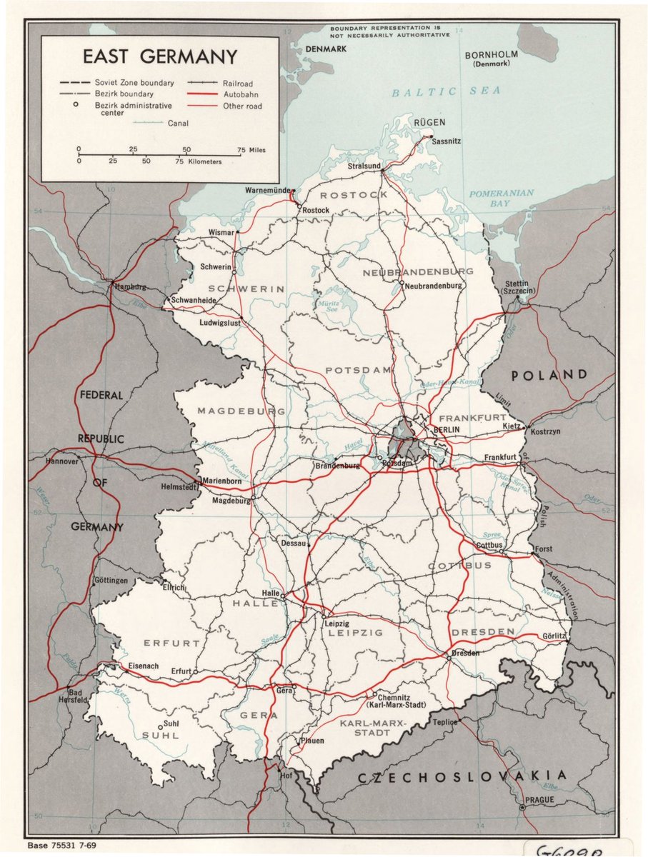


1970s: Improved #cartography efficiency led to an increase in research projects, particularly in atlases & street guides. 

#Cartography Center provides full range of maps, geographic analysis, & research in support of CIA, @WhiteHouse, senior policymakers, & IC.
#Cartography Center analyzes geospatial info & presents info visually in creative ways for maximum understanding by consumers. 


