Discover and read the best of Twitter Threads about #QGIS
Most recents (24)
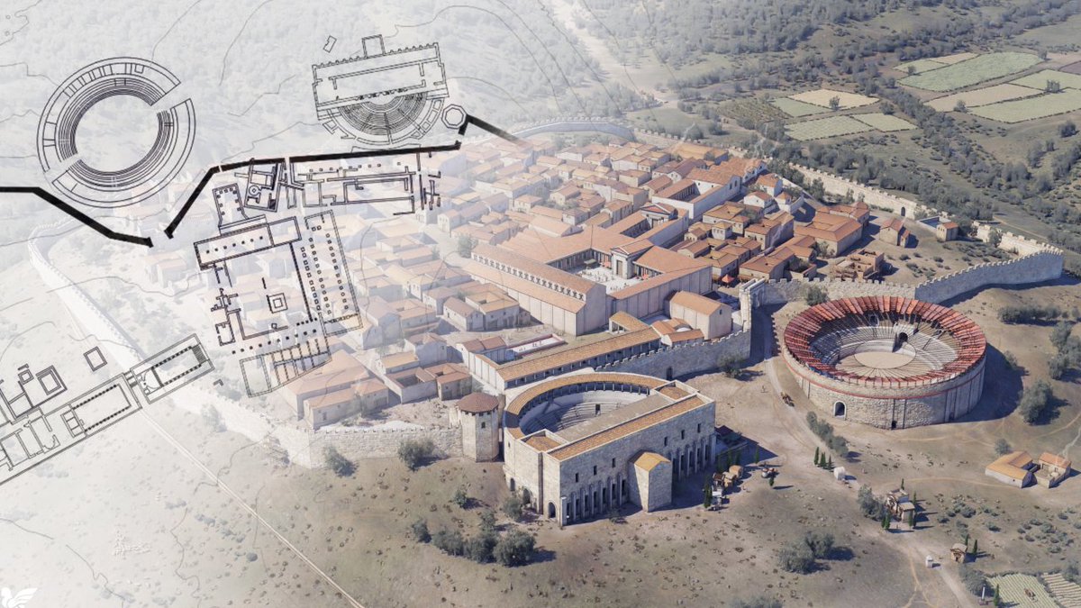
Hoy os presento mi último trabajo de reconstrucción virtual en #3D, uno al que tenía muchas ganas y que nos va a permitir viajar a uno de los enclaves romanos más importantes de la Península Ibérica: #Segóbriga, la ciudad del lapis specularis. ¿Me acompañáis? ¡Dentro hilo! 🧵👇 
Tutorial thread Blender 3-D Population Density👥📊🗺️Maps through @KonturInc using #QGIS and #Blender....#esri users you can follow along too because it can be done in your software too #gischat #thread #geospatial 


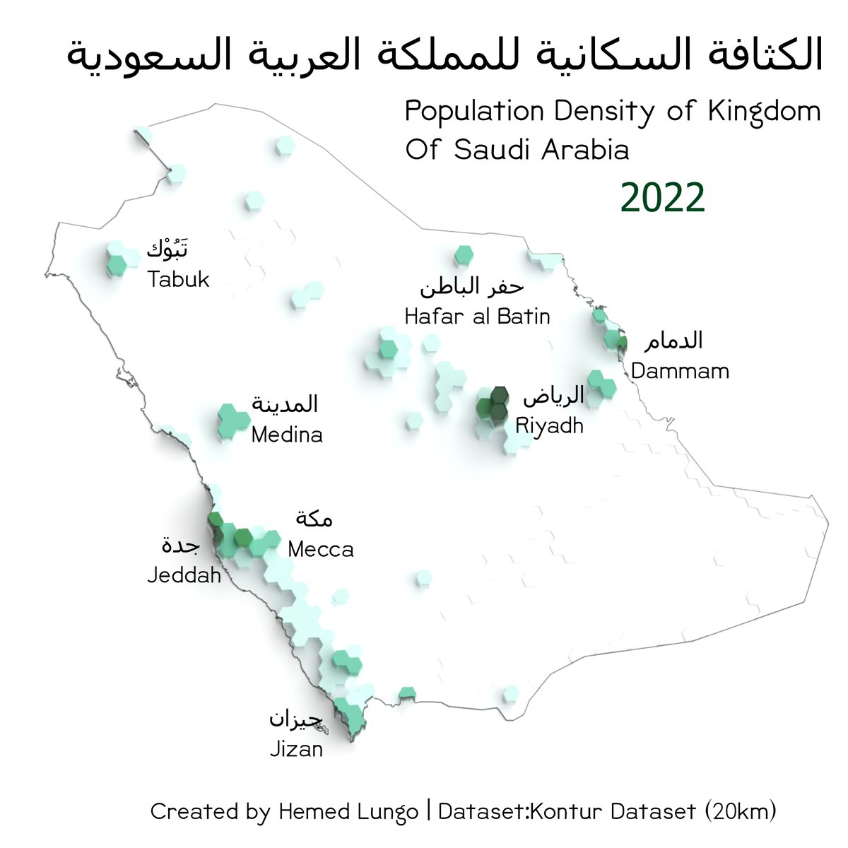
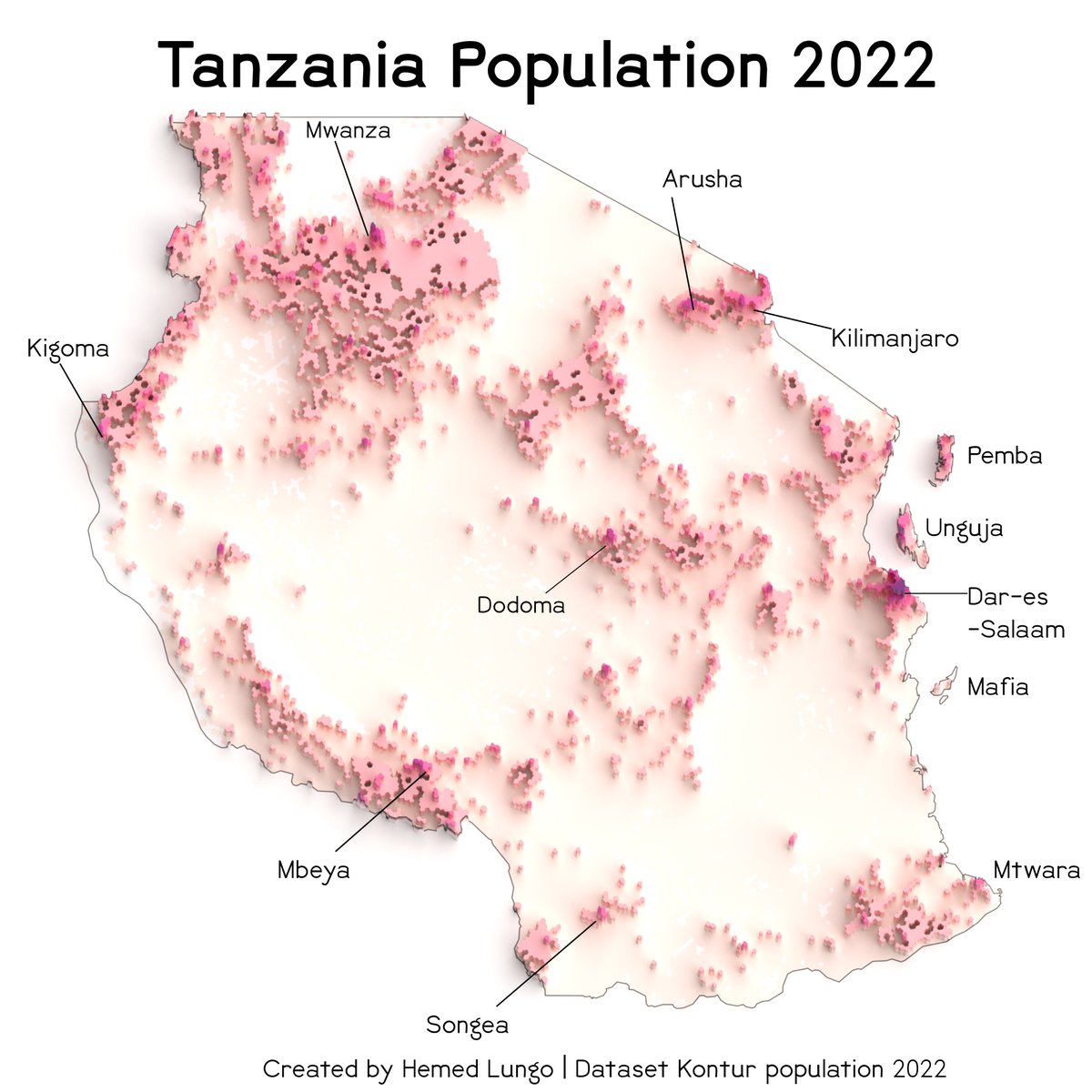
So I would divide this tutorial into four parts
1. Data Gathering(with @KonturInc )
2. QGIS(Black map and Color Map)
3. Rendering in Blender(No geometry nodes)
4. QGIS or other softwares (final touches)
1. Data Gathering(with @KonturInc )
2. QGIS(Black map and Color Map)
3. Rendering in Blender(No geometry nodes)
4. QGIS or other softwares (final touches)
So @KonturInc is a really good geospatial data provider together with risk management solution provider who deal with a lot of things as shown in link below But we will focus today on Their wonderful population data
kontur.io
kontur.io
Tutorial thread Blender 3-D Maps🏔️🗺️🧵: In this tutorial I'm going to show how you can also create 3-D Maps like the one shown below. Using #QGIS and #Blender....#esri users you can follow along too because it can be done in your software too #gischat #thread #geospatial 


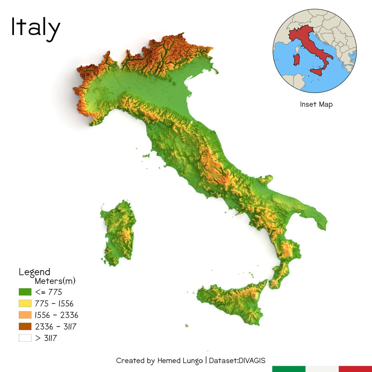


So I would divide this tutorial into four parts
1. Data Gathering(with @OpenTopography ) or DIVA
GIS
2. QGIS(Black map and Color Map)
3. Rendering in Blender(No geometry nodes)
4. QGIS or other softwares (final touches)
1. Data Gathering(with @OpenTopography ) or DIVA
GIS
2. QGIS(Black map and Color Map)
3. Rendering in Blender(No geometry nodes)
4. QGIS or other softwares (final touches)
1. In data gathering I normally use @OpenTopography to download the DEM required for blending/rendering .....the 90m and 30m and 10m are key consideration when downloading dem for instance in small area 30m works well but in large areas 90m works best....
Here is a more comprehensive list of plugins for land use and land cover (LULC) analysis in QGIS. The selection of plugins depends on the specific research question and the type of data available. #gischat #geospatial #GIS #LULCanalysis #QGIS
Semi-Automatic Classification Plugin (SCP): This plugin provides a user-friendly interface for supervised and unsupervised classification of remote sensing images. It includes a wide range of classification algorithms.#gischat #geospatial #GIS #LULCanalysis #QGIS 

Land Cover Classification System (LCCS): This plugin allows users to classify land cover based on a standardized classification system developed by the FAO. It includes a set of rules and guidelines for classifying land cover.#gischat #geospatial #GIS #LULCanalysis #QGIS 

Remote sensing (RS) software tools can help you analyze and interpret satellite or airborne data. If you're on a tight budget, don't worry - there are plenty of great free options out there!#gischat #geospatial
#QGIS is a powerful and user-friendly open-source #GIS software that includes RS tools. You can use it to visualize, analyze, and process your RS data. It supports a wide range of file formats and has an active community.#gischat #geospatial
qgis.org/en/site/foruse…
qgis.org/en/site/foruse…

Sentinel Application Platform is a free, multi-platform tool for processing and analyzing data from various RS sensors, including Sentinel-1, Sentinel-2, and Sentinel-3. It includes a user-friendly GUI and a powerful toolbox. @esa #gischat
step.esa.int/main/download/…
step.esa.int/main/download/…

1/ E se 5000 pessoas partissem, em simultâneo, de Lisboa, cada qual com o seu destino até uma das 5000 localidades mais populosas de Portugal?
A única regra é: Utilizar o caminho mais rápido.
#Portugal #Map #visualization #Python #QGIS @iestruturas_pt
A única regra é: Utilizar o caminho mais rápido.
#Portugal #Map #visualization #Python #QGIS @iestruturas_pt
2/ Este foi um "projecto-experiência" que fiz, há 2 anos, e nunca cheguei a publicar. O resultado foi visualmente agradável e, por isso, entendi agora, não deveria terminar os seus dias em oblívio numa pasta chamada pt_dent_exp_00.
3/ O intuito foi criar uma visualização animada dos padrões dendríticos que emergem da nossa infra-estrutura rodoviária e, com isto, tentar modelar o aspecto de uma "figura de Lichtenberg" ou - não muito diferente - a da propagação de um relâmpago.
I have really wonderful news! #QGIS.org is going to fund a full-time document writer to help the really overtaxed documentation team. Please read the rest of this thread for details!
This will be a 12-month contractor position with @KartozaGeo acting as the managing company for the employment contract.
The salary (1300 EUROS per month) probably means the position is more suitable for someone living in a developing nation where the cost of living is low.
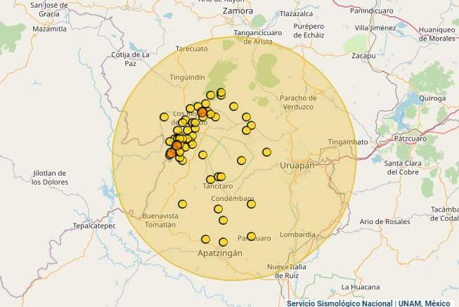
¿Estamos ante la aparición de un nuevo #volcán en #Michoacán? 🇲🇽🌋 Hilo🧵👇
✍️Nota: Algunas imágenes tienen información adicional y extendida, pueden consultara oprimiendo el botón (ALT).
✍️Nota: Algunas imágenes tienen información adicional y extendida, pueden consultara oprimiendo el botón (ALT).
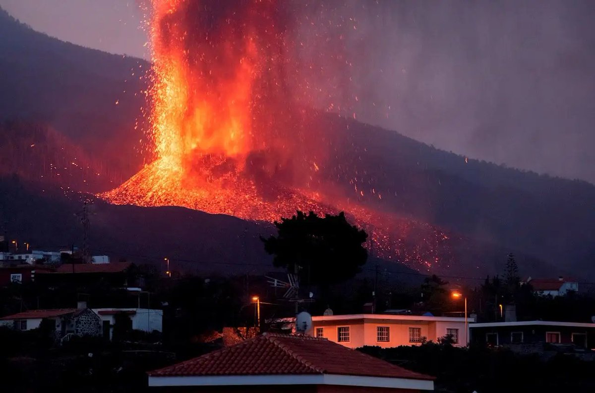
Los últimos días se han registrado nuevamente una serie de eventos sismos de poca profundidad cerca de la comunidad de Peribán de Ramos al noroeste de la Ciudad de #Uruapan. 
Do you love 3D maps, worlds & visualisations? Here are 24 world creators, mapmakers, or visuals I've come across recently. Brilliant and creative minds using many different tools! PART 1 #dataviz #GISchat #3dmaps #map #gis #3d 1/🧵
Steven Kay | @stevefaeembra creates many original and cool #3dmaps such as this great visualisation of Windturbines in the British Isles. Follow him! #Blender3D and #QGis are his tools. #SDGs #Wind #b3d 2/🧵
1/ Los mapas son herramientas clave para comprender la realidad social y como esta se plasma en el territorio
He hecho este mapita sobre la ciudad de Teruel en el que se aprecia perfectamente el constraste en los edificios del casco histórico y los nuevos desarrollos urbanos
He hecho este mapita sobre la ciudad de Teruel en el que se aprecia perfectamente el constraste en los edificios del casco histórico y los nuevos desarrollos urbanos
2/ Está hecho con #QGIS , un software gratuito y los datos están obtenidos con Catastro Inspire
Si os gusta puedo hacer un tutorial sobre cómo hacerlo, que no es muy difícil y algunas personas me habeís preguntado como hago los mapas 😁
Si os gusta puedo hacer un tutorial sobre cómo hacerlo, que no es muy difícil y algunas personas me habeís preguntado como hago los mapas 😁
3/ Para este mapa en concreto me he inspirado en este reportaje de @eldiarioes , uno de los mejores que he leído en los últimos años
especiales.eldiario.es/espana-vive-en…
especiales.eldiario.es/espana-vive-en…
No cartographer can resist the infamous joy plot. Let me give away my secrets for doing it in #QGIS... 


Acabo de actualizar y subir las imágenes de #docker para correr las últimas versiones de @qgis (3.27 master, 3.26 LR y 3.22 LTR) a mi cuenta de #DockerHub: hub.docker.com/repository/doc… 

@qgis Puedes entender cómo manejar estas imágenes siguiendo esta entrada que hice en el blog de @qgises: qgis.es/post/2021-03-2…
Qué lindo es el #Plugin #QuickOSM de #QGIS!!! Con él se pueden consultar datos de #OpenStreetMap de forma rápida dentro de QGIS.
#Hilo con ejemplos ->
#Hilo con ejemplos ->

Going to thread up some pix from today's #geology hike at #VasquezRocks.
(Why are those rocks right there? We'll get to that...) 🧵
(Why are those rocks right there? We'll get to that...) 🧵

3D maps can look complex & difficult to make…
Here are 12 humans who proved to me that 3D is not out of reach:
Different tools, many styles... all fantastic: 1/14🧵 #dataviz #3dmaps #gis
Here are 12 humans who proved to me that 3D is not out of reach:
Different tools, many styles... all fantastic: 1/14🧵 #dataviz #3dmaps #gis
Graig Taylor | @CraigTaylorViz: Legendary 3D maps made in #Cinema4D. Not only gorgeous maps but also perfectly animated worlds. His maps cannot be unseen. Clearly a #3dmap guru. #GIS #dataviz 2/14
Tyler Morgan-Wall |@tylermorganwall devlpr of the incredible R libraries #rayshader and #rayrender adding features & tutorials for free at an incredible pace: a *true treasure* for the #rstats #3dmaps & #3dviz world. A must-follow for 3d #dataviz. 3/14 🧵
Day 08: Blue
#30DayMapChallenge
Crimean native names in Southern Ukraine.
The map covers historic names of places (toponyms) used by people native to the area of the former Crimean state "Qirim Yurt" and around it.
#QGIS Data: qirimlide.wordpress.com
#30DayMapChallenge
Crimean native names in Southern Ukraine.
The map covers historic names of places (toponyms) used by people native to the area of the former Crimean state "Qirim Yurt" and around it.
#QGIS Data: qirimlide.wordpress.com

The project was initiated by Roman Alieiev, who lives in Germany and Crimean Tatar “QIRIMLI” initiative group.
See the video for more details
See the video for more details
Crimean Tatars are one of the main indigenous peoples of Ukraine. This is enshrined in law.
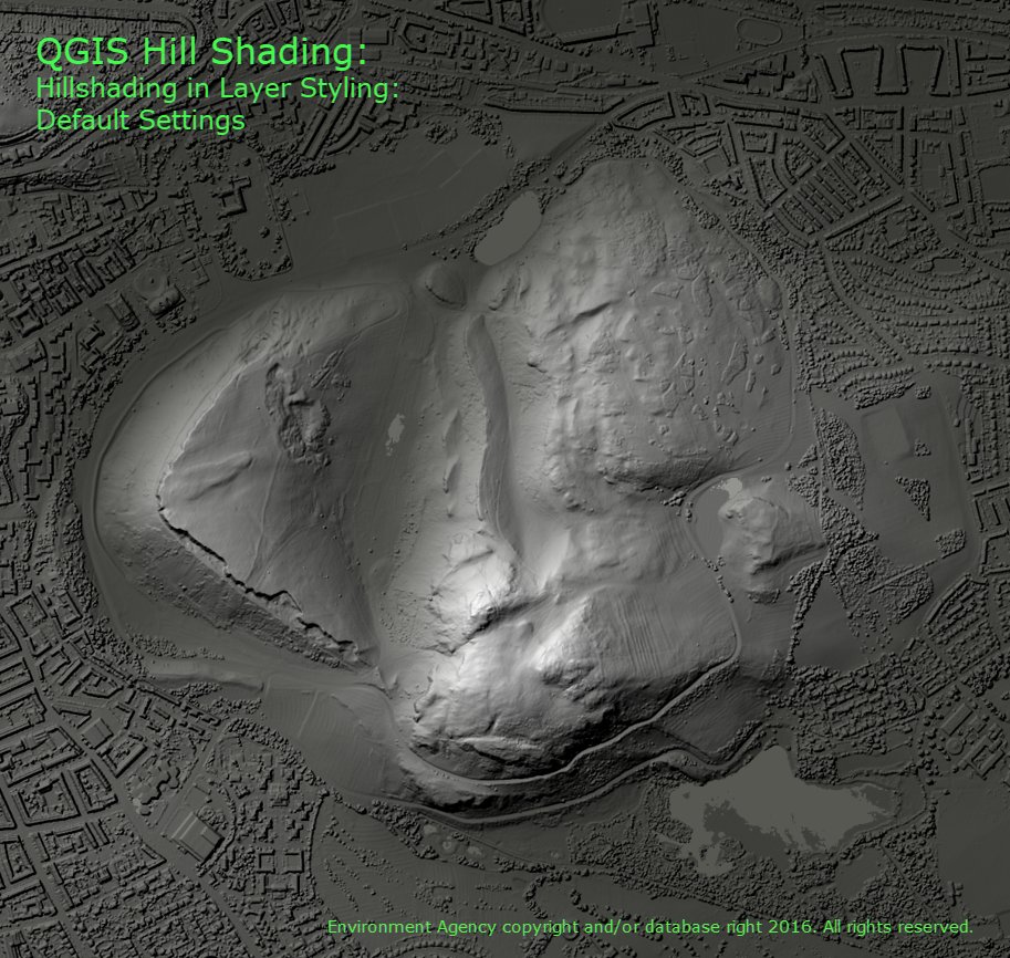
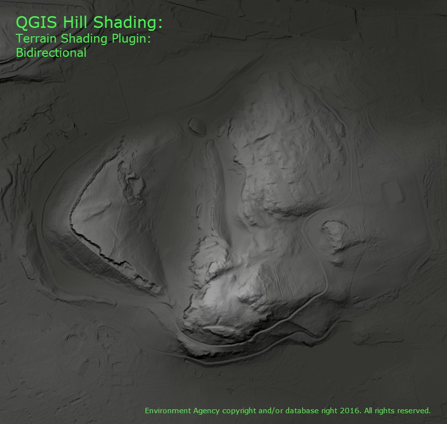
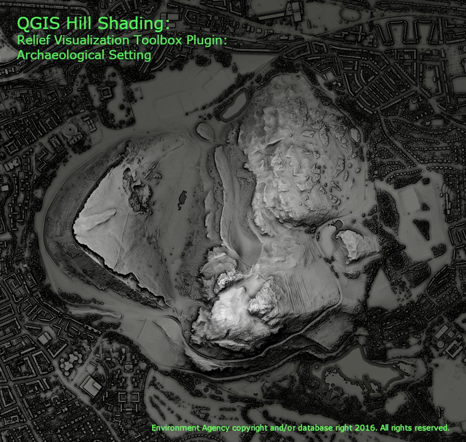
I did a comparison of the different hill shading tools in #QGIS and got some amazing results. Each one was blended with a DTM to give a bit of depth. Have a look at this thread for details on the 7 ways I tried, these are the most interesting. 1/n 
I've been looking at animating vector data in #QGIS with the Temporal Controller instead of the Time Manager. I started with @tjukanov's brilliant exercise: medium.com/@tjukanov/geog…
I wanted icons not circles, but Icons have directionality & I wanted them to face the right way
I wanted icons not circles, but Icons have directionality & I wanted them to face the right way
Thanks to @HeikkiVesanto giving me the code to find out the direction to the next point in a sequence:
...which I wrapped in a function to convert to degrees, I could use a Data Defined Override to set the rotation.
...which I wrapped in a function to convert to degrees, I could use a Data Defined Override to set the rotation.
Remember that curved #QGIS label callout I was experimenting with recently? Well it's available now in QGIS nightly releases, along with a whole bunch of other new callout sweetness 🎁👍Here's a little gallery of the new capabilities:
Massive new #QGIS plugin: #GEE Timeseries Explorer offers instant access to #EarthEngine image collections! Fetch #Landsat, #Sentinel2, or #MODIS #timeseries for any location and visualize images: geetimeseriesexplorer.readthedocs.io 🧵
Choose from our predefined collections, for instance merged & #cloud masked #Landsat TM, ETM+, OLI surface reflectance, cloud masked Sentinel2AB L2A, or just define your awesome custom collection in the built-in #Python editor. 

Extract time series profiles for #training / #validation by clicking on map, or by navigating through vector point file. Download raw time series data for #sample-based workflows efficiently with parallel download.
For this year's #30DayMapChallenge i will be trying to create 30 maps on #Berlin just using #OpenData and #OpenSource software. For day 01 - Polygons, a map of all of Berlin's street trees. #QGIS Source: github.com/sebastian-meie… 
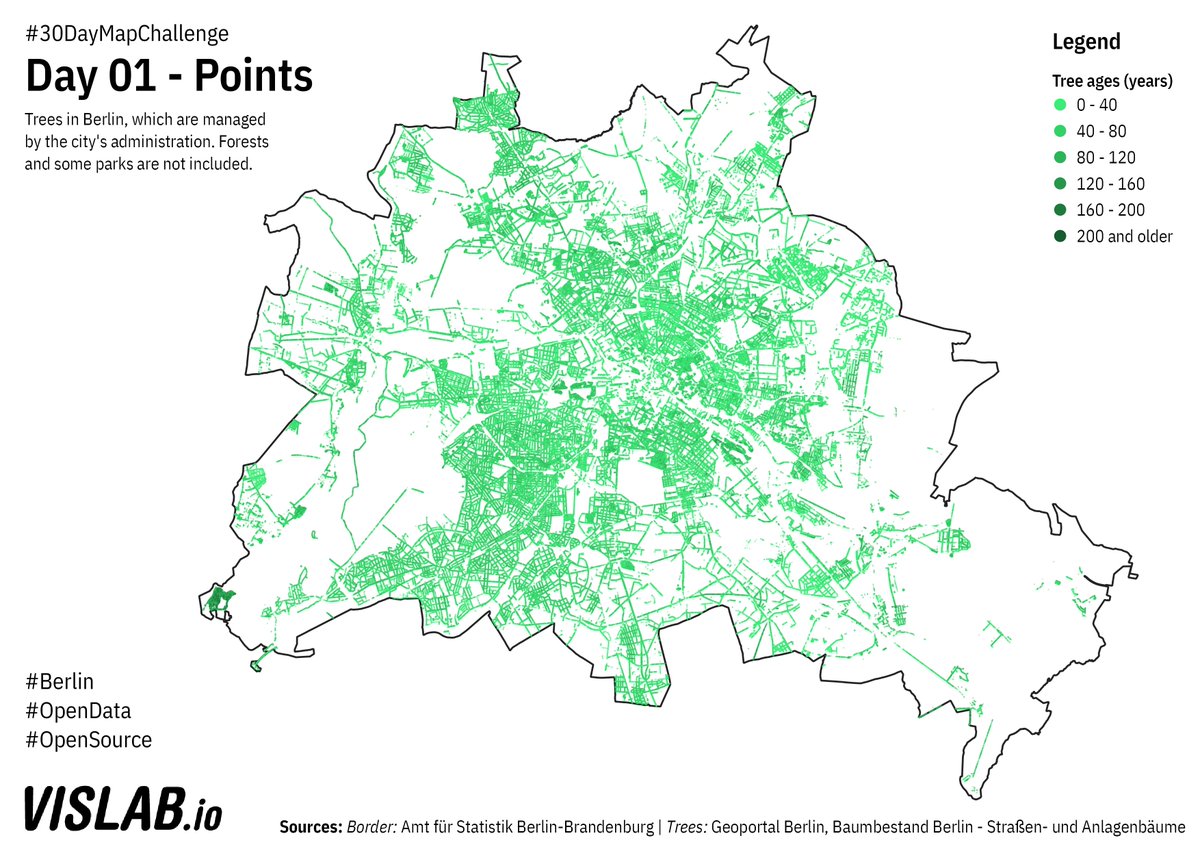
BTW @citylabberlin has built an #FOSS platform for visualising and managing joint efforts for watering trees during dry periods in the summer: giessdenkiez.de Source code: github.com/technologiesti…
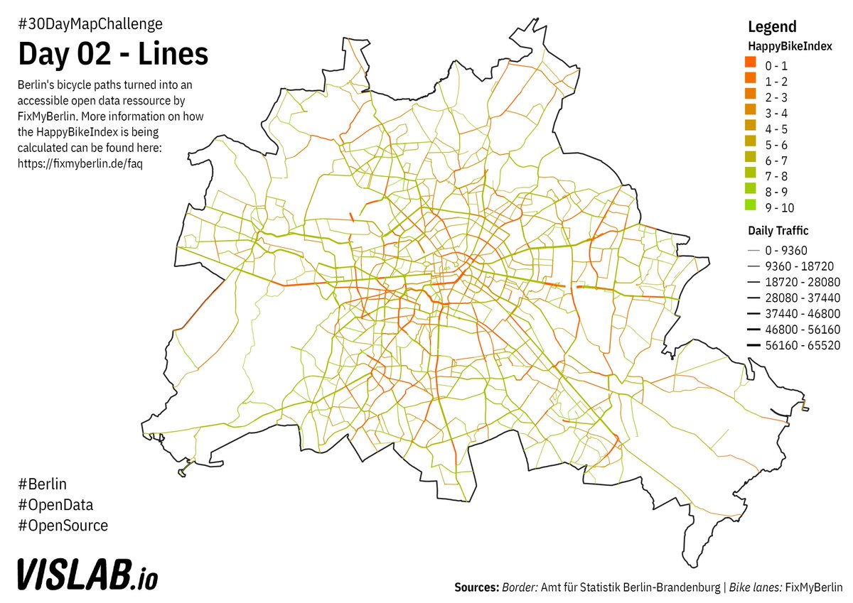
Day 2 of #30DayMapChallenge : Lines. Bike lanes in Berlin provided by @FixMyBerlin's API, showing their HappyBikeIndex. To explore the data set more in depth check out: fixmyberlin.de/zustand Code: github.com/sebastian-meie… 
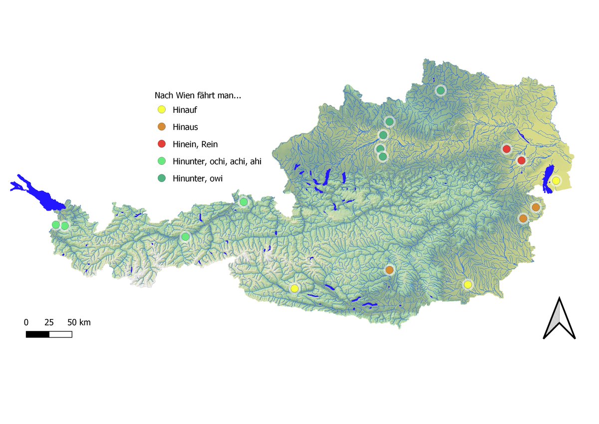
Zwischenstand:
Glaube Vorarlberger*innen fahren garnicht nach Wien und in der Steiermark und im Südburgenland muss man sich noch einigen 😁
Glaube Vorarlberger*innen fahren garnicht nach Wien und in der Steiermark und im Südburgenland muss man sich noch einigen 😁

If you care about #Asia’s #rivers, or interested in its #paleoclimate, I have a data set for you: 813 years of annual discharge (streamflow) at 62 stations on 41 rivers in 16 countries, from 1200 to 2012. This thread explains how we created it, and all the data underlying it. 

To estimate discharge hundreds of years ago, we need three things: (1) modern discharge observations, (2) a proxy of past climate, and (3) a model that links those two.
Most of our modern observations came from GSIM, a massive effort by Hong Do, @LukGudmundsson, Michael Leonard, and @sethwestra. Besides, we emailed everyone we knew asking for more data, and our colleagues kindly shared theirs.
earth-syst-sci-data.net/10/765/2018/
earth-syst-sci-data.net/10/765/2018/
I might be the last one on the population flag map bandwagon, but I’m pleased with the result! Thanks to @StatCan_eng @StatCan_fra for providing nearly *half a million* polygons to select from.
#cartography #gischat #QGIS #canada @CanadianGIS @GANSorg
(Details in the thread.)
#cartography #gischat #QGIS #canada @CanadianGIS @GANSorg
(Details in the thread.)

Over the last couple of weeks people have been posting their population flag maps, so I thought I’d try my hand at creating one for Canada. I figured that with detailed census data, I might even be able to include a reasonable facsimile of the maple leaf.
So I went to download the boundary file of Canada’s 56,589 dissemination areas, the smallest geographic area for which full census data is provided. That’s when I discovered that Statistics Canada also provides a 'dissemination block' boundary file.


