Discover and read the best of Twitter Threads about #NorthAfrica
Most recents (24)
" Exploratory Data Analysis on Terrorism "
🧵
🧵
We are performed Exploratory Data Analysis on terrorism #dataset to find out the hot zone of #terrorism. #EDA nothing but #analyzing the given data & finding the #trends, patterns & making some assumptions. #DataVisualization #DataScience #MachineLearning
In this #dataset, there are many features including countries, states, regions, gang names, weapon types, target types, years, months, days, and many more features.
{Thread} What is Africa? 🧵⬇️
Credits: @ameghnas_kabyle
#Africa #NorthAfrica #Amazigh #berber #history #ancient
#white #subsahara #black


Credits: @ameghnas_kabyle
#Africa #NorthAfrica #Amazigh #berber #history #ancient
#white #subsahara #black


A long range image based weather forecast thread for #Ethiopia, #NorthAfrica #MiddleEast and #India...
Occasioned by my return from Ethiopia to my home in France. These first two images show #Ethiopia on June 2nd and June 7th (today). The big rains are beginning.

Occasioned by my return from Ethiopia to my home in France. These first two images show #Ethiopia on June 2nd and June 7th (today). The big rains are beginning.


These three big pictures show satellite observed cloud activity yesterday over the tropical belt in the populated hemisphere from the Western Pacific across the Indian and Atlantic Oceans to the Eastern Pacific. 


The description part of this thread begins over the Indian Ocean which as you can see here - in a 16 day precipitable water forecast - is filling up with water coming in from the east.
On the basis of this GFS model forecast it looks as if the Indian Monsoon is about to begin.
On the basis of this GFS model forecast it looks as if the Indian Monsoon is about to begin.
#Ethiopia #NorthAfrica #MiddleEast long rang rainfall forecast bulletin 2022 - #1
Around this time last year I began posting rainfall forecasts for East Africa & Horn of Africa. These expanded to include North Africa & ME.
I am restarting them today.

Around this time last year I began posting rainfall forecasts for East Africa & Horn of Africa. These expanded to include North Africa & ME.
I am restarting them today.

The big picture. The West African Monsoon is undergoing an intense period and significant amounts of atmospheric is transiting the Sahara bringing clouds & rain to the Middle East.
Rain forecasts for East Africa show significant rain over the coming fortnight.
Rain forecasts for East Africa show significant rain over the coming fortnight.

Sub thread: Covers the past two weeks as West African Monsoon was building. Interestingly the rains appear to be arriving in the Horn and East Africa at roughly the same time, and at similar intensity to last year.
🧵The war in #Ukraine impacts #foodsecurity in #NorthAfrica & globally. We asked what can Europe do 👉🏼 bit.ly/35WLncH. Today @EU_Commission presented its communication on safeguarding #FoodSecurity & reinforcing the resilience of #food systems 👉🏼 bit.ly/3irbhrU
📖 Humanitarian assistance to #Ukraine & beyond will come partly through financial contributions to the @WFP. At the same time, the EU asks member states not to enforce export bans (as in Hungary) to avoid a rise in food prices, inflation & further conflicts. @VDombrovskis
🌿But this means, the EU allows to freeze ambitions for sustainability & resilience – derogating from greening obligations under the #EUGreenDeal & #EUFarm2Fork. Additional area of 4 million hectares can now be used for food & feed production. @jwojc @JeroenCandel @jeroenkwakbo
NEW—Global estimates of #ExcessDeaths indicates that 18.2 million people may have died because of the #COVID19 pandemic by December 31, 2021, according to our analysis published in @TheLancet
thelancet.com/journals/lance…
thelancet.com/journals/lance…

The peer-reviewed analysis found over 18 million* deaths as opposed to the reported nearly 6 million deaths, more than 3 times higher.
“COVID effectively increased the global death rate each year by nearly 20% in both 2020 and 2021,” said IHME Director Chris Murray ⤵
“COVID effectively increased the global death rate each year by nearly 20% in both 2020 and 2021,” said IHME Director Chris Murray ⤵
💡So what is #ExcessMortality?
Our excess mortality estimates reflect the full impact of the #pandemic on mortality around the world (after correcting for known biases), not just the deaths directly attributable to SARS-CoV-2 infection.
Our excess mortality estimates reflect the full impact of the #pandemic on mortality around the world (after correcting for known biases), not just the deaths directly attributable to SARS-CoV-2 infection.
Cyclone Shaheen-Gulab (meaning: Falcon-Rose) is making landfall in Oman right now. In this animation we can see how its outflows are bringing rain to the Horn of Africa.
This week's rainfall forecasts for #NorthAfrica #HoA and #MiddleEast follow:
This week's rainfall forecasts for #NorthAfrica #HoA and #MiddleEast follow:
Two animations follow showing the development of Shaheen-Gulab over the past 48 hours, into what looks like a well organised powerful storm. This animation begins on Friday night and runs for 24 hours.
And this one starts yesterday afternoon and runs till about half an hour ago. #ArabianStorms [@Arab_Storms]
Rains over the #HornOfAfrica are back to monsoon level, and the heavier rains are forecast to remain for at least a fortnight.
This week's rainfall forecasts for #HornOfAfrica, #NorthAfrica and the #MiddleEast follow.
This week's rainfall forecasts for #HornOfAfrica, #NorthAfrica and the #MiddleEast follow.
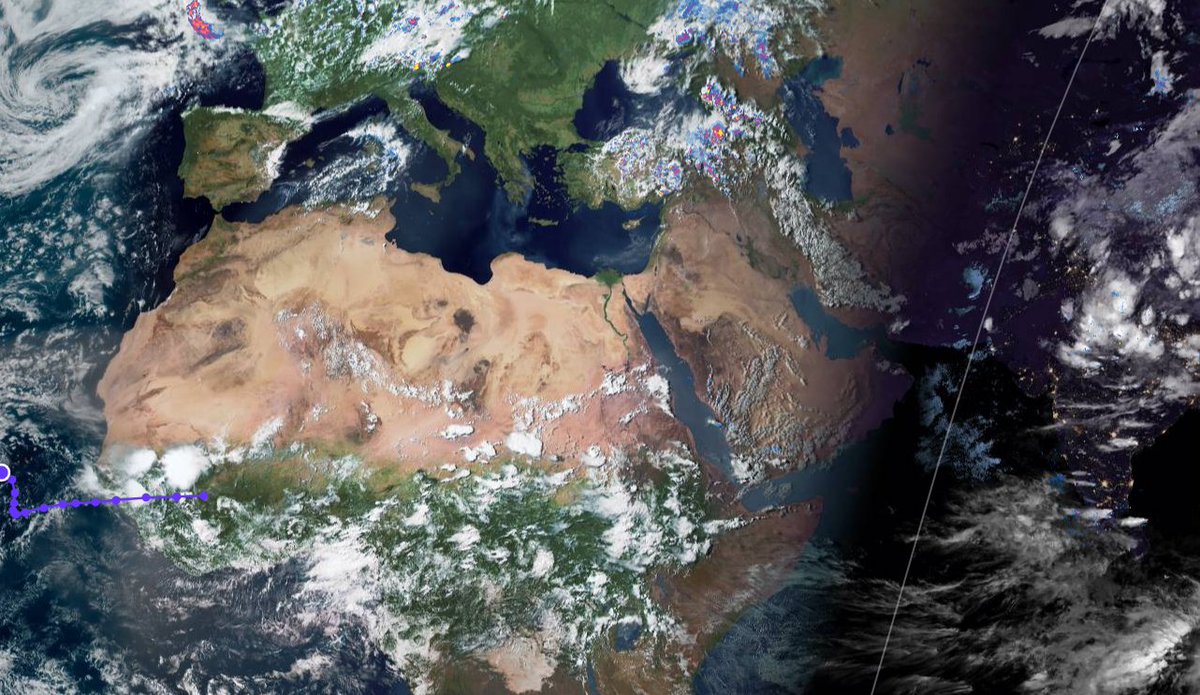
Today's forecasts big picture is of the view from above of North Africa, The Middle East, The Horn of Africa India and southern parts of Europe and Central Asia.
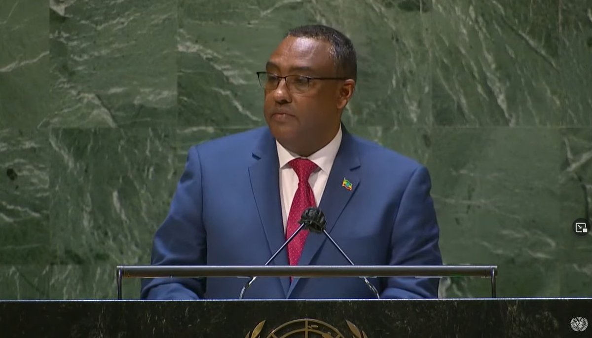
Ethiopia's @DemekeHasen has just started speaking to the #UNGA on behalf of the peoples of Ethiopia.
Ethiopia's @DemekeHasen has just started speaking to the #UNGA on behalf of the peoples of Ethiopia.

Here's a picture of Ethiopia's Deputy PM and Foreign Affairs Minister @DemekeHasen. 
Today, @irishmissionun hosts a #UNSC debate on #climate and #security. @SCRtweets has a preview: securitycouncilreport.org/whatsinblue/20…
The @UN #FoodSystemsSummit also takes place today, highlighting the overlap between 3 critical issues.
We'll be tweeting highlights from today at #UNGA 🧵👇
The @UN #FoodSystemsSummit also takes place today, highlighting the overlap between 3 critical issues.
We'll be tweeting highlights from today at #UNGA 🧵👇
@irishmissionun @SCRtweets @UN Writing for @monkeycageblog @washingtonpost, ISD's @McFarlandKellyM and @KitGraceEvans highlight key recommendations from ISD's #foodinsecurity report in advance of today's #FoodSystemsSummit: washingtonpost.com/politics/2021/…
@irishmissionun @SCRtweets @UN @monkeycageblog @washingtonpost @McFarlandKellyM @KitGraceEvans At the UNSC today, world leaders spoke of climate #resilience in the face of existential threats to our environment:
It appears the US assumption that the rains are ending soon in the Middle East and Horn of Africa is incorrect.
A rainfall forecast for the #NorthAfrica, #HornOfAfrica and the #MiddleEast follows.
A rainfall forecast for the #NorthAfrica, #HornOfAfrica and the #MiddleEast follows.
This is the cause, the Indian Monsoon is not over yet. Here we see a 16 day forecast through till early October.
This GFS long range forecast shows a significant monsoon boost which has the capacity to bring significant rain to both the Middle East and the Horn of Africa in the coming fortnight, including a late season tropical storm to Somalia.
Today's rainfall/weather update for the #NorthAfrica #HornOfAfrica and #MiddleEast follows.
The short version is that the peak of the rainy season may have passed, but there are signs of another Indian Monsoon surge coming in 10-12 days in long range forecasts.
The short version is that the peak of the rainy season may have passed, but there are signs of another Indian Monsoon surge coming in 10-12 days in long range forecasts.
Here is the long-range GFS model PWAT forecast for the Indian Monsoon. Towards the end it strengthens and we see high levels of moisture heading for the #HornOfAfrica.
A global weather surveillance thread.
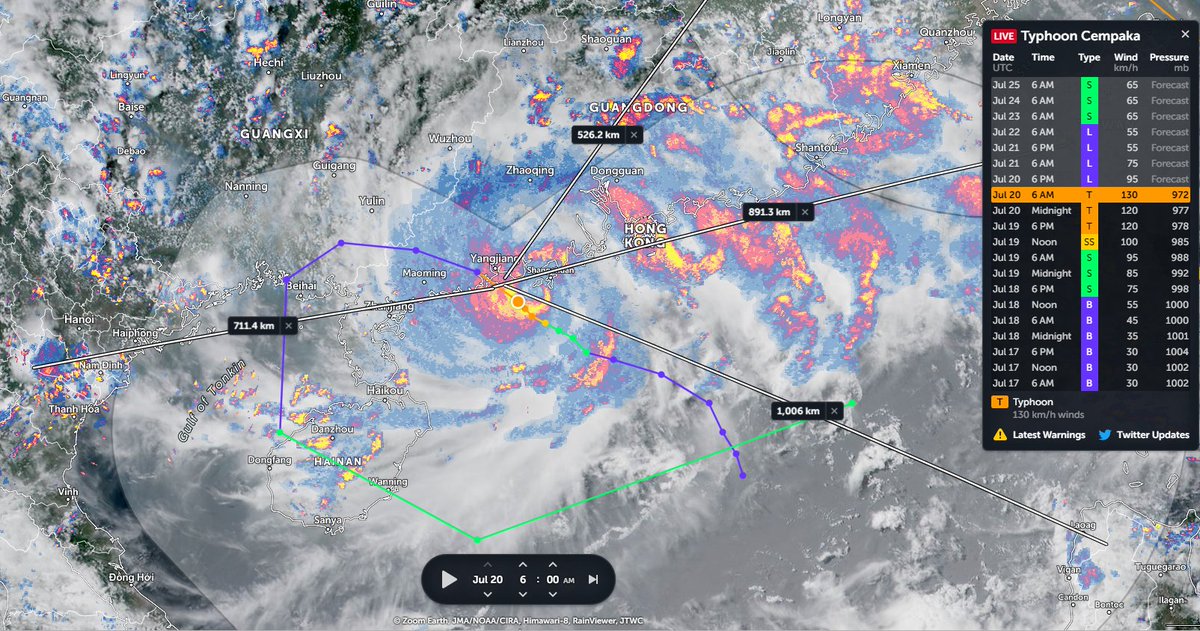
We begin in the West Pacific where Typhoon #INFA is now over China bringing rain to 100s of millions.
We begin in the West Pacific where Typhoon #INFA is now over China bringing rain to 100s of millions.
Here's a closeup of #INFA over the past 12 hours rain bands have now reached the already flooded Henan province.
Some early coverage of the impact here: nypost.com/2021/07/26/chi…
Including more harrowing video of flooding.
Including more harrowing video of flooding.
This week's rainfall forecasts for the #HornOfAfrica, #NorthAfrica and the #Middle East follow.
Image: Typhoon INFA over China showing the lights of Tokyo where the world is gathered to celebrate youth & excellence and the unity of the nations of the world at the Olympics.
Image: Typhoon INFA over China showing the lights of Tokyo where the world is gathered to celebrate youth & excellence and the unity of the nations of the world at the Olympics.
Congratulations to Ethiopia and Ethiopians everywhere on today's completion of the 2nd filling of the #GERD. It has been a great honour to follow along during this moment.
Today's rainfall forecasts for #NorthAfrica, #HornOfAfrica and #MiddleEast follow.
Today's rainfall forecasts for #NorthAfrica, #HornOfAfrica and #MiddleEast follow.
The presentation of the #ArabianMonsoonBurst has changed dramatically today with the consolidation of activity over the Arabian Peninsula into a single huge storm which is currently moving into the Red Sea over Makkah and Jeddah.
Today's rainfall forecasts follow.
Today's rainfall forecasts follow.

The scale of the storm over Islam's holiest city is huge, larger than France. Two more huge storms loom over the greater region tonight. One on the Iranian Gulf coast and another supercell thunderstorm complex over New Delhi/Rajastan, India, the size of the United Kingdom. 
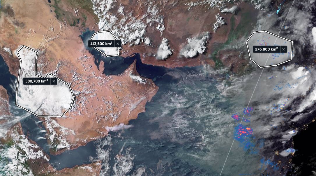
The last six hours in three animations, first India which is experiencing a massive monsoon day today in the north.
[Here the initial frames show a blank SEA as their was a satellite data outage.]
[Here the initial frames show a blank SEA as their was a satellite data outage.]
Today is possibly the apex of this #ArabianMonsoonBurst which began several days ago now. It's hard to imagine it getting bigger than this.
Today's #NorthAfrican #HornOfAfrica and #MiddleEast rainfall forecasts follow.
Today's #NorthAfrican #HornOfAfrica and #MiddleEast rainfall forecasts follow.
The animation above is for 12 hours hence the arriving and departing light effect. As always the engine behind this is the Indian Monsoon which you can see here this morning gathering strength.
A close up from the end of today shows how the big storms over #SaudiArabia are generating new atmospheric rivers of moisture, or plumes, over the Sahara, you can see these top right.
[Note: Atmospheric rivers are often invisible, this one becomes visible as night falls.]
[Note: Atmospheric rivers are often invisible, this one becomes visible as night falls.]
This is a long statement, probably a bit too long, but interesting and important. My reading is that Ethiopia has not yet decided to abandon the unilateral ceasefire, but that frustration is going, both with the TPLF and their ongoing offensive....
... and with ongoing one-sided diplomatic/media understanding of the Tigray conflict.
The @NYTimes story from @declanwalsh (see below) has become a lightning rod for public and government concerns that Ethiopia is not being listened to or being given due respect internationally.
The magnitude of #ArabianMonsoonBurst is now apparent. A major storm is about to cross the Red Sea and arrive in the #HornOfAfrica. Behind it are two enormous super-cell thunderstorms.
Today's rainfall forecasts follow.
Today's rainfall forecasts follow.
The rain activity shown in the @zoom_earth animation preceding is only radar based, Saudi radar, and in this case is complementary to the @Meteoblue satellite rainfall estimates you see below. There is likely significantly more rainfall in this than you see here. 

Here we see India (the heart of this Monsoon), this morning to 10am East Africa Time. I.E. around seven hours ago.
It's raining cats and dogs in the highlands northern Ethiopia tonight. Across all of Tigray and south into the #Abbay basin which is busy filling the GERD. The #ArabianMonsoonBlast is getting into gear now but it is far from over.
Today's Rainfall forecasts follow.
Today's Rainfall forecasts follow.
The Bay of Bengal and Arabian Sea are ultimately responsible for all of this and so we begin with a couple of satellite images of them today. I will post another picture of the #GERD as soon as it reveals itself from under the clouds. 

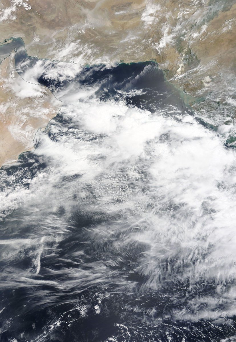

Here's a rainfall map from @Meteoblue which can be followed live at >> meteoblue.com/fr/meteo/curre….
Mekele isn't right under the rain but Aksum and Shire are. Hopefully this will slow down the warriors.

Mekele isn't right under the rain but Aksum and Shire are. Hopefully this will slow down the warriors.


On day 3 of #ArabianMonsoonBlast here's the view over the region tonight. This is definitely bringing rain, and lots of it to both Tigray and #GERD.
Today's rainfall forecasts follow.
Today's rainfall forecasts follow.
Today's Big Pictures provide a view of the entire planet today in three images.
1. The Atlantic
2. The Pacific
3. Asia
Sometimes its helpful to take a broad view and remember that we are all on this planet together. And that we share the one amazing life giving biosphere.


1. The Atlantic
2. The Pacific
3. Asia
Sometimes its helpful to take a broad view and remember that we are all on this planet together. And that we share the one amazing life giving biosphere.
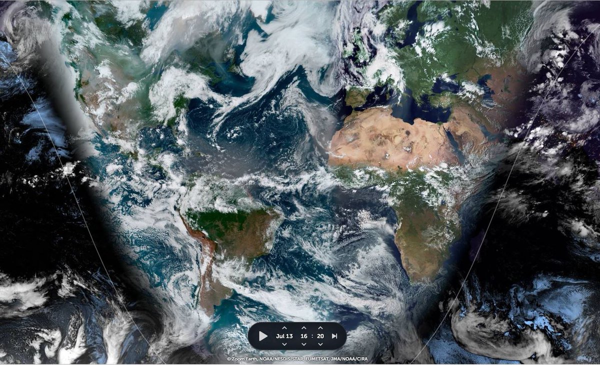


I found another #MonsoonBurst in the pipeline, this time over the Western Pacific. One which shows very clearly that weird weather is now a universal phenomena in the Northern Hemisphere. And it all started with another Typhoon...
Thread attached...
Thread attached...
The full monsoon has now arrived in the #HornOfAfrica. Very intense rain has begun in the Nile Basin and will continue for a week or more.
What will happen in the #MiddleEast is less clear, but it will involve a lot of rain and #ArabianStorms. Today's forecasts follow.
What will happen in the #MiddleEast is less clear, but it will involve a lot of rain and #ArabianStorms. Today's forecasts follow.
This animation shows the flow of rain bearing clouds heading south west across Pakistan which signals the first phase of an event which will intensify significantly over coming days.
This animation shows under wrapped in pulsating bands of storms headed both East and West. It is this intense period of Monsoon activity which is powering the phenomena that his bringing this rain to Yemen, Oman and Saudi Arabia.
Since the last rainfall forecast bulletin on Saturday, the forecast West Sahara rainfall burst has come and gone, and the forecast #ME/#HoA rainfall burst is now about to commence.
Today's rainfall forecasts for #NorthAfrica, #HornOfAfrica and #MiddleEast follow.
Today's rainfall forecasts for #NorthAfrica, #HornOfAfrica and #MiddleEast follow.
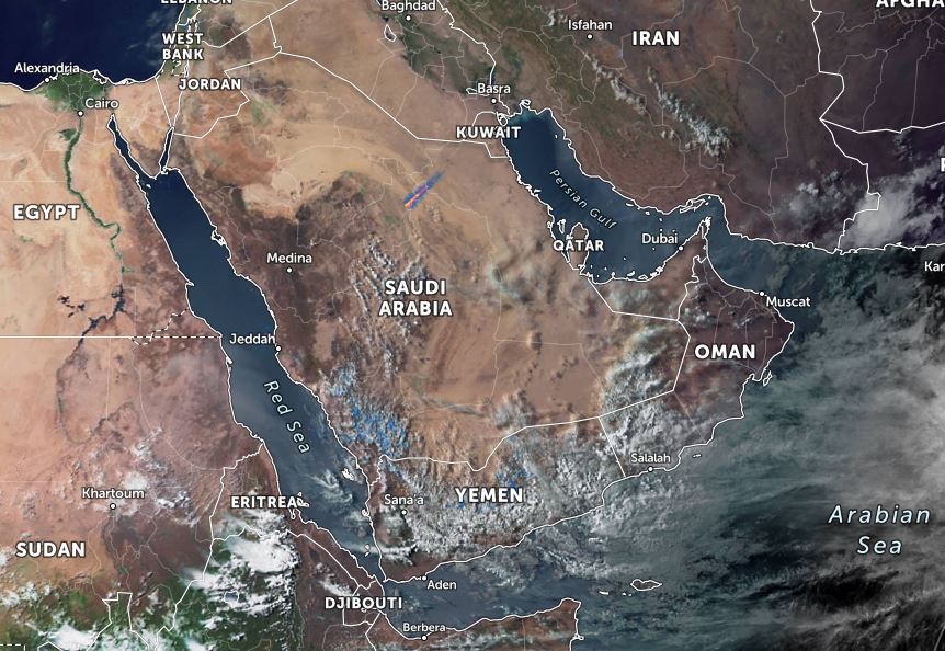
First an update on Western Sahara. The peak of the storms came overnight on Saturday morning. Here we see a 6 hour rainfall animation from 2.30am to 8.30am.
And here we see a wider view following sunrise on Saturday morning. If you are curious as to what was forecast Saturday's rainfall forecast thread is quoted below >>
The next two weeks promise to bring astonishing weather to both sides of the Red Sea & across the Sahara. In this weather bulletin I will explain what the models are forecasting.
Today's #NorthAfrica #HornOfAfrica and #MiddleEast rainfall forecasts follow.
Today's #NorthAfrica #HornOfAfrica and #MiddleEast rainfall forecasts follow.

In the image above we see part of Arabia and part of the #NileBasin storms - those which feed the Blue Nile/Abbay and the Tekeze basins the source of most of the Nile's flow.
Below we see:
1. All Nile Basin rainfall as of this evening
2. All of this evenings #ArabianStorms

Below we see:
1. All Nile Basin rainfall as of this evening
2. All of this evenings #ArabianStorms


