Discover and read the best of Twitter Threads about #Abbay
Most recents (24)
If you happen to look at the news in the last couple of weeks about it, you will find a lot.👇
For the casual reader, what these news articles Don't tell you WHY exactly #Egypt and #Ethiopia are locked in these bitter disagreements over the #Nile water use via the #GERD.
1/23


For the casual reader, what these news articles Don't tell you WHY exactly #Egypt and #Ethiopia are locked in these bitter disagreements over the #Nile water use via the #GERD.
1/23
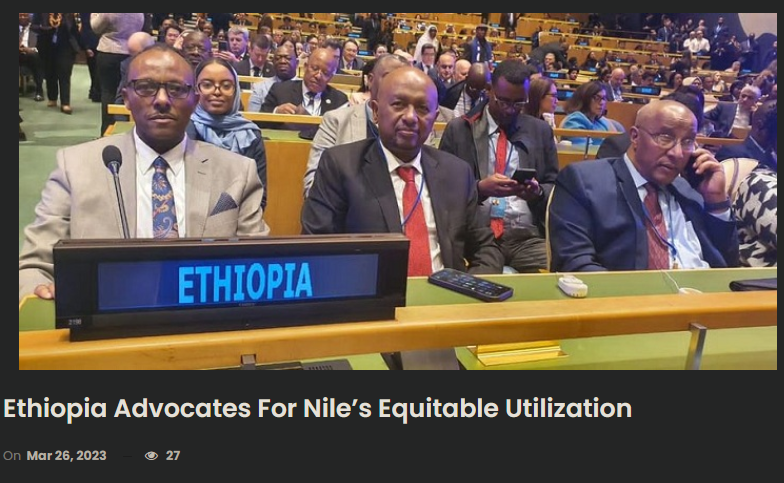
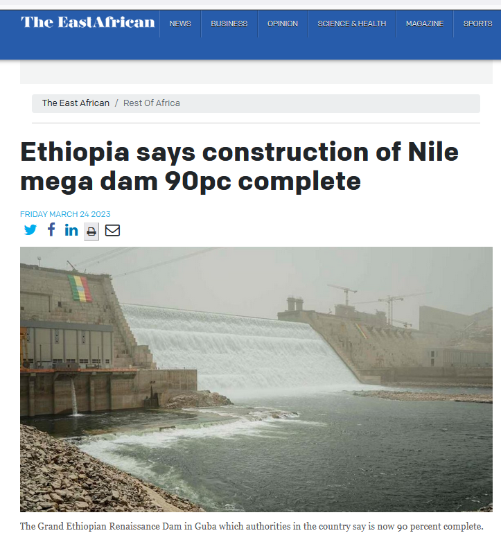

Quick background:
The #Nile river is shared by 11 countries. Of its total annual flow contribution, #Ethiopian rivers including #Abbay (Blue Nile) that #GERD is being built accounts 85% or ~77 Billion Cubic Meters (BCM). The rest of the Nile countries accounts ~15%.
2/23
The #Nile river is shared by 11 countries. Of its total annual flow contribution, #Ethiopian rivers including #Abbay (Blue Nile) that #GERD is being built accounts 85% or ~77 Billion Cubic Meters (BCM). The rest of the Nile countries accounts ~15%.
2/23
There is a massive gap between the realities of climate financing and the promises made in 2009. But there is a much bigger gap between the promises and what is acknowledged to be needed.
This thread looks at the realities of #COP26 vs the spin.
This thread looks at the realities of #COP26 vs the spin.
Today's rainfall/weather update for the #NorthAfrica #HornOfAfrica and #MiddleEast follows.
The short version is that the peak of the rainy season may have passed, but there are signs of another Indian Monsoon surge coming in 10-12 days in long range forecasts.
The short version is that the peak of the rainy season may have passed, but there are signs of another Indian Monsoon surge coming in 10-12 days in long range forecasts.
Here is the long-range GFS model PWAT forecast for the Indian Monsoon. Towards the end it strengthens and we see high levels of moisture heading for the #HornOfAfrica.
This week's rainfall forecasts for the #HornOfAfrica, #NorthAfrica and the #Middle East follow.
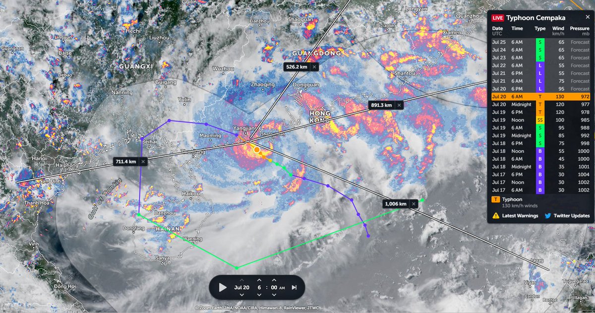
Image: Typhoon INFA over China showing the lights of Tokyo where the world is gathered to celebrate youth & excellence and the unity of the nations of the world at the Olympics.
Image: Typhoon INFA over China showing the lights of Tokyo where the world is gathered to celebrate youth & excellence and the unity of the nations of the world at the Olympics.
Congratulations to Ethiopia and Ethiopians everywhere on today's completion of the 2nd filling of the #GERD. It has been a great honour to follow along during this moment.
Today's rainfall forecasts for #NorthAfrica, #HornOfAfrica and #MiddleEast follow.
Today's rainfall forecasts for #NorthAfrica, #HornOfAfrica and #MiddleEast follow.
The presentation of the #ArabianMonsoonBurst has changed dramatically today with the consolidation of activity over the Arabian Peninsula into a single huge storm which is currently moving into the Red Sea over Makkah and Jeddah.
Today's rainfall forecasts follow.
Today's rainfall forecasts follow.

The scale of the storm over Islam's holiest city is huge, larger than France. Two more huge storms loom over the greater region tonight. One on the Iranian Gulf coast and another supercell thunderstorm complex over New Delhi/Rajastan, India, the size of the United Kingdom. 
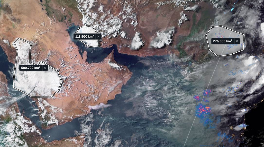
The last six hours in three animations, first India which is experiencing a massive monsoon day today in the north.
[Here the initial frames show a blank SEA as their was a satellite data outage.]
[Here the initial frames show a blank SEA as their was a satellite data outage.]
Today is possibly the apex of this #ArabianMonsoonBurst which began several days ago now. It's hard to imagine it getting bigger than this.
Today's #NorthAfrican #HornOfAfrica and #MiddleEast rainfall forecasts follow.
Today's #NorthAfrican #HornOfAfrica and #MiddleEast rainfall forecasts follow.
The animation above is for 12 hours hence the arriving and departing light effect. As always the engine behind this is the Indian Monsoon which you can see here this morning gathering strength.
A close up from the end of today shows how the big storms over #SaudiArabia are generating new atmospheric rivers of moisture, or plumes, over the Sahara, you can see these top right.
[Note: Atmospheric rivers are often invisible, this one becomes visible as night falls.]
[Note: Atmospheric rivers are often invisible, this one becomes visible as night falls.]
The magnitude of #ArabianMonsoonBurst is now apparent. A major storm is about to cross the Red Sea and arrive in the #HornOfAfrica. Behind it are two enormous super-cell thunderstorms.
Today's rainfall forecasts follow.
Today's rainfall forecasts follow.
The rain activity shown in the @zoom_earth animation preceding is only radar based, Saudi radar, and in this case is complementary to the @Meteoblue satellite rainfall estimates you see below. There is likely significantly more rainfall in this than you see here. 

Here we see India (the heart of this Monsoon), this morning to 10am East Africa Time. I.E. around seven hours ago.
It's raining cats and dogs in the highlands northern Ethiopia tonight. Across all of Tigray and south into the #Abbay basin which is busy filling the GERD. The #ArabianMonsoonBlast is getting into gear now but it is far from over.
Today's Rainfall forecasts follow.
Today's Rainfall forecasts follow.
The Bay of Bengal and Arabian Sea are ultimately responsible for all of this and so we begin with a couple of satellite images of them today. I will post another picture of the #GERD as soon as it reveals itself from under the clouds. 

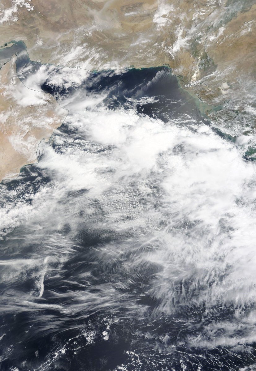

Here's a rainfall map from @Meteoblue which can be followed live at >> meteoblue.com/fr/meteo/curre….
Mekele isn't right under the rain but Aksum and Shire are. Hopefully this will slow down the warriors.

Mekele isn't right under the rain but Aksum and Shire are. Hopefully this will slow down the warriors.


On day 3 of #ArabianMonsoonBlast here's the view over the region tonight. This is definitely bringing rain, and lots of it to both Tigray and #GERD.
Today's rainfall forecasts follow.
Today's rainfall forecasts follow.
Today's Big Pictures provide a view of the entire planet today in three images.
1. The Atlantic
2. The Pacific
3. Asia
Sometimes its helpful to take a broad view and remember that we are all on this planet together. And that we share the one amazing life giving biosphere.


1. The Atlantic
2. The Pacific
3. Asia
Sometimes its helpful to take a broad view and remember that we are all on this planet together. And that we share the one amazing life giving biosphere.
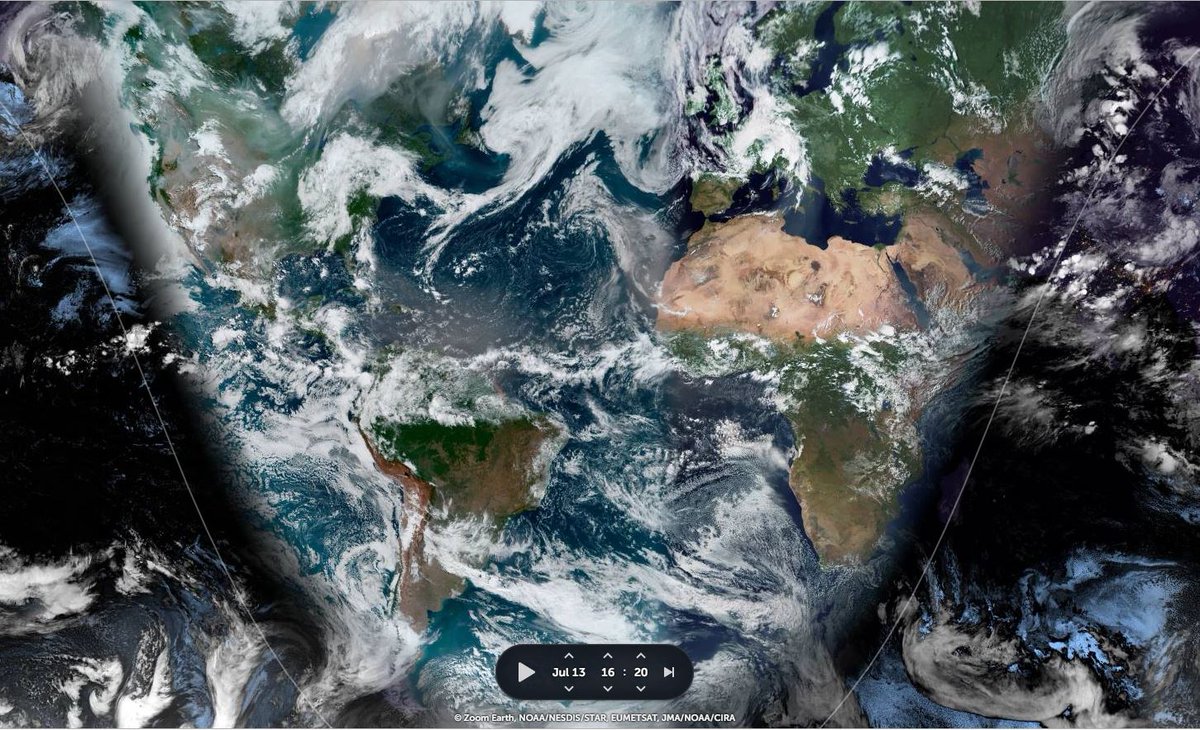


I found another #MonsoonBurst in the pipeline, this time over the Western Pacific. One which shows very clearly that weird weather is now a universal phenomena in the Northern Hemisphere. And it all started with another Typhoon...
Thread attached...
Thread attached...
The full monsoon has now arrived in the #HornOfAfrica. Very intense rain has begun in the Nile Basin and will continue for a week or more.
What will happen in the #MiddleEast is less clear, but it will involve a lot of rain and #ArabianStorms. Today's forecasts follow.
What will happen in the #MiddleEast is less clear, but it will involve a lot of rain and #ArabianStorms. Today's forecasts follow.
This animation shows the flow of rain bearing clouds heading south west across Pakistan which signals the first phase of an event which will intensify significantly over coming days.
This animation shows under wrapped in pulsating bands of storms headed both East and West. It is this intense period of Monsoon activity which is powering the phenomena that his bringing this rain to Yemen, Oman and Saudi Arabia.
Since the last rainfall forecast bulletin on Saturday, the forecast West Sahara rainfall burst has come and gone, and the forecast #ME/#HoA rainfall burst is now about to commence.
Today's rainfall forecasts for #NorthAfrica, #HornOfAfrica and #MiddleEast follow.
Today's rainfall forecasts for #NorthAfrica, #HornOfAfrica and #MiddleEast follow.
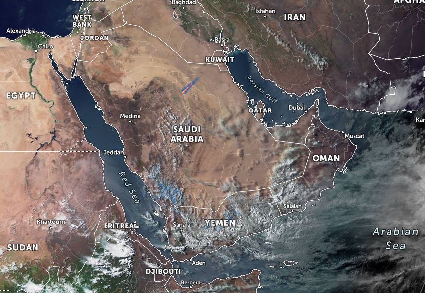
First an update on Western Sahara. The peak of the storms came overnight on Saturday morning. Here we see a 6 hour rainfall animation from 2.30am to 8.30am.
And here we see a wider view following sunrise on Saturday morning. If you are curious as to what was forecast Saturday's rainfall forecast thread is quoted below >>
The next two weeks promise to bring astonishing weather to both sides of the Red Sea & across the Sahara. In this weather bulletin I will explain what the models are forecasting.
Today's #NorthAfrica #HornOfAfrica and #MiddleEast rainfall forecasts follow.
Today's #NorthAfrica #HornOfAfrica and #MiddleEast rainfall forecasts follow.

In the image above we see part of Arabia and part of the #NileBasin storms - those which feed the Blue Nile/Abbay and the Tekeze basins the source of most of the Nile's flow.
Below we see:
1. All Nile Basin rainfall as of this evening
2. All of this evenings #ArabianStorms

Below we see:
1. All Nile Basin rainfall as of this evening
2. All of this evenings #ArabianStorms


Two Nile dams joined by nile 100kms apart as seen this morning by @NASA's Modis satellite. [Top right Sudan's Roseires and bottom left the #GERD.]
Today's rainfall forecasts for #NorthAfrica, #HornOfAfrica and #MiddleEast follow.
Today's rainfall forecasts for #NorthAfrica, #HornOfAfrica and #MiddleEast follow.

Today's big picture is a dramatic shot of the Sahara at sunset with a massive storm over Mali and a line of clouds from the heart of Algeria's desert south east to Chad. On the right you can see tonight's storms over the #Ethiopia highlands. 
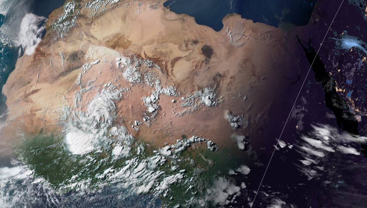
The rainfall in the Western Sahara has just started but it has a few more days to run. In this animation of a simulation you see the precipitable water anomaly, which highlights areas which have much more water than normal for this time of year.
As the UNSC met tonight to discuss the #GERD storms continued to form over Ethiopia's highlands the source of the water which is currently filling the dam.
Today's #NorthAfrica #HornOfAfrica and #MiddleEast rainfall forecasts follow.
Today's #NorthAfrica #HornOfAfrica and #MiddleEast rainfall forecasts follow.
During the UNSC meeting. Ethiopia's water minister explained how this works. "The filling of the dam is part of the construction process.... When the dam is filled the water either flows over the dam or through the bottom outlets." 

The Minister later spoke to media :
Q: (@AJEnglish): Why don't you stop filling the dam?
A: All dams are filling. Why? Because it is the rainy season. In fact it is good to protect from floods. We have bountiful water. It doesn't hurt anyone.
Q: (@AJEnglish): Why don't you stop filling the dam?
A: All dams are filling. Why? Because it is the rainy season. In fact it is good to protect from floods. We have bountiful water. It doesn't hurt anyone.

On day 2 of official #GERD filling we have glimpse through the clouds and what looks like a nearly full GERD lake in a recent photograph taken after the spillways were commissioned this year.
Today's #NorthAfrica #HornOfAfrica and #MiddleEast rainfall forecasts follow.

Today's #NorthAfrica #HornOfAfrica and #MiddleEast rainfall forecasts follow.


This morning's rainfall update thread is attached here.
The thread also looks at a major #DesertRain event to the west of the Horn, over Sudan, Chad and Niger where August/September like rains appear to have come early.
The thread also looks at a major #DesertRain event to the west of the Horn, over Sudan, Chad and Niger where August/September like rains appear to have come early.
Here's an update from this afternoon with satellite estimated rainfall over the last 24 hours showing 14-35mms of rain over the #Abbay basin. 
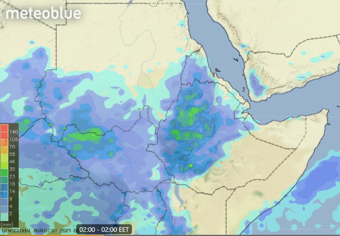
Today's recent rainfall update. 24 hours rainfall across Horn of Africa and Eastern Sahara. There are now reports of flooding in Sudan, which had very heavy rainfall yesterday.
#Ethiopia #Abbay #GERD #DesertRain
#Ethiopia #Abbay #GERD #DesertRain

And a live satellite image of the same area from @zoom_earth 

Over 24hrs 25-60mms rain has fallen over all three Nile tributaries with the heaviest falling over the #Abbay in Ethiopia's highlands which feeds the #GERD. Here we see an image of storms starting up this morning.
Rain forecasts will follow.
Thread contains rainfall update.
Rain forecasts will follow.
Thread contains rainfall update.
I jumped the gun calling the beginning of #GERD filling on1 July - as the big rainy season began.
Official news of filling came yesterday in the form of an objection to the filling from Egypt after being notified by #Ethiopia that it is underway.
Official news of filling came yesterday in the form of an objection to the filling from Egypt after being notified by #Ethiopia that it is underway.
#GERD filling is expected to be less than 13.5 Billion Cubic Meters as time ran out to raise the dam to the height needed to hold this amount of water.
When the filling is completed spilling over the center of the dam will resume as you can see in this image below from 2020.
When the filling is completed spilling over the center of the dam will resume as you can see in this image below from 2020.

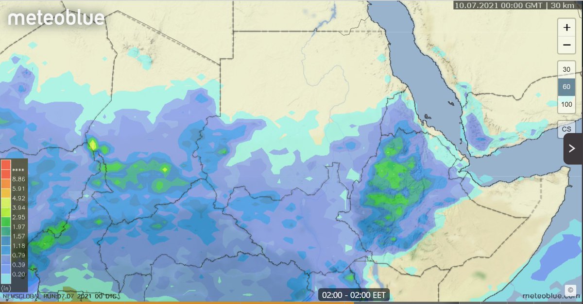
Today we open the #NorthAfrica #MiddleEast #HornOfAfrica #GERD rainfall forecasts with some new plots, courtesy of @meteoblue. This first one is a 24 hour estimate of rainfall till 9pm today over Ethiopia.
Green = 1 inch of rain over the #Abo & #Abbay basins.
Green = 1 inch of rain over the #Abo & #Abbay basins.

This satellite data based plots shows estimated rainfall over the last three days of rainfall across North Africa. #DesertRain is falling across all the Sahel. In Sudan and Chad nearly an inch in the past three days. 

2 recent #pictures on day 5 of the 2021 Grand Ethiopian Renaissance Dam #GERD filling.
1. Satellite image this morning.
2 Date unknown, posted on Twitter today.
Meanwhile it looks as if the #HOA rain is about to get heavier. Today's forecasts follow.

1. Satellite image this morning.
2 Date unknown, posted on Twitter today.
Meanwhile it looks as if the #HOA rain is about to get heavier. Today's forecasts follow.


Today's big picture hasn't changed much.
TS #Elsa can still be seen bottom left, she will be crossing Cuba later today.
Bottom right we see storms over #Ethiopia and #Yemen.
In Europe the #EuropeBigWet continues with North Atlantic weather moving in from West.
TS #Elsa can still be seen bottom left, she will be crossing Cuba later today.
Bottom right we see storms over #Ethiopia and #Yemen.
In Europe the #EuropeBigWet continues with North Atlantic weather moving in from West.

The convective storms over Ethiopia and Sudanese Nile Basins tonight is remarkably intense. Bringing massive amounts of rain across a huge area, including the #Abbay /#BlueNile basin, on the 4th day of #GERD filling.
Today's #HOA #ME and #NorthAfrica rainfall forecasts follow.
Today's #HOA #ME and #NorthAfrica rainfall forecasts follow.
In this wider view you can see the full size of today's rain areas which extended deep into Sudan later in the afternoon.
These two images are at sunset the sizes of the two large convective areas, the eastern one extends well north into Eritrea and covers Tigray and the entire #Abbay Basin. The first image provides an idea of size. Each storm area is larger than the UK and Ireland. 


Day three of official #GERD filling today in Ethiopia. And a gap in the clouds this morning reveals the GERD lake on the #Abbay river.
Today's #HornOfAfrica, #NorthAfrica and #MiddleEast rainfall forecasts follow.
Today's #HornOfAfrica, #NorthAfrica and #MiddleEast rainfall forecasts follow.

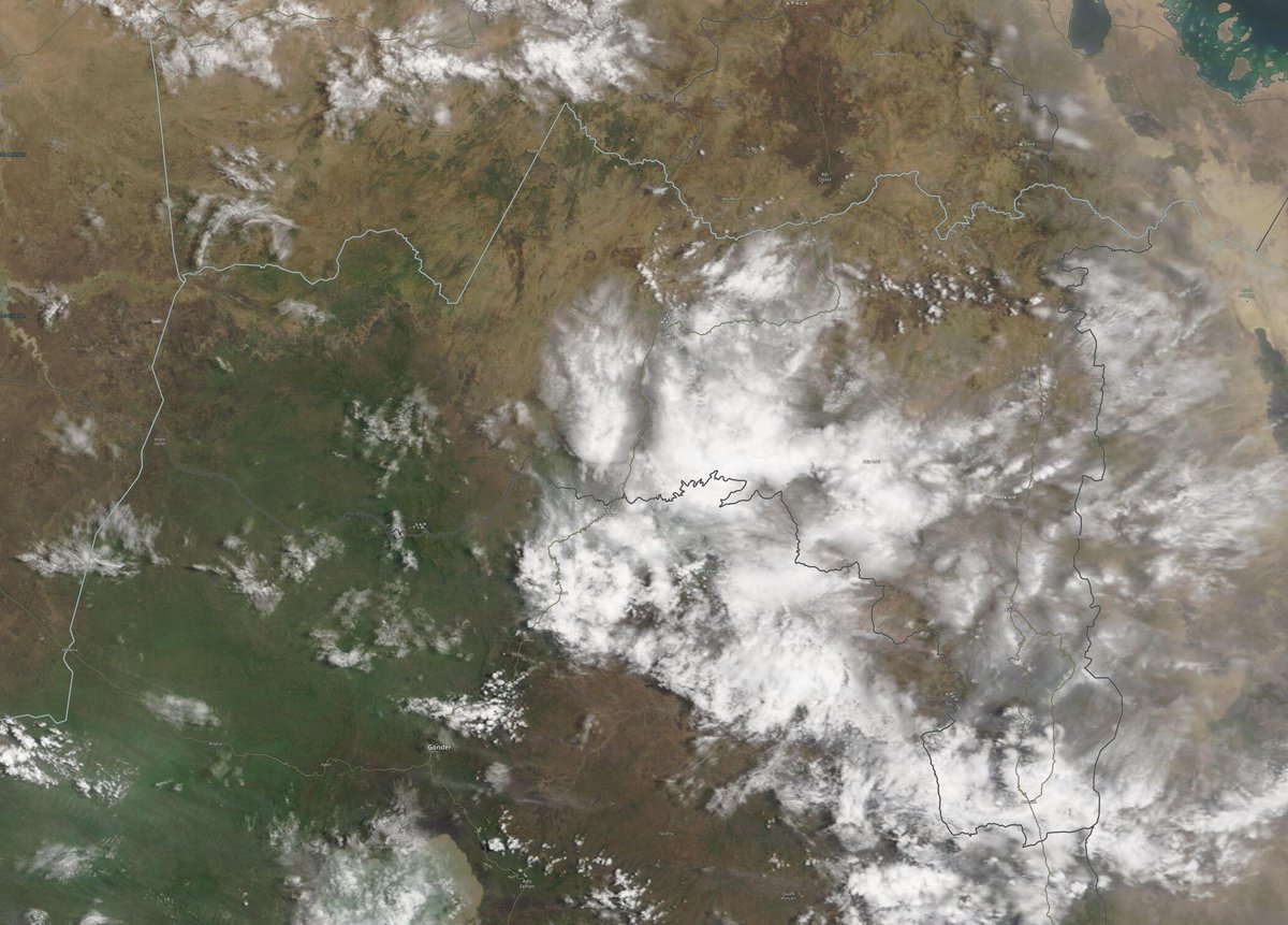
Here we zoom out a little, the source of the #Abbay/#BlueNile Lake Tana takes pride of place. You can see the #GERD lake in the bottom left hand corner.
These images are from the @NASA Modis Worldview service. Also below a picture of the #GERD from back in January.

These images are from the @NASA Modis Worldview service. Also below a picture of the #GERD from back in January.


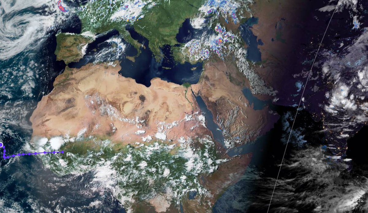
Here's today's big picture as ever of the great Sahara Desert. You can see today's #ArabianStorms starting up bottom right, and top left a new rain front coming into Western Europe where the 2021 #EuropeBigWet continues to bring rain and unseasonably mild temperatures. 

The big-rains season in Ethiopia is now underway, and today is the second day of #GERD filling. As it was yesterday, today's rains were strong over the #Abbay Catchment.
Today's rainfall forecasts for the #HornOfAfrica, #MiddleEast and #NorthAfrica follow.
Today's rainfall forecasts for the #HornOfAfrica, #MiddleEast and #NorthAfrica follow.
This animation shows the storms as they began today, fueled by water baring winds from the Indian Monsoon.
Attached thread show's yesterday's forecast report.
Attached thread show's yesterday's forecast report.
In the big picture today we can see yet another day of #ArabianStorms continuing the trend which began in April.
In Europe another big front is bearing down in the North Atlantic as two large storm systems continue to bring significant rains to West, Central & Eastern Europe.
In Europe another big front is bearing down in the North Atlantic as two large storm systems continue to bring significant rains to West, Central & Eastern Europe.


