Discover and read the best of Twitter Threads about #Cempaka
Most recents (7)
This thread is about Typhoon #INFA, a storm the likes of which the world has never seen before. Enduring, unpredictable, astonishingly wet, massive, slow moving, and never alone.
And 13 days after designation as a storm, #INFA is far from finished in its journey of destruction


And 13 days after designation as a storm, #INFA is far from finished in its journey of destruction


My coverage of #INFA began on 14th July after it had formed into a visible and formidable storm, albeit not yet a Typhoon. But by then weather models already showed it was a significant threat.
Not simply as a storm but as a broader weather pattern.
Not simply as a storm but as a broader weather pattern.
The area in which the storm was expected to form showed up in the models earlier. Here we see it on the 10th of July in the GFS MLSP forecast. But it was probably there even earlier.
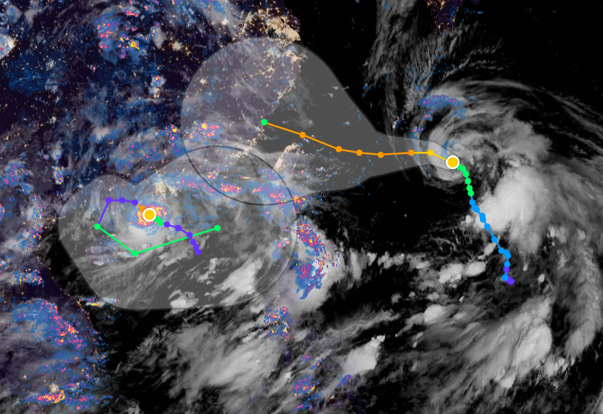
This animation shows 24 hours in the life of three storms in the West Pacific. The remnants of former Typhoon #Cempaka bottom left, Typhoon #INFA in the middle and TS #Nepartak far right which is headed to Japan.
Shangai is already receiving rain from In-fa, 650kms away.
Shangai is already receiving rain from In-fa, 650kms away.
A truly extraordinary storm. Maybe illustrative of what tropical storms of the future may look like.
#INFA developed slowly, moves slowly and is not particularly strong, but he/she is orchestrating rain catastrophes from 100s of KMs away in Shangai the Phillipines and Japan.
#INFA developed slowly, moves slowly and is not particularly strong, but he/she is orchestrating rain catastrophes from 100s of KMs away in Shangai the Phillipines and Japan.

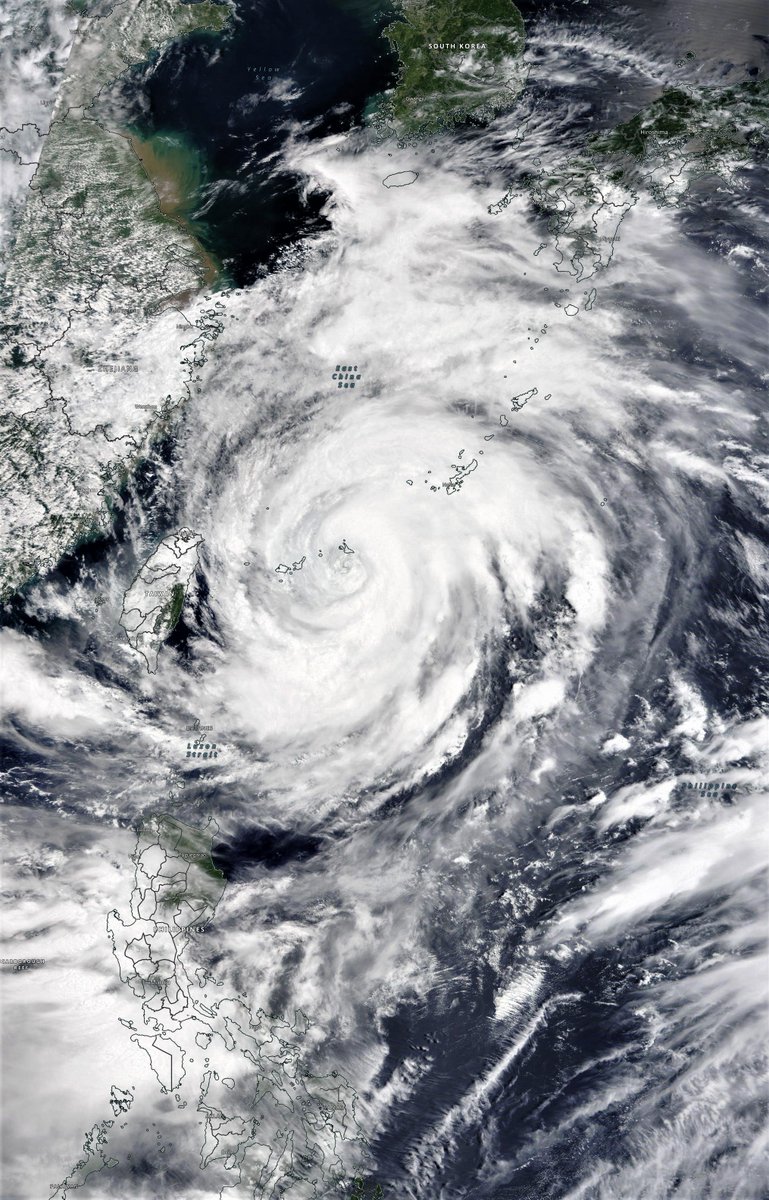
A big high resolution photo of INFA from this morning from @NASA WorldView. This is a truly huge storm. 

#INFA and a widening gyre.
July 22nd #Japan #Olympics2021 weather update, rain, wind, rain and more rain. This is not looking at all ok.
TL/DR: the model forecasts for East Asia have changed. And gotten significantly worse.
July 22nd #Japan #Olympics2021 weather update, rain, wind, rain and more rain. This is not looking at all ok.
TL/DR: the model forecasts for East Asia have changed. And gotten significantly worse.
Here's a high resolution satellite image of Typhoon #INFA which is continuing to defy all predictions.
But the potential impacts of this storm both for those in its path and for the wider region are getting steadily worse.
But the potential impacts of this storm both for those in its path and for the wider region are getting steadily worse.

Yesterday's thread can be found here >>
TL/DR the only hope at this point is that the models can't compute this right, and what they say will happen doesn't.
It's now time for prayer, and for Japan to prepare for widespread catastrophic rainfall.
TL/DR the only hope at this point is that the models can't compute this right, and what they say will happen doesn't.
It's now time for prayer, and for Japan to prepare for widespread catastrophic rainfall.
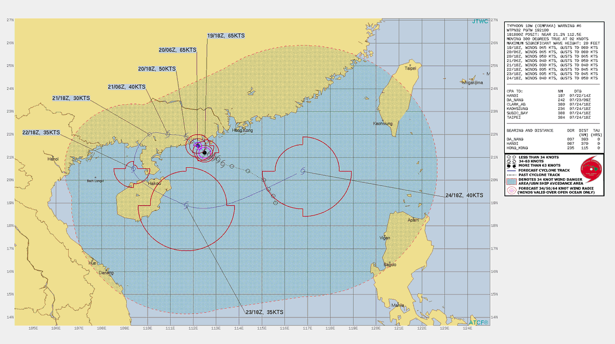
ECMWF ensembles showing the Fujiwhara effect between Typhoon #Cempaka 🌼 and Typhoon #Infa 🎆 as the two storms were forecasted to move around each other 🌀 

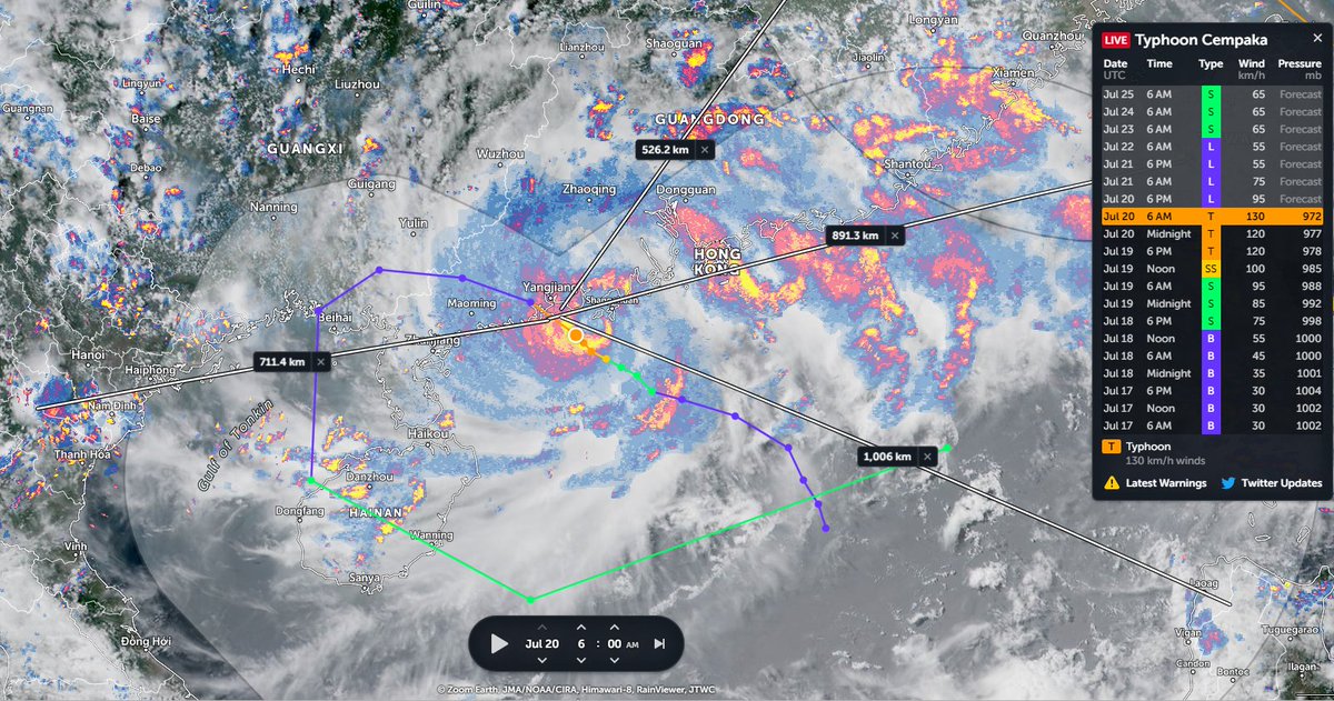
Typhoon #Cempaka rapidly intensifying while drifting slowly offshore of Guangdong Province, China (#Cempaka name meaning: a type of tree with fragrant flowers 🌼 name origin: Malaysia)


