Discover and read the best of Twitter Threads about #ClimateChangeNOW
Most recents (24)
For comparison - here (quoted tweet) is last year's thread,There are lots of similarities with observable weather patterns & model forecasts as the two threads pertain to a similar state of the global energy balance.


The most notable differemce with the 2023 Equinox is that ENSO (the La Nina/El Nino oscillation) is moving into neutral which could result in a reduction of tropical convection and therefore less precipitation. However that is not yet cpc.ncep.noaa.gov/products/analy…… twitter.com/i/web/status/1… 


[#CentralAmerica #ExtremeWeather #ClimateChangeNOW update THREAD (ongoing coverage - initiated October 2 - storms #Julia #Karl]
With #Karl now dissapated the next disturbance has now been designated by @NHC_Atlantic.


With #Karl now dissapated the next disturbance has now been designated by @NHC_Atlantic.


The situation remains complex and unpredictable with many significant variables at play which could alter the outcome. The latest complete GFS run shows the next hurricane landfalling in Mexico 24 Oct. & remnants forming into a Gulf cyclone on 26 Oct.
[#ExtremeWeather #ClimateChangeNow coverage initiation THREAD].
The next potentially devastating northern hemisphere hurrricane candidate #92B has now been designated.


The next potentially devastating northern hemisphere hurrricane candidate #92B has now been designated.


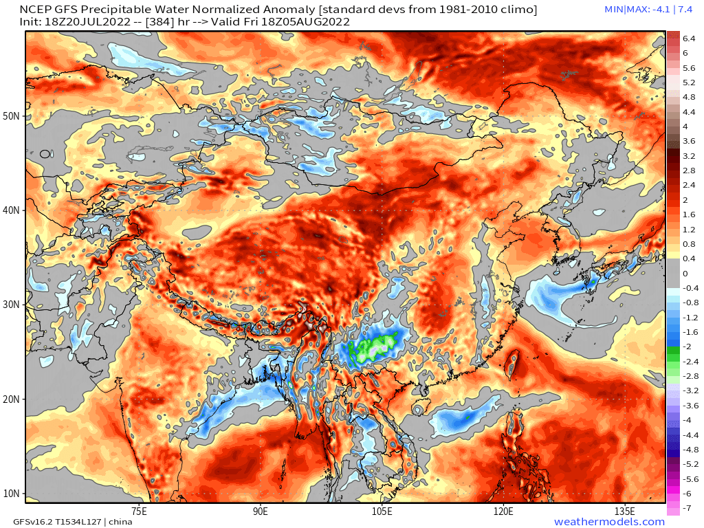
The potential new storm - which is modeled to head north into the Bay of Bengal in coming days and make - has been in global simulation models for several days. This is the latest GFS3 IWVT model run.
#Invest92b #92b GFS3 Model 16 day forecast of precipititable water (PWAT)
With a series of West Pacific tropical storms & typhoons - including #NenengPH [which you can see arriving in Vietnam shortly on upper right] - the Nth. Indian ocean is flooded with water vapour.
With a series of West Pacific tropical storms & typhoons - including #NenengPH [which you can see arriving in Vietnam shortly on upper right] - the Nth. Indian ocean is flooded with water vapour.
#ExtremeWeather #ClimateChangeNOW update THREAD (ongoing coverage)
While Tropical Storm #Karl is finished, the #ExtremeWeather event associated with #HurricaneJulia and #TSKarl is not yet over.
While Tropical Storm #Karl is finished, the #ExtremeWeather event associated with #HurricaneJulia and #TSKarl is not yet over.
In the animation above you can see the end of #TSKarl #Karl as it, like its parent storm #HurricaneJulia was pushed through the Tehuantepec wind gap into the Gulf of Tehuantepec in the Pacific. 
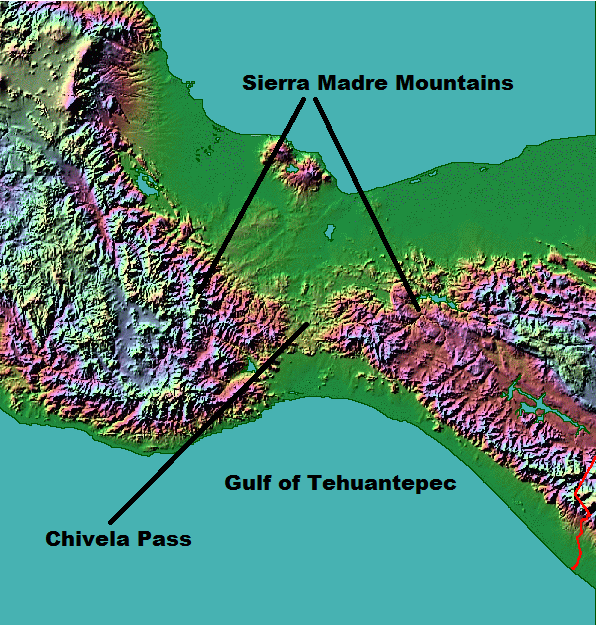
This animation pics up the story over southern Mexico's Pacific coast this afternoon and evening and shows several convective bursts over land. The one at the end on the bottom left hand side is directly over Acapulco.
[#ExtremeWeather #ClimateChangeNow DATA ANOMALY THREAD – Central & North America]
In this thread I release five sets of data which appear to show atmospheric geo-engineering over North America at unprecedented scale, seemingly for the purpose of keeping hurricanes away.
In this thread I release five sets of data which appear to show atmospheric geo-engineering over North America at unprecedented scale, seemingly for the purpose of keeping hurricanes away.

During observations of #Invest91L #HurricaneJulia & #TSKarl in Central America there was an issue elephant sized mystery in the room – a tangential one, namely what is going on with the Arctic?
The constant impact of a the endless series of arctic blasts on forecasts came particularly obvious when hurricanes in both the Atlantic and Pacific were shown in a forecast moving south in model forecasts.
[#NotYetAHurricaneKarl update Thread, waiting for sunrise ed. #ExtremeWeather #ClimateChangeNow ]
The ridge to the north of #Karl has moved south a fair bit and appears to be pushing #Karl to the south at the eastern edge of the offical NHC Track cone.
The ridge to the north of #Karl has moved south a fair bit and appears to be pushing #Karl to the south at the eastern edge of the offical NHC Track cone.
Here's another view where you can see the leading edge of the ridge that is pushing down on the hurricane capturing it near the entrance to the Tucanpecer's northern funnel.
Lookingclose at the last four hours @NHC_Atlantic may have a point about #NotYetAHurricane #Karl not quite yet being a hurricane - as predicted by the GFS it has collapsed and broadened out close to midnight as the models said.
#ClimateChangeNOW late summer update THREAD.
As winter in the north approaches we are roughly halfway to solstice/midwinter. The Sun's angle to the earth is moving south and we are seeing a burst of late cyclone activity in the Atlantic, Pacific and Indian oceans.
As winter in the north approaches we are roughly halfway to solstice/midwinter. The Sun's angle to the earth is moving south and we are seeing a burst of late cyclone activity in the Atlantic, Pacific and Indian oceans.
The ENSO oscilation remains in a strong La Nina position and seems likely to remain so for the forseeable future. Forecast models tend to predict a return to neutral ENSO but they have done so for some time now & the cause (Antarctic ice melt) may not go away. 


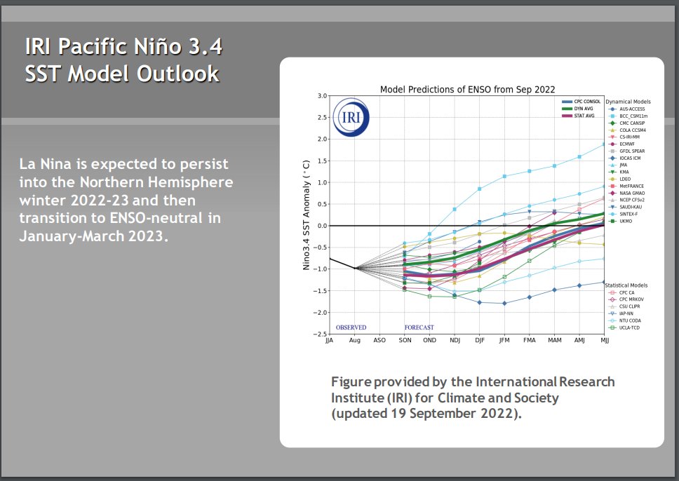


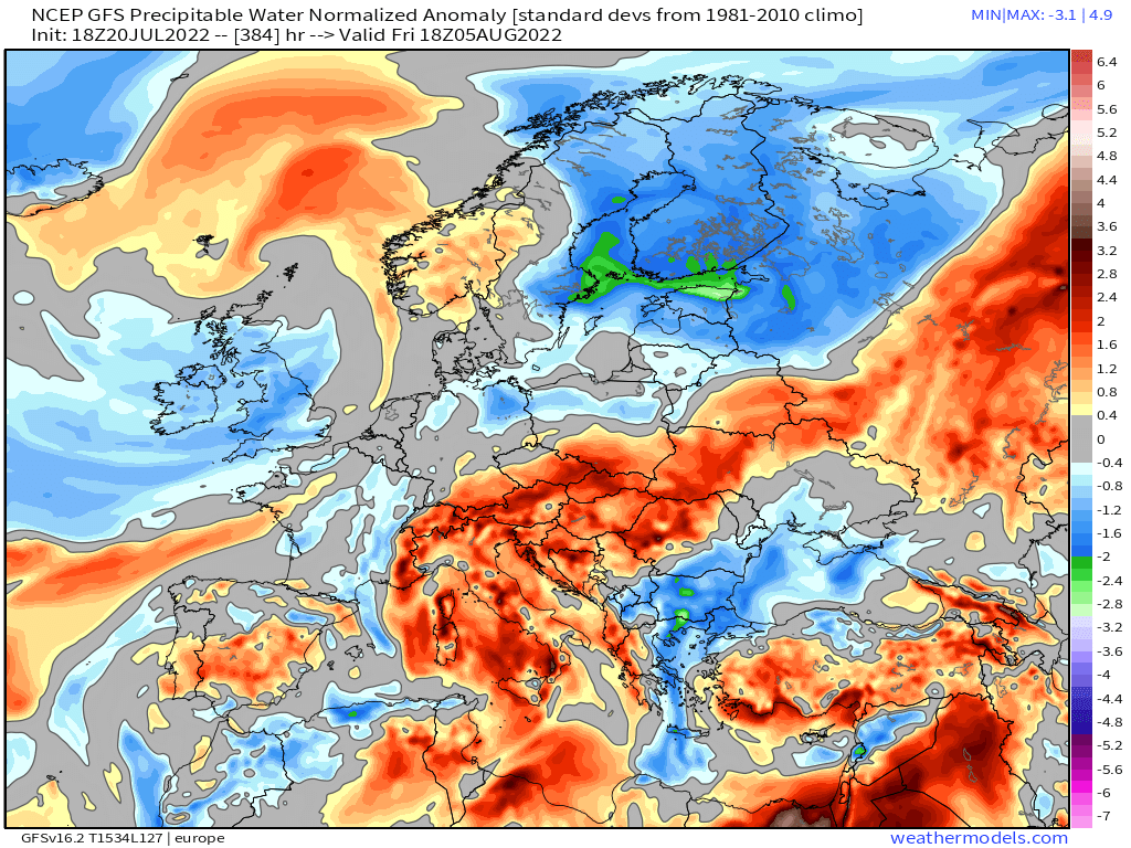
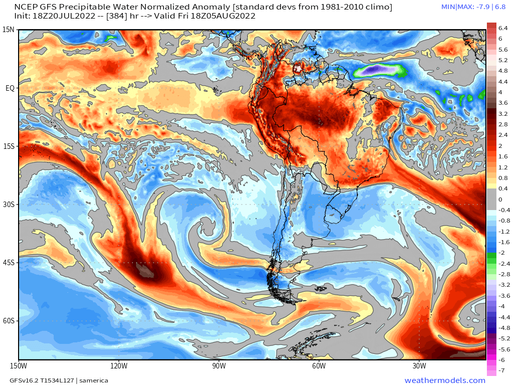
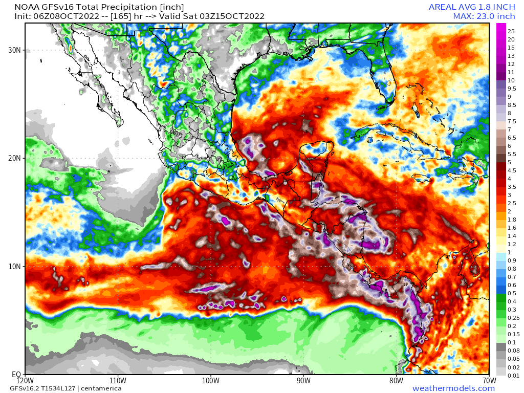
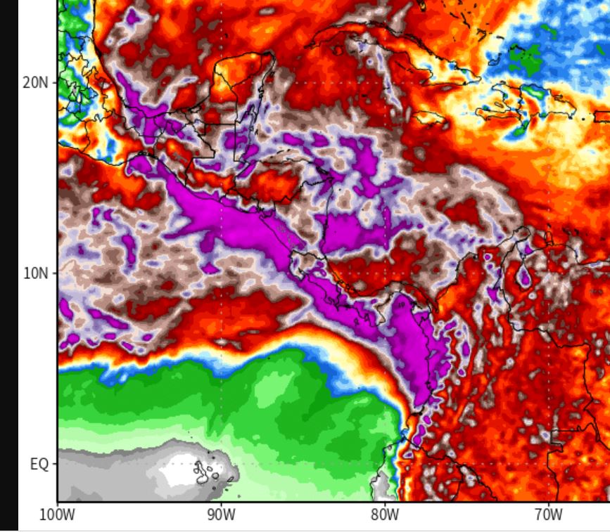
Higher air temperatures globally increase the capacity of the atmosphere to hold water and the consequence is more #ExtrremeWeather rain events causing flooding - recently in West Pacific, Central America, South America, & Indian subcontinent. (see recent 16 day forecasts below) 


[Ongoing coverage #HurricaneJulia Event #ExtremeWeather #ClimateChangeNow]
At sunrise the remnants of #HurricaneJulia now #Invest93L are developing extremely rapidly over the South Western Gulf of Mexico.
At sunrise the remnants of #HurricaneJulia now #Invest93L are developing extremely rapidly over the South Western Gulf of Mexico.
And the southern #Invest93L remnants of #HurricaneJulia are also developing very rapidly.
Moreover, because of their proximity and positioning the southern storm's outflows are feeding #Invest93L North, which help may explain its spectacular burst of convection on daybreak.
#ClimateChangeNOW #ExtremeWeather #HurricaneJulia update thread 8-10-22 (late evening CEST)
The possibility Julia may never become a hurricane is clearly on the cards. Her continued divergence (southwards) from the offical track also has signifcant implications r.e. impact.
The possibility Julia may never become a hurricane is clearly on the cards. Her continued divergence (southwards) from the offical track also has signifcant implications r.e. impact.
This is illustrated in the latest GFS model run. The full 16 day run is a little implausible but this 165 hours is at least credible.
As you can see here the remnants of Julia cross the isthmus (as discussed in the last update) and then moves deeper into the Pacific.
As you can see here the remnants of Julia cross the isthmus (as discussed in the last update) and then moves deeper into the Pacific.
#ClimateChangeNOW #ExtremeWeather #HurricaneJulia update thread 8-10-22
A lot has changed in the last 12 hours - not so much in the short term but in the longer term model track predictions - and therefore in the outcomes which can be expected for the wider region.
A lot has changed in the last 12 hours - not so much in the short term but in the longer term model track predictions - and therefore in the outcomes which can be expected for the wider region.
Specifically fromthe latest GFS run (and its predecessors) the degree of uncertainty with respect to impacts is increasing. At present Julia is not officially a hurricane and the extent of structure in the 300km wide central area of convection is not known.
Latest GFS Run.
Latest GFS Run.
#CentralAmerica #ClimateChangeNOW #ExtremeWeather #HurricaneJulia #IMPACT 16-day assessment THREAD.
It is time to consider what is about to happen in Central America from a #LossAndDamages perspective.
It is time to consider what is about to happen in Central America from a #LossAndDamages perspective.

With less than 72 hours till #HurricaneJulia's expected landfall in Nicaragua, #TD13L #PC13L #Invest91L has already wreaked untold havoc in Venezeula, it is now over Colombia. The death toll is rising.
What is ahead is dangerous. #ExtremeWeather impacts for 200 million souls.

What is ahead is dangerous. #ExtremeWeather impacts for 200 million souls.


#ExtremeWeather #ClimateChangeNOW thread.
Introducing what is soon to be #HurricaneJulia, presently Potential Cyclone #PC13AL with a rare near 100% probability [per @NHC_Atlantic] of forming.
One of the, if not the, wettest storm in living memory in the Western Hemisphere.
Introducing what is soon to be #HurricaneJulia, presently Potential Cyclone #PC13AL with a rare near 100% probability [per @NHC_Atlantic] of forming.
One of the, if not the, wettest storm in living memory in the Western Hemisphere.

@NHC_Atlantic At present the GFS shows #HurricaneJulia making formal landfall at 6am local time Sunday, with modest winds for a hurricane. Heavy, flood and slip causing rains however will arrive well ahead of landfall and by midday Sunday the center of the storm will cover all of Nicaragua. 


Large storms of this kind are very dangerous from a flooding perspective as the rain will be persistent for a long time. This is a seven day ECMWF model rain forecast Nicaragua and Honduras it gives rough idea of how much rain may fall. I.E. a lot - continuously, everywhere.
#Carracas #Carribean #ExtremeWeather #WX #ClimateChangeNOW update Thread.
#Invest91L may not be a tropical storm yet, let alone a hurricane, and it may not even become one. But it is already having hurricane like rain impacts in Venezeula, and in particular in Carracas.
#Invest91L may not be a tropical storm yet, let alone a hurricane, and it may not even become one. But it is already having hurricane like rain impacts in Venezeula, and in particular in Carracas.
This morning there is a colossal 2.8 million km2 area of intense convection over the Nth South America/Amazon rain forest south of #Invest91L
Here is a view of the dominant convective system in all of this which has formed directly south of #Invest91L - and is shaped like a pine cone.
#ClimateChangeNow #ExtremeWeatherUpdate THREAD
#Invest91L located East of the Seaward Islands has woken up at day break with explosive convection - and is starting to look organised.
This storm is forecast to move towards the Gulf of Mexico.
#Invest91L located East of the Seaward Islands has woken up at day break with explosive convection - and is starting to look organised.
This storm is forecast to move towards the Gulf of Mexico.
In the long range PWAT animation in the quoted thread above you can see one possible outcome, a massive cyclone embedded in a gyre which nearly covers the entire Gulf of Mexico.
But that is still a long way off and can probably be considered a worst case scenario.
But that is still a long way off and can probably be considered a worst case scenario.
#ClimateChangeNow Update THREAD.
The unusual, unpredictable and #ExtremeWeather of #HurricaneIAN is still continuing in the North East of the US. The remnant low has strengthened and remains parked off the Maryland coast.
This storm has now spent nearly a week over the US.
The unusual, unpredictable and #ExtremeWeather of #HurricaneIAN is still continuing in the North East of the US. The remnant low has strengthened and remains parked off the Maryland coast.
This storm has now spent nearly a week over the US.
Last night I posted a fairly discursive thread looking at the Tropical Atlantic, and some threats in the long range GFS forecast - including the threat posted by the remnants of #HurricaneIan
Here we are looking in particular at the stationary low pressure center off the coast of Maryland (Top Left) in the animation above. The impacts are becoming more significant now as the remnants of #IAN - back over the Atlantic are strengthening again.
Last 12 hours in DC.
Last 12 hours in DC.
What is happening in the Carolinas is not just a hurricane. The catastrophic event ahead is probably more due to the Atmospheric River which #HurricaneIAN has directed onshore. The second image here roughly delinates the two.
On the ground however this is one weather event.

On the ground however this is one weather event.


More on the #HurricaneIAN - Atmospheric River combination, to understand this event in context, this is a very important part of the story.
#ExtremeWeather #ClimateChangeNow.
#ExtremeWeather #ClimateChangeNow.
This thread also looks at this issue. #HurricaneIAN has been embedded in this atmospheric river since it started intensifying explosively.
This combination is I think pretty unusual, and it may lead to unexpected consequences in the Carolinas.
This combination is I think pretty unusual, and it may lead to unexpected consequences in the Carolinas.
#ExtremeWeather #ClimateChangeNow
#HurricaneIAN Update thread.
Near live 6hr satellite imagery #IAN beginning its exit of Florida over Cape Canaveral and the Kennedy Space Center. And it looks like it started strengthening significantly before it's center crossed the coast.
#HurricaneIAN Update thread.
Near live 6hr satellite imagery #IAN beginning its exit of Florida over Cape Canaveral and the Kennedy Space Center. And it looks like it started strengthening significantly before it's center crossed the coast.
This wider angle view helps put the storm into wider perspective, in particular its size, and the importance and significance of the massive convective area to the East of Florida from which #TSIan #HurricaneIAN is being fuelled.
The big question now is how will #HurricaneIAN interact with this atmospheric river as it crosses the Atlantic heading towards the Carolinas, specifically, will this extremely complex moist air field strengthen or inhibit intensification.
#ExtremeWeather #ClimateChangeNow
Sunrise Update #HurricaneIAN Update thread. (continuing story).
A #HurricaneHunter mission has upgraded #Ian to 155 MPH just 1 kmh short of Cat 5 status with 50kms till eyewall landfall.
Sunrise Update #HurricaneIAN Update thread. (continuing story).
A #HurricaneHunter mission has upgraded #Ian to 155 MPH just 1 kmh short of Cat 5 status with 50kms till eyewall landfall.
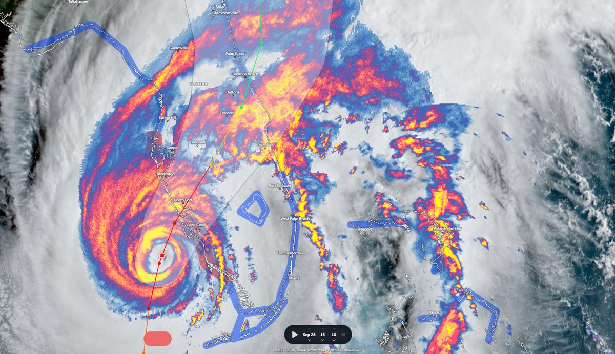
This is going to be a US Prime Time storm - landfall is expected around breakfast time in the US - and will continue all day. The storm's track is significantly worse than expected - and the storm is significantly stronger than initially expected.
Practically speaking we are looking at a storm similar in strength to Hurricane Andrew in its landfall destruction potential with the rainfall and flooding potential of Katrina (New Orleans) or Harvey (Houston) - and consequently one of the most expensive in history.
#ClimateChangeNow
Typhoon Muifa lashes eastern China, forcing 1.6 million people from homes sc.mp/o406?utm_sourc… via @scmpnews
Typhoon Muifa lashes eastern China, forcing 1.6 million people from homes sc.mp/o406?utm_sourc… via @scmpnews
@SCMPNews 24 hour satellite loop.
12 hour satellite closer view of Shanghai landfall.
.@UN briefing on Pakistan Floods - on the launch of a 160 Million Dollar flash appeal to address emergency needs in the wake of a colossal nation wide flooding disaster in a country of 220 million.
Launch of Pakistan Floods Response Plan - NYC Press Conf.
Launch of Pakistan Floods Response Plan - NYC Press Conf.
@UN The @NASA Earth observatory [earthobservatory.nasa.gov/images/150279/…] has posted some imagery that provides a clear view of the scale of the flooding - which highlights standing water in blue.
Left >> Aug. 4th
Right >> Aug. 28th
Note that there was already signiifcant flooding on August 4th.

Left >> Aug. 4th
Right >> Aug. 28th
Note that there was already signiifcant flooding on August 4th.


The remaining images here of Pakistan Flooding were taken yesterday by @NASA's Worldview satellite system.
First a picture of the entire country.
First a picture of the entire country.
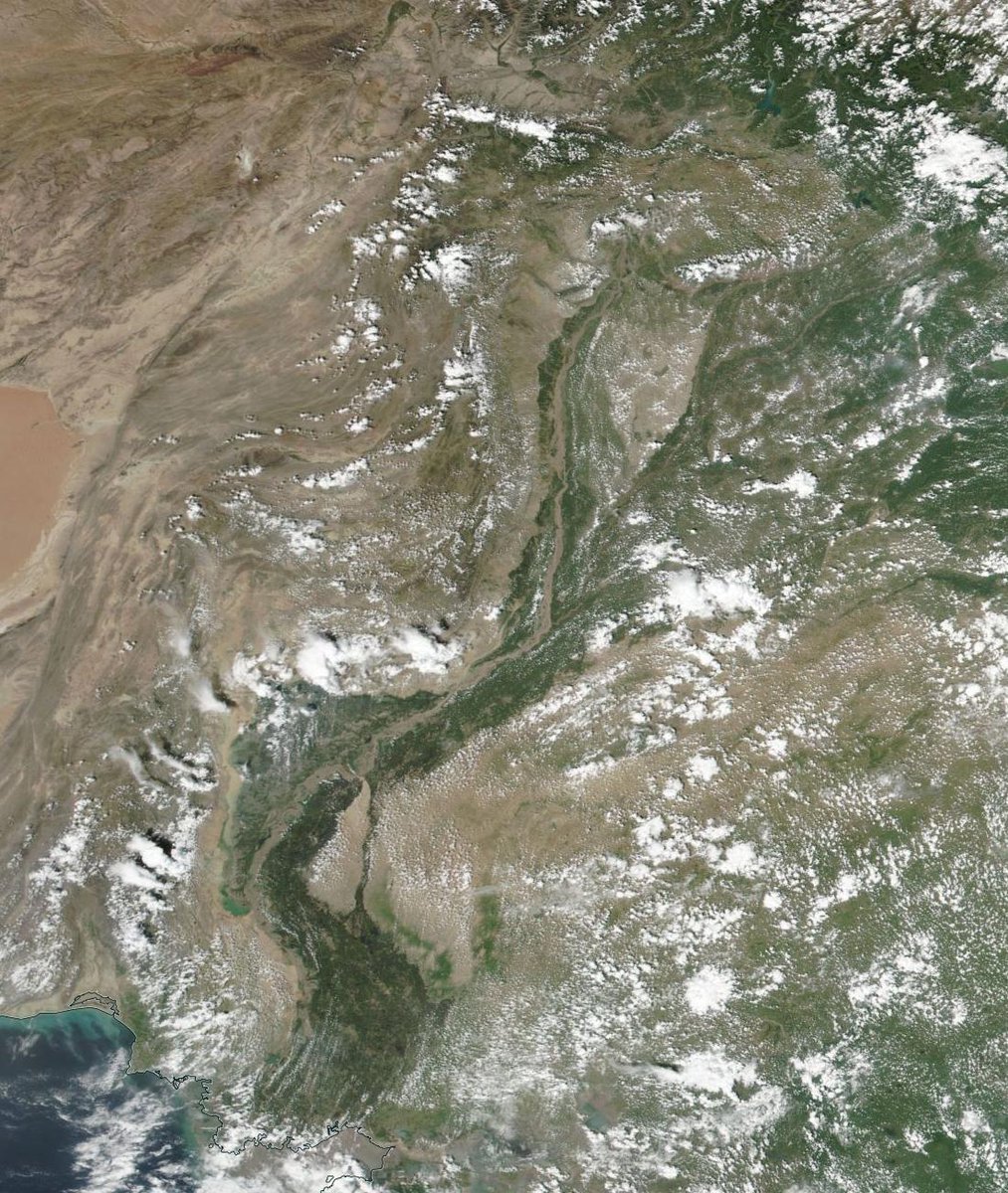
Europe/Germany's freak flood event in the Ahr valley was last years "wake the fuck up" event for 2021 in #ClimateChange Terms.
The 17-day-long stationary cyclone like storm over Pakistan since August 10th is 2022s. As of now we have no idea how big this event is.
The 17-day-long stationary cyclone like storm over Pakistan since August 10th is 2022s. As of now we have no idea how big this event is.
The number of affected people has climbed rapidly today as the storm finally appears to be coming to an end. The latest number is 45 Million severely effected people. But some of the most effected areas in the mountains of Afganistan & Pakistan are inaccessible.
At least 145 bridges have been washed away and 1000s of KMs of roads.
Tracking thread on rain/drought in Europe.
Last three days have seen some, which is very welcome to address a 500 year drought. I posted the thread below on Aug 14th when rain finally came to Bretagne, France.
#ClimateChangeNow Thread
Last three days have seen some, which is very welcome to address a 500 year drought. I posted the thread below on Aug 14th when rain finally came to Bretagne, France.
#ClimateChangeNow Thread
Its worth pointing out that an extreme drought in Europe is not as bad as elsewhere in the world. Europe is used to getting lots of rain, and will likely continue to do so - and it has good reservoirs to deal with drought - this one is basically from June.
This thread consists mostly of satellite imagery over the past three days + some forecast data images which help explain what is going on. But not too many. And it looks at water transport from the Nth Atl & the West African Monsoon.
Day 1. 13-14 August - East NATL
Day 1. 13-14 August - East NATL
The failure of all weather models to identity this storm as dangerous is a wake up call. It was in the same place as the catastrophic flooding last year.
The EU needs meso-scale forecasting systems similar to those in the US.
The EU needs meso-scale forecasting systems similar to those in the US.
Here's a picture of a supercell thunderstorm over Germany yesterday evening from @UwBeobachtung - storms similar to this can produce dangerous tornadoes. Europe may well soon face tornadoes - as well as acutely dangerous flooding events. 
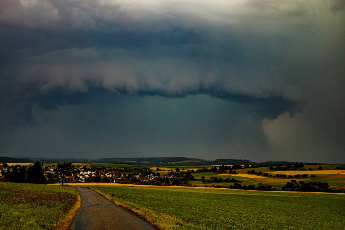
Improved weather forecasting for the entore planet has been clearly identified by the @WMO as one of the most useful investments that could be made for #ClimateAdaptation and #ClimateResilience it would be a no-brainer to deploy systems world wide like those used now in the US.
#ClimateChangeNow
16 day total precipitation anomaly forecasts for:
1. Central America
2. Europe
3. North America
4. South America


16 day total precipitation anomaly forecasts for:
1. Central America
2. Europe
3. North America
4. South America

