Discover and read the best of Twitter Threads about #Tauktae
Most recents (13)
And then around midday. In Levi (@TropicalTidbits) commentary he mentions several times how fast the storm is moving. And this becomes apparent in these animations.
And this is also pertinent in relation to the hazard's #Elsa #TSElsa potentially poses as she strengthens.
And this is also pertinent in relation to the hazard's #Elsa #TSElsa potentially poses as she strengthens.
Levi also talks about the GFS (U.S. @NOAA) and European (@ECMWF) models disagreeing on track/guidance. Here's the latest GFS model forecast for the Caribbean. In it the storm does not strengthen a great deal. But it does reach the Gulf of Mexico by Tuesday. I.E. Elsa is moving.
This animation shows a PWAT (Precipitable water) simulation for the same period, through to a potential landfall on Wednesday/Thursday. I was curious to see how much #Elsa would gather together and influence the PWAT distribution. And it appears she will do so.
@ipcc_ch reports that b/w 1971 & 2010, oceans absorbed over 90% of the heat gained by the planet due to #globalwarming. This led to #sealevel rise and has also resulted in higher frequency & intensity of #cyclones worldwide. #ClimateChange #MumbaiMustPrepare @mumbaismagic
Indian Ocean has also warmed but what is worrying is the higher rate of #warming in comparison to other global ocean basins. Data shows that Indian Ocean’s rapid basin-wide warming of ~1degC over the last 60 yrs exceeds that of the global average of ~0.7 degC. #MumbaiMustPrepare
Arabian Sea & Bay of Bengal have also seen consistent warming in past decades. The trend in rise in sea surface temperature for BoB has been 0.16C/decade & 0.18C/decade for AS. Arabian Sea indeed has been warming quite rapidly and impacts are for us to see. #MumbaiMustPrepare
Here is the continuation of the #WestAfricaWaterPlume transformation of European weather this morning into something which is both unpredictable and not particularly nice, i.e. windy wet and cold.
The following three animations are offered to help Europeans who are curious to understand what is going on. Our weather reports tend to be geographically confined in a manner that obscures the bigger picture.
The first shows the water vapour picture over 84 hours till Friday arpund midday. The #WestAfricaWaterPlume can be seen coming in bottom left over Algeria. simultaneously another storm is coming in at speed into the British isles. Hence all the rain.
#BombayHighCourt to hear plea by #ParamBirSingh, former #MumbaiPolice Commissioner seeking transfer of investigation of cases registered against him from Thane police to #CBI.
Hearing before Justices SS Shinde and NR Borkar.
@MumbaiPolice
Hearing before Justices SS Shinde and NR Borkar.
@MumbaiPolice

The vacation court on Friday protected Singh from arrest minutes before its authority as vacation bench came to an end on Friday midnight.
#BombayHighCourt #ParamBirSingh #MumbaiPolice
barandbench.com/news/litigatio…
#BombayHighCourt #ParamBirSingh #MumbaiPolice
barandbench.com/news/litigatio…
Sr Adv Mahesh Jethmalani appears for Singh. Sr Adv Darius Khambata appears for #MaharashtraGovernment. ASG Anil Singh appears for #CBI.
#BombayHighCourt #ParamBirSingh #MumbaiPolice #CBI
#BombayHighCourt #ParamBirSingh #MumbaiPolice #CBI
This morning's rainfall forecast is actually last nights (I am in the process of moving - a bit stretched. There is a lot going on.
Here we see the ongoing impacts of a #WestAfricaWaterPlume coming into the Middle East and 2 large storms, one over Syria and one over Medina
Here we see the ongoing impacts of a #WestAfricaWaterPlume coming into the Middle East and 2 large storms, one over Syria and one over Medina
Here are last night's 10-day rainfall forecasts for North Africa which are nothing short of astonishing with respect especially to what is expected in #Algeria and #Mauritania. The largest forecast #DesertRain event to date. 


This animation is from the is morning and shows the current status of both #WestAfricanMonsoon events. The Plume directed at the #MiddleEast is continuing and the one in the west Sahara is strengthening.
We have another large #ArabianStorm which was not anticipated by the global weather models. And like those before it, it is fueled by the #WestAfricaMonsoon and a #WestAfricaWaterPlume. This time across the Red Sea in the vicinity of #Makkah.
Today's rainfall forecasts follow.
Today's rainfall forecasts follow.
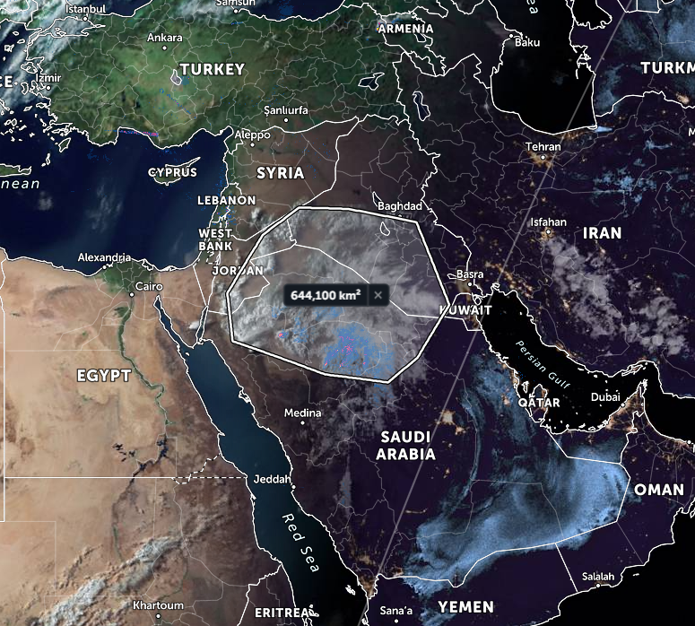
This animation shows the current state of a weather event that has been a few days in coming. #ArabianStorms
@Arab_Storms
@Arab_Storms
The origin of this event is very similar to that which caused several days of extremely severe thunderstorms in #Oman earlier in the month. This animation is from May 18th shortly after it first appeared in the @zoom_earth satellite imagery.
🇮🇳#India #Tauktae #CycloneTauktae
-REPORT-
Tropical Cyclone TAUKTAE made landfall in the afternoon of 17 May over the coast of Saurashtra (Gujarat State, north-western India), with maximum sustained winds up to 200 km/h.
According to national authorities (NDM India),
-REPORT-
Tropical Cyclone TAUKTAE made landfall in the afternoon of 17 May over the coast of Saurashtra (Gujarat State, north-western India), with maximum sustained winds up to 200 km/h.
According to national authorities (NDM India),
the human impact has reached 23 fatalities and 41 injured people across Karnataka, Kerala, Maharashtra, Goa States and Lakshadweep Union Territory. More than 217,450 people across the western coast of India have been evacuated.
Full or partial damage has been reported to 643,890 houses, several road sections and public infrastructure. TAUKTAE is forecast to weaken, as it moves north-northeastwards, reaching Rajasthan State in the afternoon of 18 May.
#CycloneTaukte has left behind a trail of destruction on the western coast of India. 24 people reportedly dead, several fishers missing, fishing boats badly damaged.
@GuerrillaSahafi of @GaonConnectionEspoke with the fishers in Maharashtra
#Tauktae
en.gaonconnection.com/cyclone-taukta…
@GuerrillaSahafi of @GaonConnectionEspoke with the fishers in Maharashtra
#Tauktae
en.gaonconnection.com/cyclone-taukta…
“We were alerted by the weather dept that a cyclone will hit Mumbai around May 15. So, we had parked our boats in safe areas. But still, boats destroyed... In the Madh port alone, 25-30 boats have been damaged... some fishermen missing." #Tauktae
Read: bit.ly/3owjgGb
Read: bit.ly/3owjgGb
“In Gujarat’s Saurashtra alone, the fishing community has suffered a loss of an estimated seventy crore rupees (Rs 700 million) due to the cyclone,” Usmangani Shersiya, secretary, National Fishworkers' Forum .
#Tauktae #CycloneTaukte
Read: bit.ly/3owjgGb
#Tauktae #CycloneTaukte
Read: bit.ly/3owjgGb
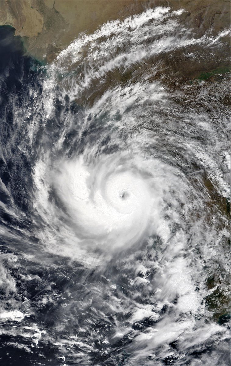
Cyclone Tauktae is now onshore over the Indian State of Gujarat India. The storm has weakened since these photos were taken by @NASA Modis this morning, but is still packing 150kmh winds & has done a lot of damage.
Rainfall forecasts for #MiddleEast and #HornOfAfrica follow.


Rainfall forecasts for #MiddleEast and #HornOfAfrica follow.


Today's satellite presentation of the area has a new feature which has been strengthening over the past few days. A stream of water vapour out of Central Africa & Sudan transiting Chad and Sudan and then the Red Sea near Jeddah.
There is also an increasing amount of activity in the Western Sahara which supports the CMC and KMA model predictions of significant rainfall in these areas in recent forecasts.
Tonight Extremely Severe Cyclonic Storm Tauktae is already a Cat 3 Hurricane equivalent Cyclone, 24 hours ahead of schedule and tearing up the West Indian coastline on its way north.
Today's #ME and #HOA rainfall forecasts follow.
Today's #ME and #HOA rainfall forecasts follow.
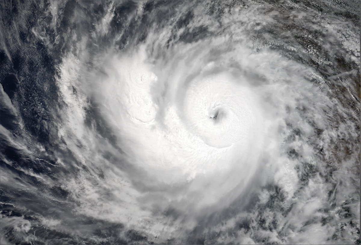
Three more views from the image.
The first shows the positioning of this morning's @NASA Modis picture of Tauktae in relation to the coast. Nearly half the central convection area is over India.
The 2nd shows a wider perspective. & the 3rd provides borders for orientation.


The first shows the positioning of this morning's @NASA Modis picture of Tauktae in relation to the coast. Nearly half the central convection area is over India.
The 2nd shows a wider perspective. & the 3rd provides borders for orientation.


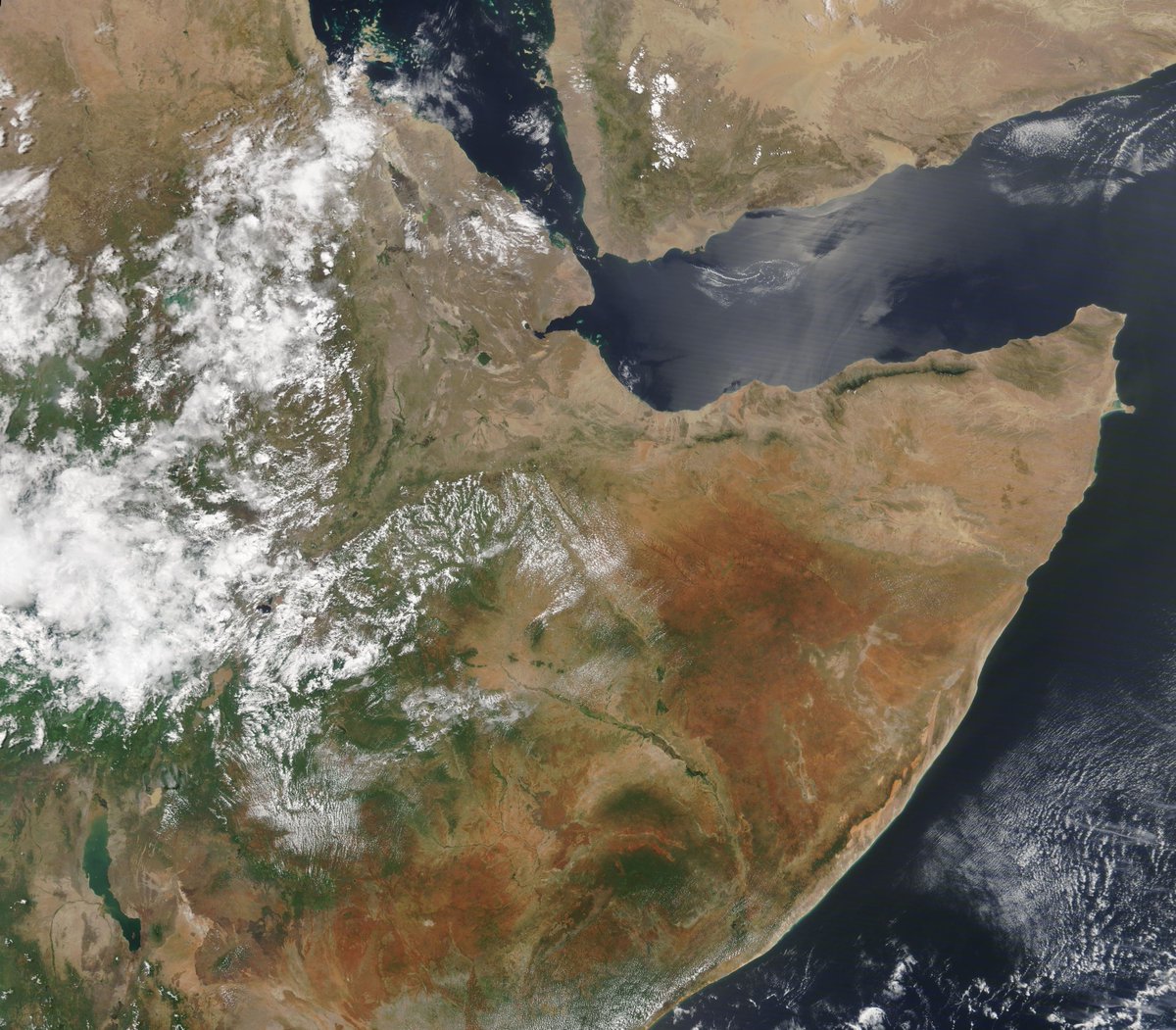
Further west here are four images from today of the #HornOfAfrica, the #NileDelta, the #Levant and #UAE + #Oman. 




Severe Cyclone Tauktae is happening..... moving north up the West India Coastline and strengthening rapidly. It is expected to become a very severe storm (Cat 3) in 48 hours.
Today's #MiddleEast and #HornOfAfrica forecasts follow,
Today's #MiddleEast and #HornOfAfrica forecasts follow,
Meanwhile back on solid ground, East Africa is looking resplendently verdant this morning. Here in a photo taken by the @NASA Modis satellite. 


Eyes in the sky....
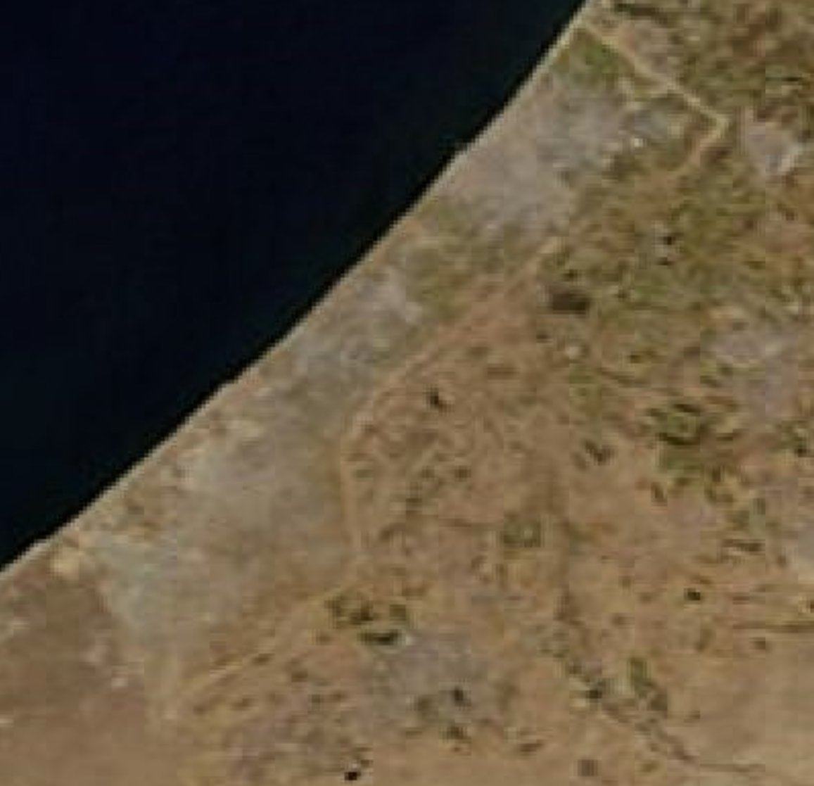
There's an unusually clear picture today of the Levant, Israel, Gaza and Jerusalem as the world is watching as the horrific bombardment of Gaza continue. Including today, the bombing of the @AJEnglish and @AP offices.
War crimes are multiplying by the hour.


There's an unusually clear picture today of the Levant, Israel, Gaza and Jerusalem as the world is watching as the horrific bombardment of Gaza continue. Including today, the bombing of the @AJEnglish and @AP offices.
War crimes are multiplying by the hour.



Tropical Cyclone “TAUKTAE” in the Southeast Arabian Sea
The Depression over Southeast Arabian has intensified into a Cyclonic Storm “TAUKTAE” and lay centered at 0800 PST of 15 May 2021 near latitude 12.7N and longitude 72.3E,
#CycloneTauktae #Tauktae #CycloneAlert
The Depression over Southeast Arabian has intensified into a Cyclonic Storm “TAUKTAE” and lay centered at 0800 PST of 15 May 2021 near latitude 12.7N and longitude 72.3E,
#CycloneTauktae #Tauktae #CycloneAlert

at a distance of about 1460 Km south-southeast of Karachi. Maximum sustained winds around the system centre are 70-90 Kmph gusting to 100 Kmph.
The system is likely to intensify further into a Severe Cyclonic Storm (SCS) during next 12-18 hours and move in north-northwest direction and reach Indian Gujarat by 18th May morning.
Cyclone along the India-Pakistan border. IMD/global forecasts indicate that the low-pressure system in the Arabian Sea will develop into Cyclone #Tauktae on 16 May, move close to the west coast, and advance to the Indo-Pak north of Gujarat. Heavy rains expected along the track.
IMD weather forecast bulletins are available here:
mausam.imd.gov.in/imd_latest/con…
INCOIS-IMD joint bulletins are available here:
incois.gov.in/WEBSITE_FILES/…
mausam.imd.gov.in/imd_latest/con…
INCOIS-IMD joint bulletins are available here:
incois.gov.in/WEBSITE_FILES/…
Observed and forecasted track from IMD, along with wind distribution on the coast.
IMD bulletin on 14 May: mausam.imd.gov.in/Forecast/marqu…
IMD bulletin on 14 May: mausam.imd.gov.in/Forecast/marqu…

