Discover and read the best of Twitter Threads about #firewx
Most recents (9)
The @NWS Incident Meteorologist program celebrates its 94th Anniversary of providing on site weather support to America’s wildland firefighting efforts!
On July 29, 1928, Leslie G. Gray went on the first IMET mission to the Miller Canyon Fire in California.
#FireWX
1/4
On July 29, 1928, Leslie G. Gray went on the first IMET mission to the Miller Canyon Fire in California.
#FireWX
1/4

"For the first time on any fire...the U.S. Weather Bureau has established a bureau on the fire line. Weather Observer Gray was sent from San Francisco to establish on office on Chews Ridge" on the Miller Canyon Fire. "He was able to inform the fire fighters of humidity changes"
2
2

Leslie G. Gray's article for the Monthly Weather Review: A Mobile Fire Weather Forecast Unit, about the vehicle and equipment used to collect weather information and create forecasts for wildland firefighting efforts.
The full article is available at journals.ametsoc.org/view/journals/…
3/4
The full article is available at journals.ametsoc.org/view/journals/…
3/4

#CalfCanyonFire towards center, #CooksFire slightly up and to the right, seen on GOES satellite at the moment. #NM #FireWX
#CalfCanyonFire GOES heat detections at 23:10UTC 

Interactive map for #CalfCanyonFire
Friday is going to be a major #FireWx day. If you live within any of the areas below, it's a "pack your go bag/back your car into your driveway" day. Pay attention! It could save your life. #wildfire #weather
Thread🧵 | #KansasFires
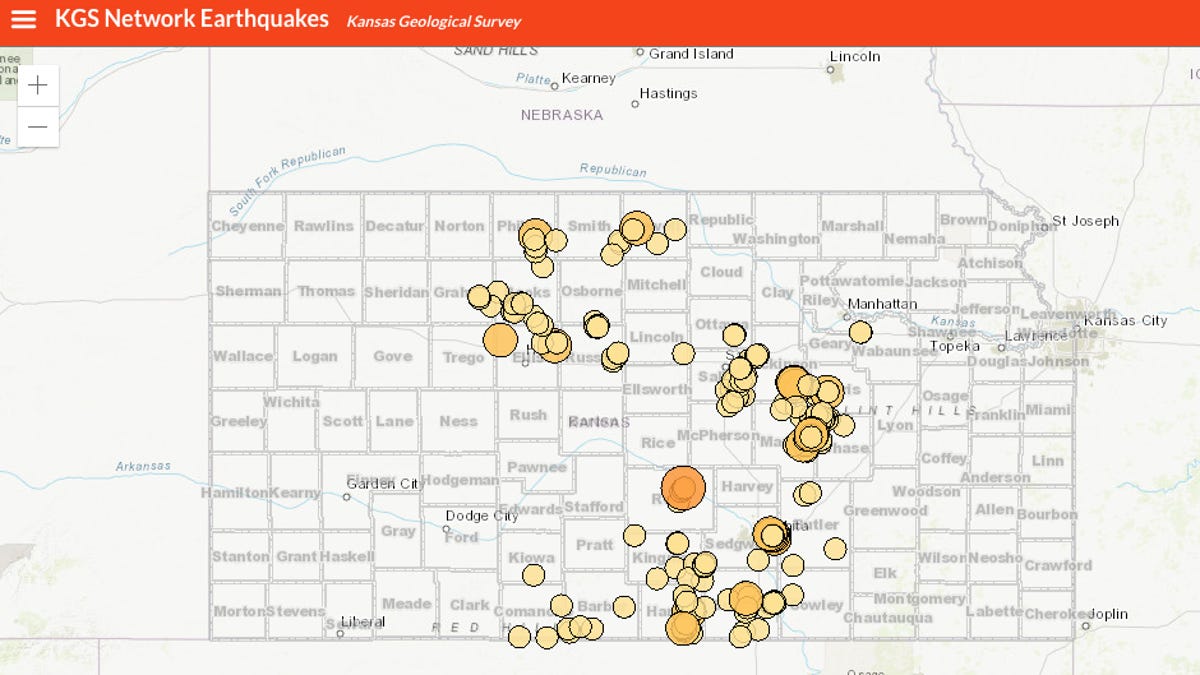
While working live on wildfires/storms, I frequently discover mapping crossovers to my quake work.
Today I'm tracking yesterday's fires + March 2017/2020 fires & mapping with current/past #Kansas #earthquake swarms + faults. ⬇️👀
#kswx #ksfire #wildfire


While working live on wildfires/storms, I frequently discover mapping crossovers to my quake work.
Today I'm tracking yesterday's fires + March 2017/2020 fires & mapping with current/past #Kansas #earthquake swarms + faults. ⬇️👀
#kswx #ksfire #wildfire



Admittedly, July had more stuff than June. Alot of material to cover & all. We will be happy to reveal them all in the #WxWrapUp for July 2021. (🧵 of 10; (1/10) 

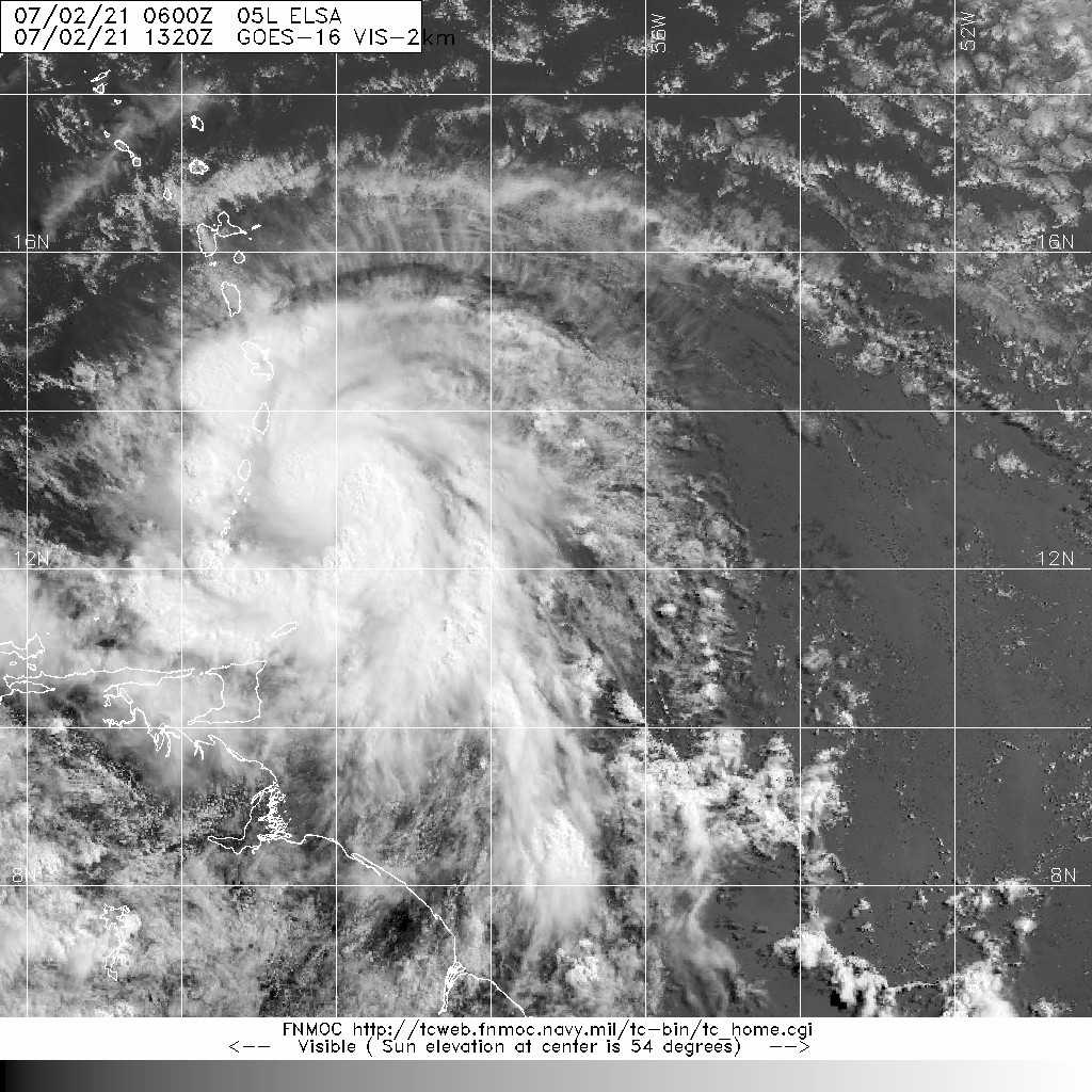
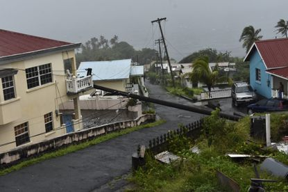
#Tropics: Elsa may have brought the memes, but the impacts were no laughing matter. Elsa nearly caused $1B in damages & effects were felt from Barbados to Greenland where it snowed. Elsa is the earliest "E" storm on record. (2/10) 



Fire danger spiking again: after a barely 24-36 hr dip in ERC values from spotty precip/cooler temps last weekend, levels have shifted quickly back to near max high values (extremely dry). Bay marine region 3A in Summer/Fall like values (1/2) #CAwx #FireWx 


In retrospect the signs of an early fire season start have been there for awhile. Spring fuel moisture values tracking near or at record lows vs. what should’ve been seasonal highs. Extreme drought cause and effect. (2/2) #CAwx #FireWx @nbcbayarea nbcbayarea.com/news/local/cli…
Ignore the fact it’s early May, conditions are Summer dry already esp. hills, parched by drought and above average temps. Add wind and you’ve got a Fire Weather Watch for interior NorCal starting Sunday. Important messaging by @NWSSacramento #CAwx #FireWx 

A potentially historic fire weather event is unfolding across the West, especially over the West Coast, during the next 3 days. Widespread critical fire weather is expected west of the Rockies, including offshore/downslope winds in the Cascades/Sierra/Coast Ranges #FireWX #fire 


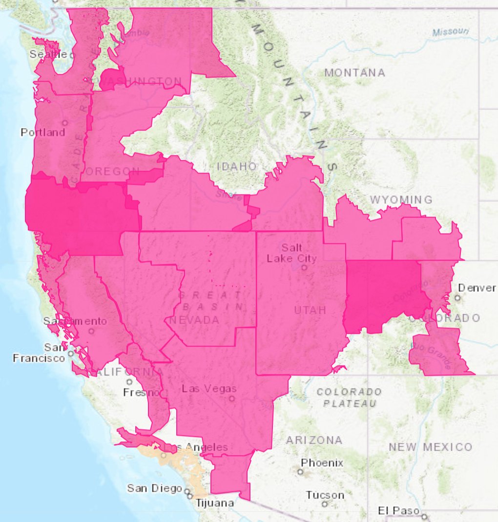
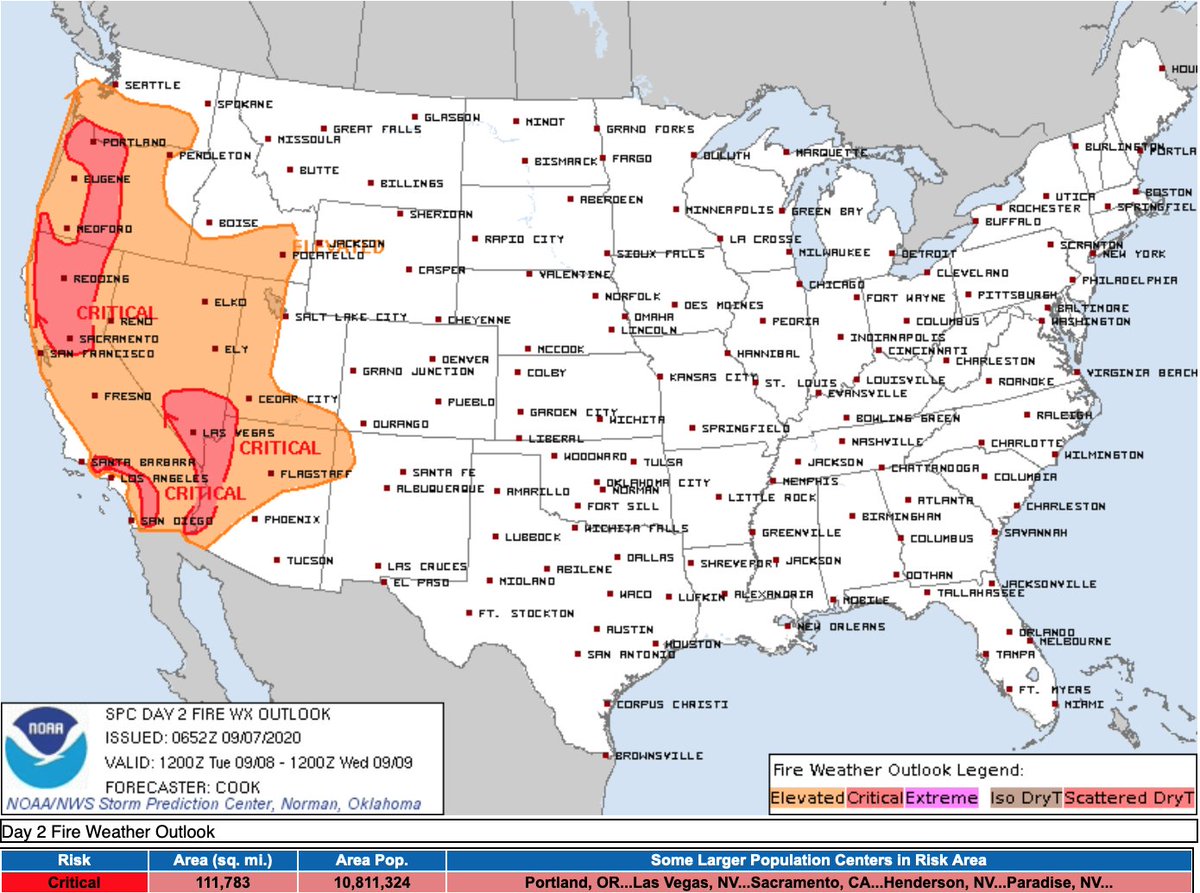
Extremely dry and easterly windy conditions will develop over the Cascades later today followed by a moderate event in the N Sierra Foothills, Sac Valley and N Bay Area, then a Santa Ana. Quick roundup of what NWS offices are saying about this event: 1/n
#cawx #orwx #firewx


#cawx #orwx #firewx
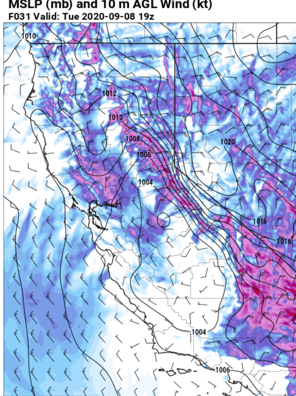
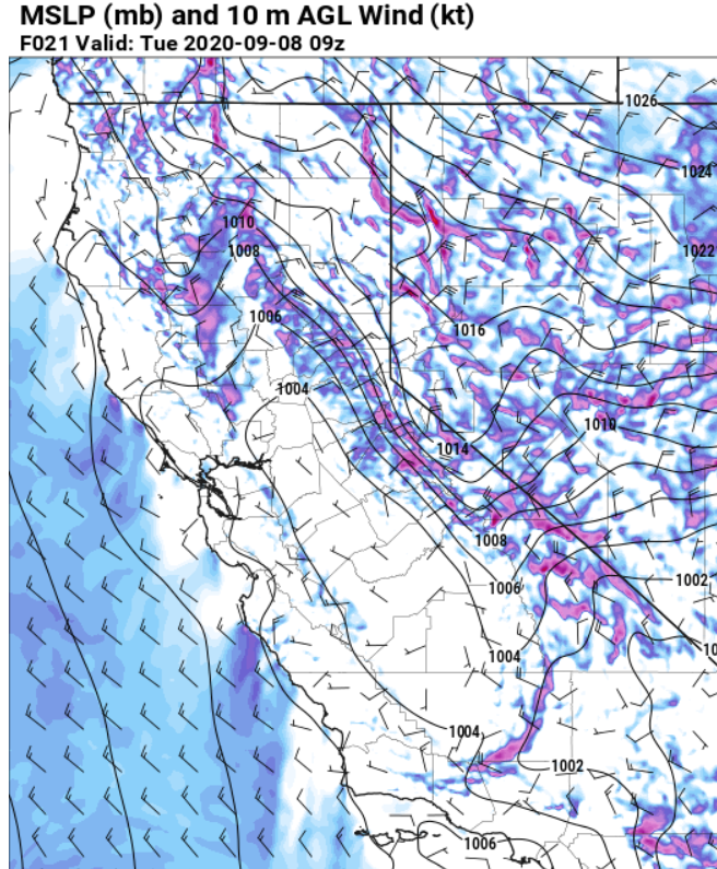
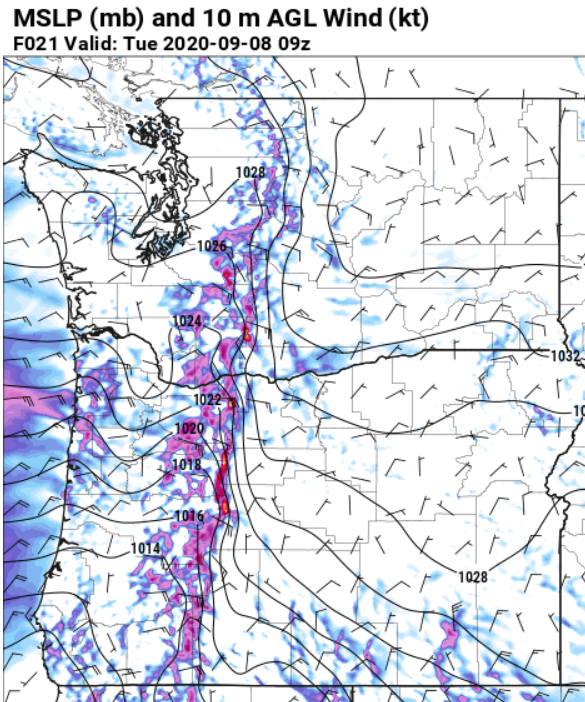
NWS Portland:
“All the ingredients are coming together as expected for a potent and likely historic September East Wind event
... that only occurs a couple times a century in September. Extreme fire danger and locally damaging winds are likely. 2/n
“All the ingredients are coming together as expected for a potent and likely historic September East Wind event
... that only occurs a couple times a century in September. Extreme fire danger and locally damaging winds are likely. 2/n
NWS Portland cont:
"The strongest east winds still appear to focus through the gap in the high Cascades between Mt Adams and Mt Hood … western portions of the Columbia Gorge, Portland/Vancouver metro area, north Oregon Coast and Coast Range” The Coast Range too!. 3/n
"The strongest east winds still appear to focus through the gap in the high Cascades between Mt Adams and Mt Hood … western portions of the Columbia Gorge, Portland/Vancouver metro area, north Oregon Coast and Coast Range” The Coast Range too!. 3/n


