Discover and read the best of Twitter Threads about #DebrisFlow
Most recents (3)
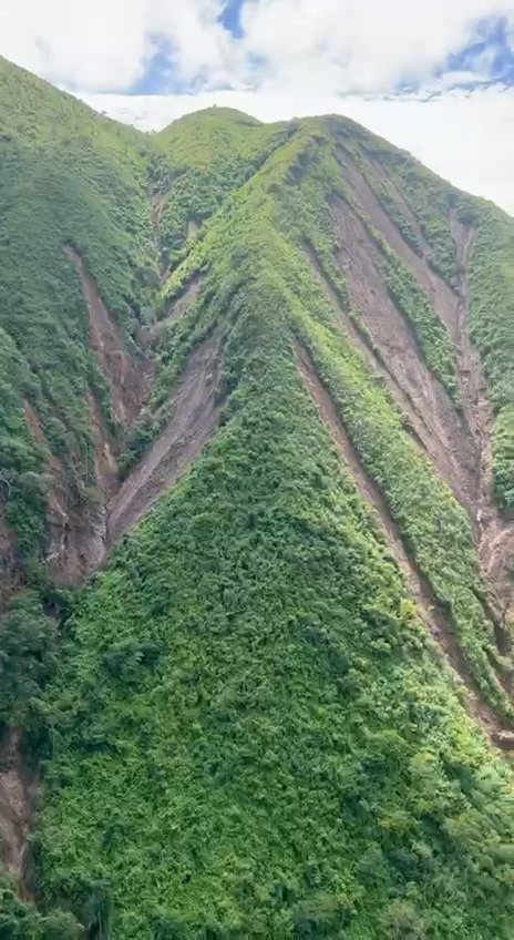
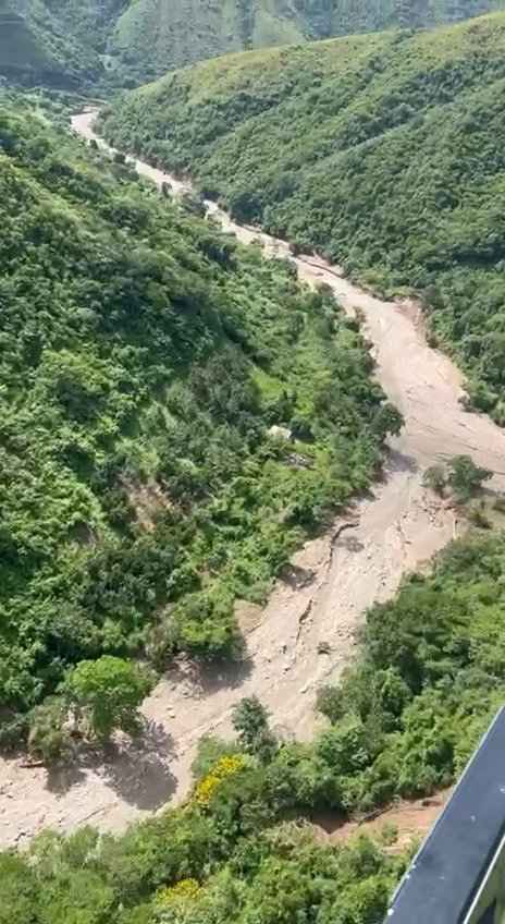
#AsíSeVe la microcuenca del norte de #LasTejerías (que incluye las quebradas de Patos y #Chorrerón) cuyo desbordamiento y #deslave el sábado 8OCT causó severos daños a la pequeña ciudad y dejó múltiples víctimas por el colapso de viviendas y demás inmuebles.
Las imágenes fueron obtenidas en un vuelo de helicóptero del servicio aéreo de la Gobernación de Aragua. (Video)
Hemos hecho diversas capturas "cuadro a cuadro" para observar desplazamientos importantes de masas de tierra y deslizamiento/destrucción de la capa vegetal.


Hemos hecho diversas capturas "cuadro a cuadro" para observar desplazamientos importantes de masas de tierra y deslizamiento/destrucción de la capa vegetal.


Se nota que el descenso del agua provocó profundas cicatrices verticales desde puntos elevados.
El cauce se ve ocupado por una masa de barro que evidentemente estuvo en movimiento durante la lluvia y permite suponer que se registró un flujo de detritus o escombros (#debrisflow).


El cauce se ve ocupado por una masa de barro que evidentemente estuvo en movimiento durante la lluvia y permite suponer que se registró un flujo de detritus o escombros (#debrisflow).


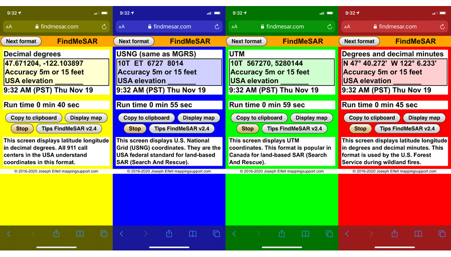
1/_ Calling 911 with a cell phone to get help? They might not know your location unless you tell them! FindMeSAR.com (I am developer) is a web page that uses the GPS in your phone to display your coordinates and accuracy value. #SearchAndRescue #DebrisFlow 

2/_ Use it like so:
Browse to FindMeSAR.com
Tap “Next format” until the yellow screen appears
Wait a few seconds for the accuracy value to get to 30 feet or less
Tap ‘Stop”
#EmergencyManagement
Browse to FindMeSAR.com
Tap “Next format” until the yellow screen appears
Wait a few seconds for the accuracy value to get to 30 feet or less
Tap ‘Stop”
#EmergencyManagement
3/_ The yellow screen displays your location in latitude longitude, decimal degrees. Every 911 call center understands that coordinate format.
There is an icon you can save on your home screen.
There is an icon you can save on your home screen.
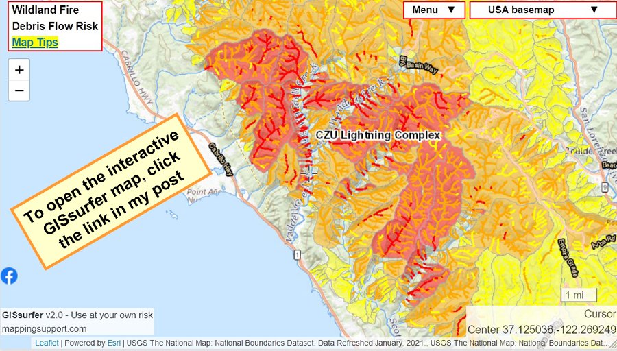
1/_ Interactive #GIS map showing risk of #DebisFlow for wildland fires. For the legend and to get the most benefit from the map, please click “Map tips” in upper left corner. To search on address click Menu > Search. #CAwx
Open #GISsurfer map: bit.ly/39Y5BRA
Open #GISsurfer map: bit.ly/39Y5BRA

2/_ The map opens at the #CZULightningComplex. You can pan the map to other 2020 fires and see the same type of data. Be patient! The map might be slow to refresh. It depends in part on how much other work the GIS server is doing.
3/_ The map can display the risk of debris flow for fires back to 2017. Here is one way to make a map to see the risk of debris flow for a fire prior to 2020:
A. Click the basemap button and look under the “Overlays” heading
B. Click “Turn off all overlays”
A. Click the basemap button and look under the “Overlays” heading
B. Click “Turn off all overlays”
